
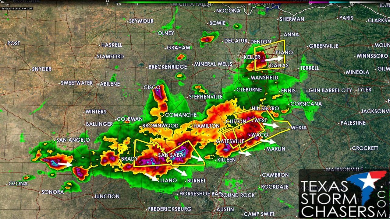
- A storm located near D/FW Airport is in the process of weakening. As it began weakening about 15 minutes ago it shot out a strong downburst with 60-80 MPH winds across North Richland Hills, Bedford, and Euless. We’ll probably be seeing some wind damage photos coming out of those locations soon. The good news is this storm is weakening as it moves northeast inot northwest Dallas county and eventually southwest Collin County. We’ll have to see if any new storms fire up on the outflow being shot out by this storm. Additional isolated storms fire firing up in Wise and Eastland counties to the west of D/FW. These storms may produce small hail but are not showing signs of intensification at this time.
- A severe thunderstorm produced a 75 MPH wind gust at Waco Regional Airport at 8:05 PM. This storm extends from just west of Prairie Hill to just north of Lorena at this time. It continues to push east but may also be int he process of starting to weaken a bit. Nevertheless wind gusts over 60-65 MPH remain a threat with this storm.
- A line of strong to severe storms extends from Adamsville to just northwest of Lampasas to Cherokee to Brady. This activity is making southeastward progress at 20 to 30 MPH. The stronger cores may produce quarter to ping-pong ball size hail and damaging wind gusts over 60 MPH. These could move into Central Texas over the next few hours with a threat of damaging winds.
- Our lone tail-end supercell west of Menard has weakened but a new storm has gone up 20 miles south of San Angelo. This storm may produce quarter size hail and 60 MPH wind gusts as it slowly moves east. It will not impact San Angelo but folks in town may get a nice light show to their south.


0 Comments