
The next few days will feature on and off rain chances across Texas. It won’t be raining everywhere at every moment throughout the next couple of days. The cloudy and wet pattern we’ve been dealing with the past few days will continue through at least Friday. Some might argue that’s not a bad thing considering high temperatures have been 15 to 20 degrees below average for mid-May. We could definitely go without having severe weather or flash flooding though. Alas we only provide the weather information – we can’t change it! Activity this morning is not severe although we have multiple areas seeing rain. There will be pockets of rain and storms the next couple of days in various areas of Texas. Various factors such a boundaries and rain-cooled air will make it difficult to predict the exact timing/location of rain/storms over the next few days. So we’ll just go with the old summer saying. Isolated to scattered showers/storms over the next few days and nights. Some of you will get wet – some of you won’t. If you end up under rain it won’t last all day.
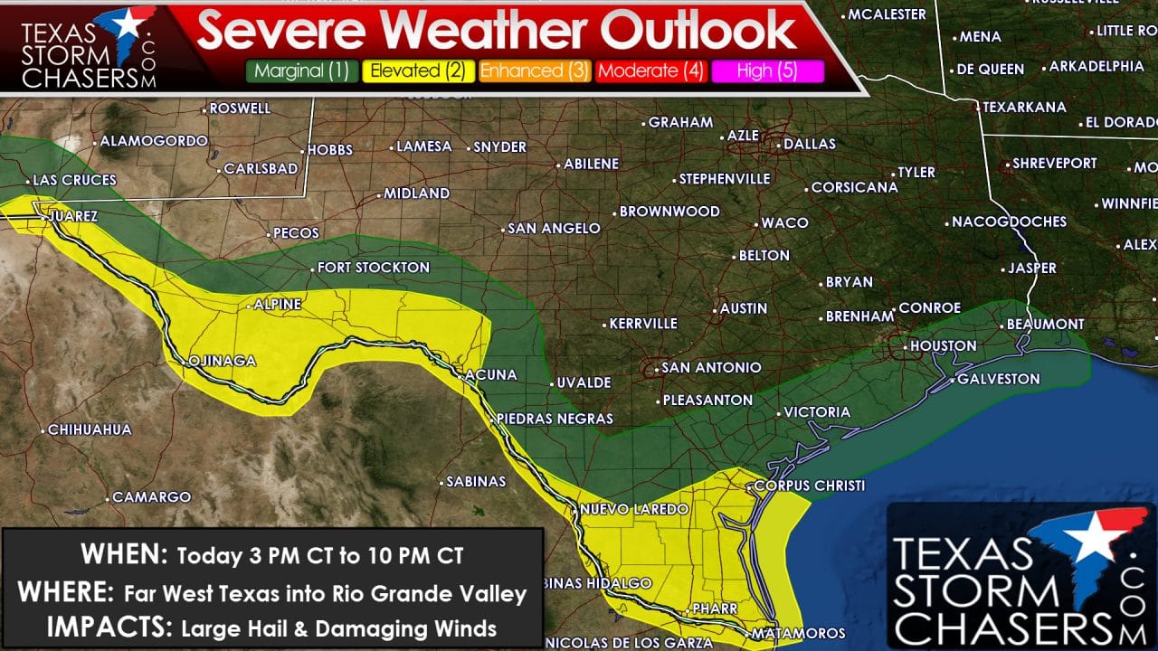
The risk for a few severe thunderstorms will exist this afternoon and evening across Far West Texas into the Alpine area through Northwest Mexico and into the Rio Grande Valley. Like yesterday we may have discrete thunderstorms develop after 2 PM MT/3 PM CT. The strongest of the storms may produce hail up to the size of golfballs and localized damaging wind gusts over 60 MPH. The most intense activity today may stay south of the border but it’ll be a close call. El Paso, Alpine, Del Rio, Laredo, McAllen, Brownsville, and Corpus Christi are in a category 2- standard severe weather risk this afternoon and this evening. A category 1 marginal risk runs northeast along the coastline and includes the Coastal Plains and Southeast Texas where an isolated strong storm is possible.
For Thursday we have a category 2 standard severe weather risk across the Middle Texas Coast, the Coastal Plains, and Southeast Texas including Corpus Christi, Victoria, Bay City, Brenham, Conroe, Houston, Galveston, and Beaumont. Like today we could see storms start to increase in intensity by the early afternoon hours as daytime heating causes the atmosphere to destabilize. Its unknown how exactly tomorrow’s storm event will evolve. We could have isolated storms pop up by the afternoon hours in the risk area and also have a cluster of storms move from west to east – starting out in the Hill Country tomorrow morning. Regardless the severe weather threats from the strongest storms would be in the form of damaging wind gusts and large hail. Flash flooding and very heavy rain are also concerns and may be more of a worry tomorrow than the overall severe weather risk. We’ll have to see how things evolve today since we’re having to go day-by-day here. Outflow boundaries or a worked over enviornment from previous day/night storms could quickly change the forecast. We saw that happen yesterday when an outflow boundary pushed the overall severe weather risk 100 to 150 miles further south than expected previously.
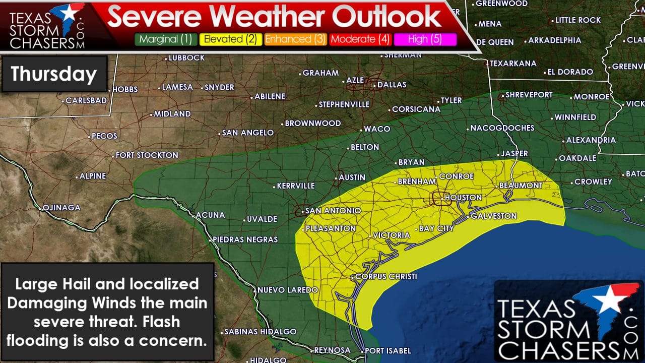
Tomorrow evening and Tomorrow night are looking quite wet for Southeast Texas – including Houston. Some storms could be severe but the more pressing concern may be the potential for heavy rain and flash flooding. Some locations may receive 2 to 4 inches of rain by tomorrow night which would result in flooding.


0 Comments