
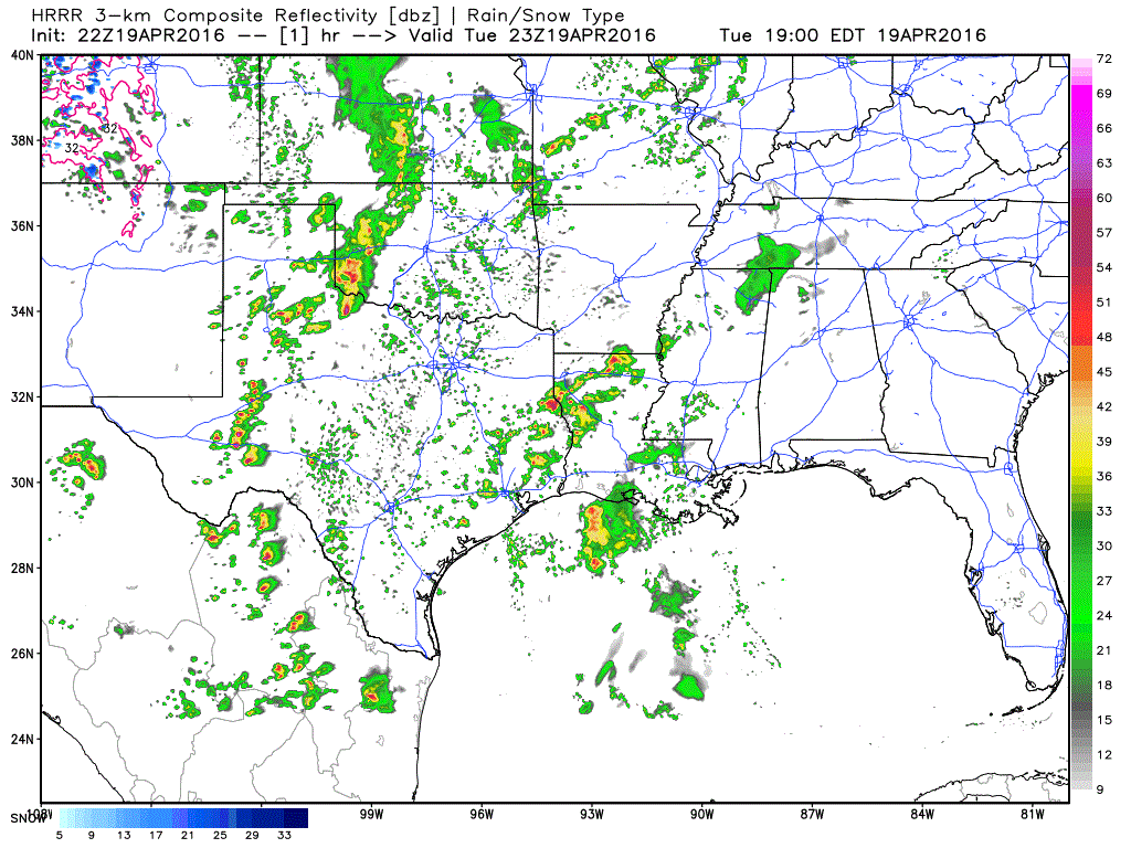
The chance for strong to severe storms increases this evening across northwest Texas and west Texas…then later tonight across north central Texas and through west central and central Texas. Currently, we are monitoring two areas of activity which has already produced a couple of severe-warned storms. The first is across northwest Texas between Vernon and Seymour. The second is across far west Texas between Ft. Stockton and Sanderson. The storms ongoing across northwest Texas are producing frequent lightning, winds in excess of 60mph with ping pong ball to baseball size hail reported within the last half hour near Seymour. The storms across west Texas are producing frequent cloud to ground lightning, 60+mph winds with reports of hail from penny size up to around 1.75 inches in the past half hour. Additional storm development across west Texas is expected this evening, eventually developing into clusters and bowing line segments after dark as they move east across west central Texas between now and midnight.
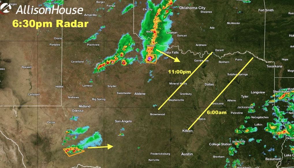
As we continue into the late evening and early overnight hours, the complex of storms across northwest Texas will gradually increase in coverage and congeal into a squall line which will impact north central Texas during the early overnight hours. Impacts to the immediate Dallas/Ft. Worth area are expected between 11pm as the squall line begins to move into the northwestern counties…and by 6am as the line continues southeast out of the immediate metroplex area. While widespread severe weather is not expected, there is concern about the threat of damaging winds and even a quick tornado spin up along the leading edge of the squall line as it approaches north central Texas. Instability values will remain moderate, and we’ll remain mostly uncapped we head into the overnight hours, which raises the concern that the leading edge of this squall line may be surface based and able to produce a few isolated tornado spin-ups. If, when and where that happens is impossible to forecast, so our best advice is to go to bed tonight with either your NOAA Weather Radio plugged in or with fresh batteries, or have your smartphone volume turned up sufficiently for you to hear it if Warnings are issued for your location. Again, this threat is low, but it’s not zero either, so it’s best to be on the safe side, have a plan in place and be prepared.


0 Comments