
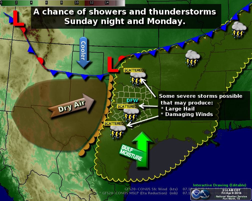
The focus of the forecast will be on rain/storm chances this weekend. Showers and a few storms will be possible late tonight and tomorrow. The threat of severe weather increases on Sunday and on Monday. Temperatures will be warm and what you would expect for early April.
We’ll be looking out for a few rain/storm chances over the coming days. The first chance will begin tonight and continue into the first half of Saturday. Mind you we’re not talking about heavy rain or severe weather. By late this evening I expect we’ll have light showers underway across Far West Texas, the Panhandle, and the Permian Basin. Very dry air in the lowest two miles of the atmosphere may cause some rain to evaporate before reaching the ground. During the morning hours Saturday a large area of light rain will move into the Concho Valley, Big Country, Hill Country, and South-Central Texas. Most locations will only receive enough rain to wet the ground and pavement. Dry air in the lowest levels of the atmosphere will likely cause some rain to evaporate before it reached the surface. Very light showers will be possible through the late afternoon tomorrow across the eastern half of Texas. One quarter to one half inch of rain may fall across parts of the Permian Basin and Big Country. Otherwise most rain totals will remain under one quarter inch. A few embedded storms may occur which would pose a threat to outdoor venues. Severe weather is not expected tonight or on Saturday. If we can get this storm system to book it along hopefully we’ll be able to have most rain out of the picture by late Saturday afternoon.
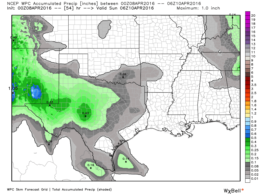
Potential rain accumulations through Saturday evening
The second round of potential activity could be more potent by Sunday afternoon and Sunday evening. Scattered thunderstorms may develop by the afternoon hours on Sunday across the Big Country, Northwest Texas, and the eastern Texas Panhandle The exact positioning/timing details of Sunday’s event will likely change since we’re still 48+ hours out. Some of the storms on Sunday may be severe with large hail and damaging wind gusts. Please check back for forecast updates since the timing and location details will change and become more refined. Monday could feature yet another round of thunderstorms across North Texas and Northeast Texas – some of which may also be severe.


0 Comments