
A couple distinct thunderstorm clusters are underway just before 10 PM. THe strongest cells in these clusters are strong to severe with large hail and localized damaging wind gusts. The tornado threat is lower compared to this morning, but we’ll still have to watch for isolated tornado potential overnight. As always you can keep up with storms in your area by using our free interactive weather radar. Just click on the radar link on the top of this page.
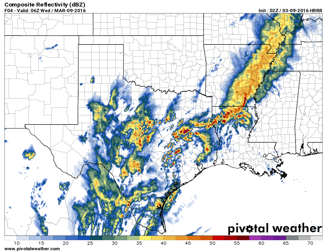
Simulated radar just after midnight
Our expectation is for additional thunderstorms to develop as we continue into the late night hours. By midnight its possible we’ll have scattered storms underway across East Texas, southern sections of North Texas, the Brazos Valley, into the Big Country and South Texas. Some of the storms may be strong to severe with a threat of hail up to the size of golfballs. Localized wind gusts over 60 MPH will also be possible. A tornado can’t be ruled out – especially with any storms closer to the coast where low-level wind shear will be strongest.
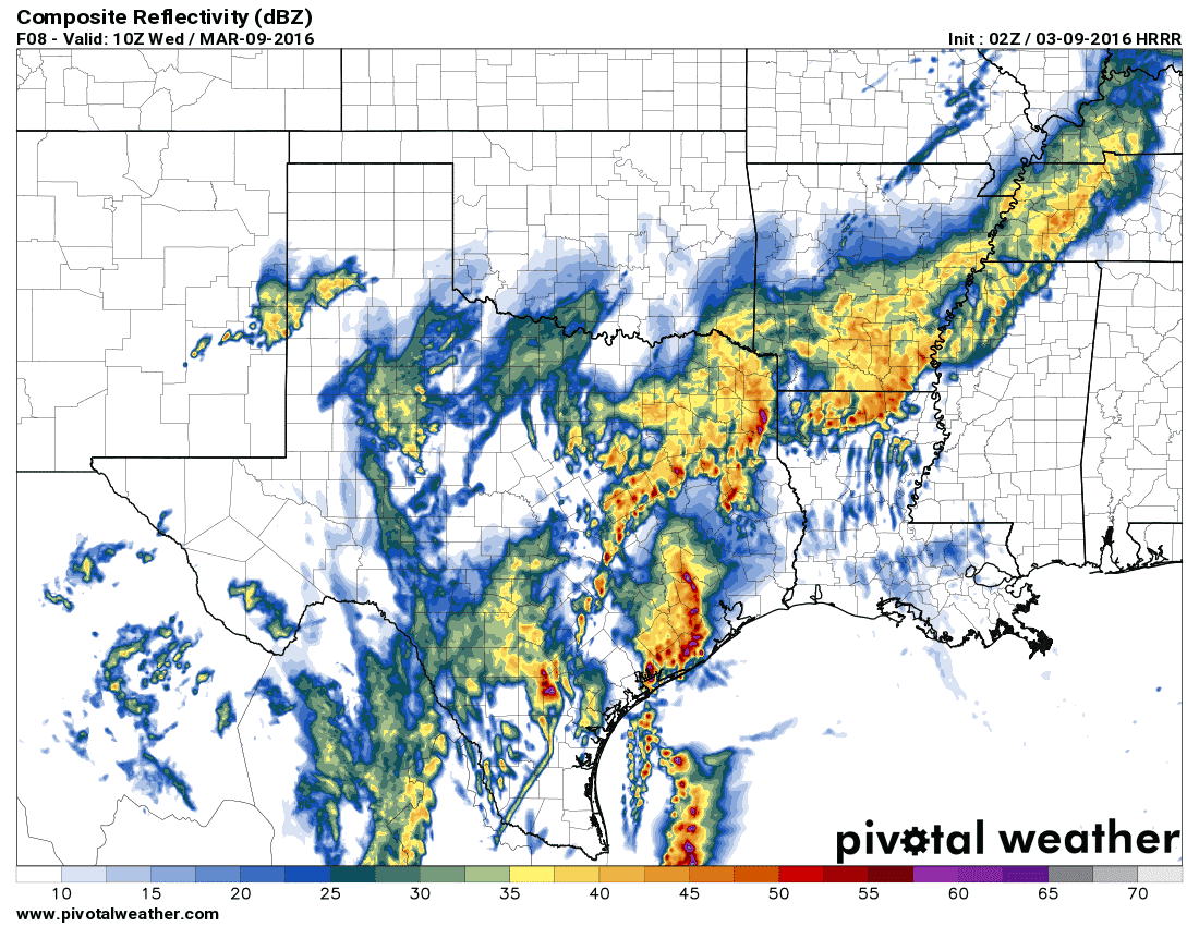
Simulated radar around 4 AM Wednesday
By 4 AM its possible that a complex of severe storms will be pushing east from the Coastal Plains into Southeast Texas. That complex, should it actually organized as depicted here, could have an enhanced damaging wind threat. We’d also have to watch it for a few tornadoes. Widespread rain and storms should be underway across East Texas and Central Texas – although the severe weather threat would be diminishing for those regions. Rainfall rates of 1 to 3 inches per hour are expected with the heaviest storms. Flash flooding will become an increasing concern overnight. By Wednesday the flooding threat will be significant across East Texas and Southeast Texas. The severe weather threat will be fairly marginal by the time you get north to Interstate 20.
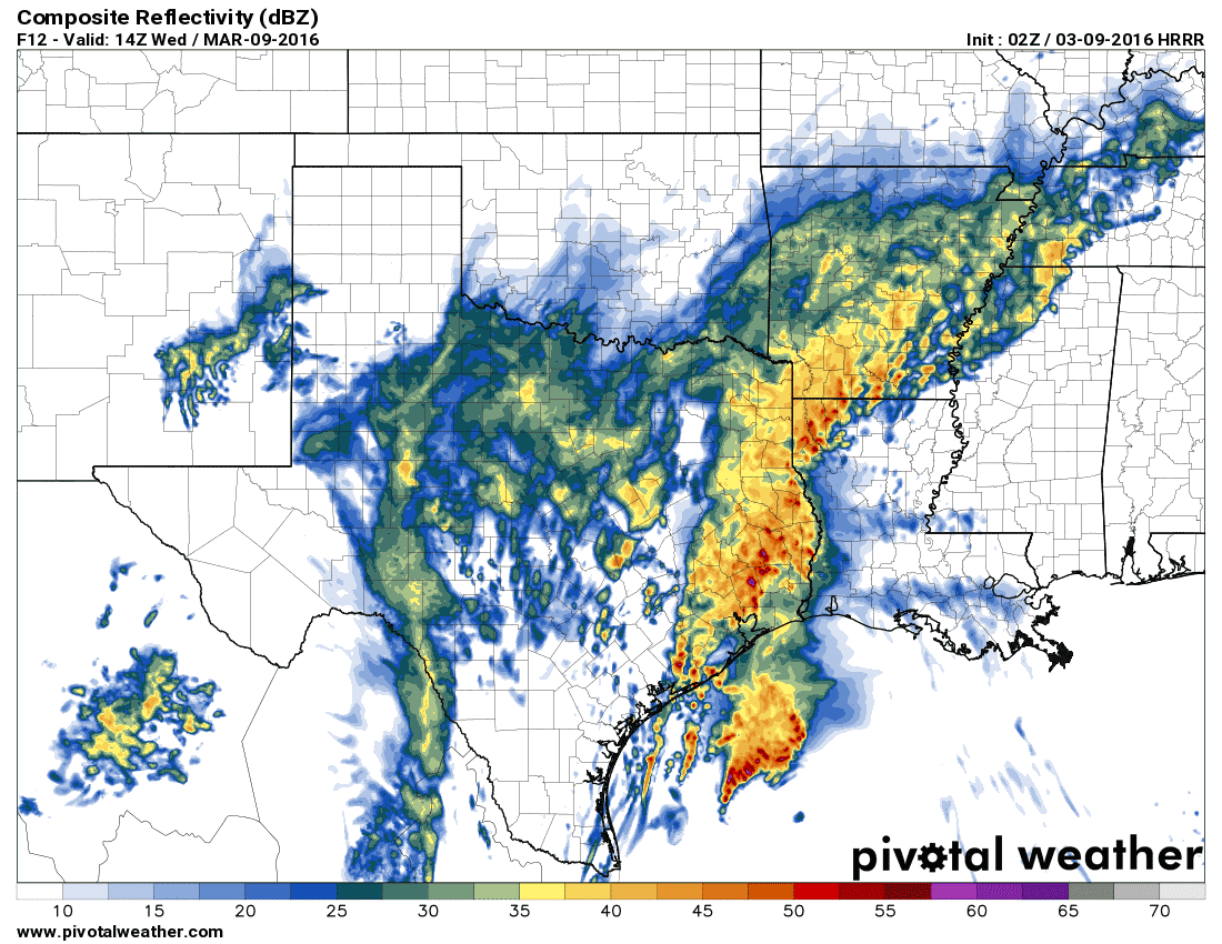
Simulated Radar around 10 AM Wednesday
By mid-morning Wednesday we should still have widespread rain and storms across East Texas and Southeast Texas. Light to moderate rain may be falling across North Texas the big Country, into the Concho Valley, Hill Country, Central Texas, and South-Central Texas. Any severe weather threat would be confined to Southeast Texas on Wednesday. The overall severe weather threat will begin diminishing on Wednesday with flooding becoming the primary concern. Some locations could pick up five inches of rain tonight. Give yourself extra time for the morning drive into work. If you come upon flooded roads please turn around!


0 Comments