
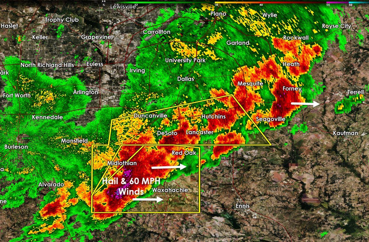
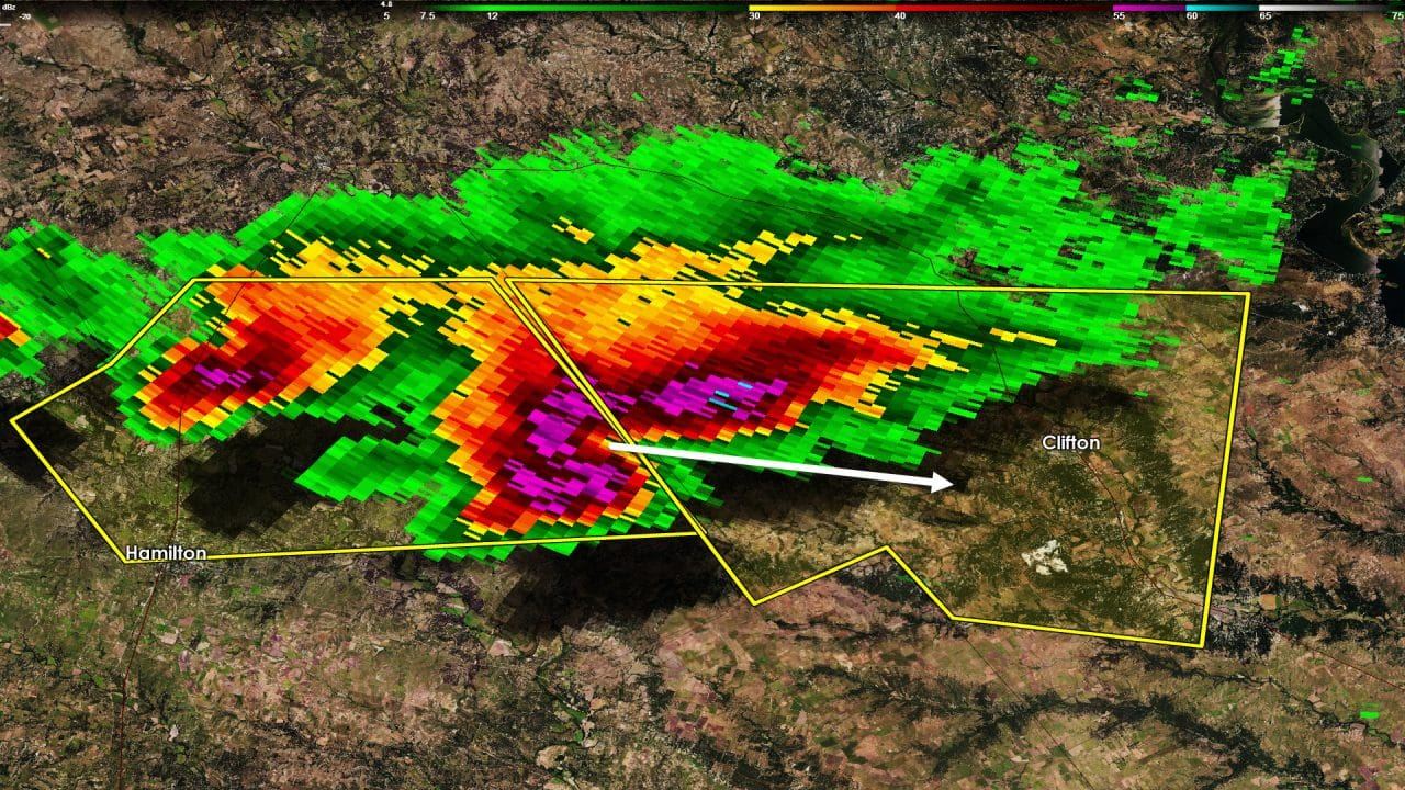
- Two isolated severe thunderstorms are in progress across North Texas. The first severe storm is near Midlothian with large hail and 60 MPH winds. The second cell is near Cranfills Gap and could contain golfball size hail. Both of these storms are moving east at 25-30 MPH. These storms are expected to continue to move east over the next 2-3 hours but will gradually weaken after sunset. They’ll be running into a stronger cap which will eventually cause them to weaken and dissipate. When that happens is up to mother nature. The severe weather threat for the immediate D/FW Metroplex and all locations northwest/west of the line has ended.

- We’ve had multiple tornado warnings in Northeast Texas this afternoon. At least one possible tornado occurred earlier this afternoon. At the time of this writing the strongest storms had exited into Arkansas. One storm near Pittsburg was severe-warned but is quickly weakening. I can’t rule out a few additional severe storms through the evening hours but the overall threat is decreasing as the strongest storms move into Arkansas.


0 Comments