
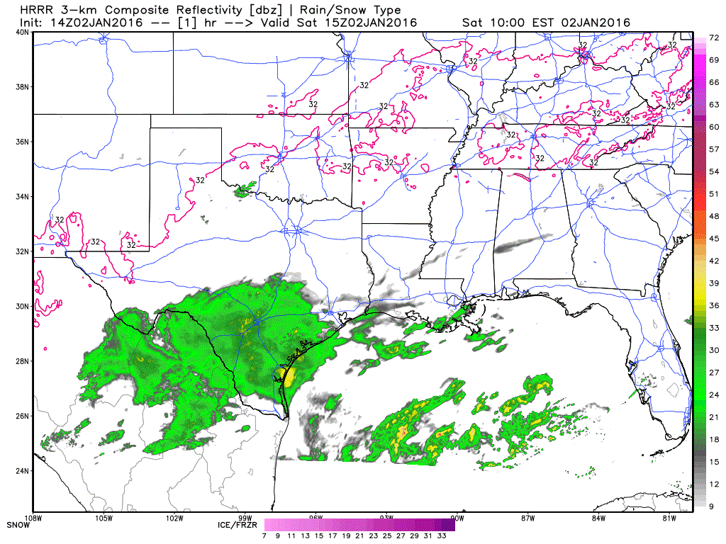
Good morning and happy Saturday! Today’s forecast looks like it will end up being pretty much a carbon copy of yesterday’s with mostly gloomy skies and showers expected once again today across the southern 1/3 of the state, with chilly and dry conditions expected elsewhere. Folks in the Rio Grande Valley, Coastal Plains and Southeast Texas can all expect another day of continuous rain before this mess begins to clear our early Sunday. No severe weather is expected, which is a good thing, but folks across these regions could easily see another 1/4 to 1 inch of rainfall accumulation by tomorrow morning. Here is a peek at simulated radar from one of our short-range models to give everyone an idea of what the radar might look like between now and around 11pm this evening.
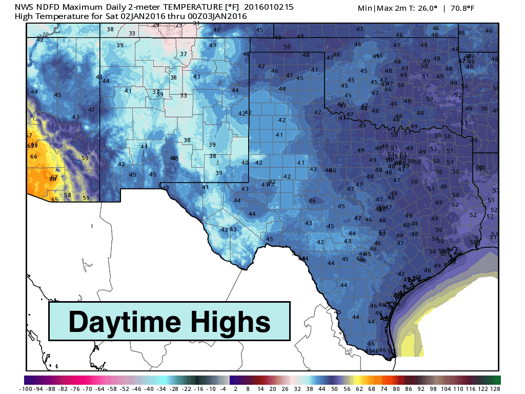
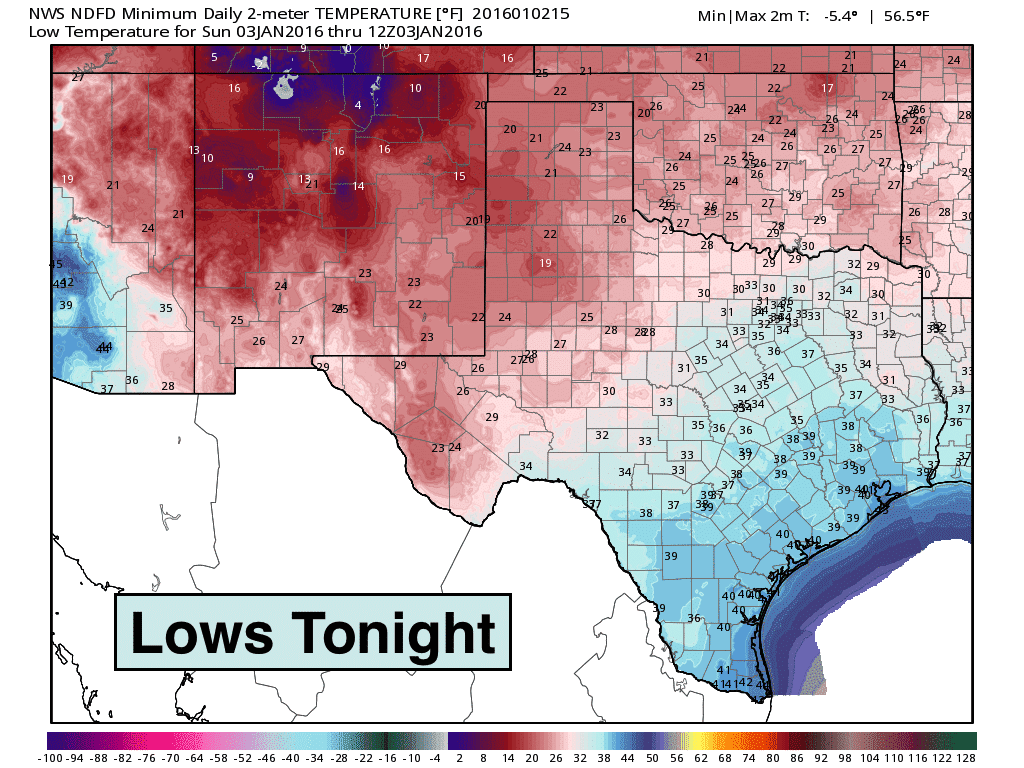
Highs Today…chilly with plenty of cloud cover. The only areas which will see any clear skies today will be the panhandle…and maybe a few spots across far north Texas by later this afternoon. Everyone else will stay socked in for today. Lows tonight…cold and pretty much what we expect for early January. Overall, temps will continue to range a good 5 to 15 degrees below normal as we head into the next work week, so just expect that trend to hang with us for a bit longer. Rainfall chances return mid-week with another upper level disturbance moving across the state. Beyond that, forecast models are struggling to come to a consensus on our weather pattern beyond next weekend, but none are showing the potential for any major winter precipitation outbreaks. This of course will disappoint the snow lovers but keep the rest of everyone happy for now! As always, we’ll keep an eye on things and let you know if any of that changes!


0 Comments