

Simulated Radar from 06Z 4KM NAM at 6 AM Saturday

Simulated Radar from 06Z 4KM NAM at 9 AM Saturday
Simulated Radar from 06Z 4KM NAM at 3 PM Saturday
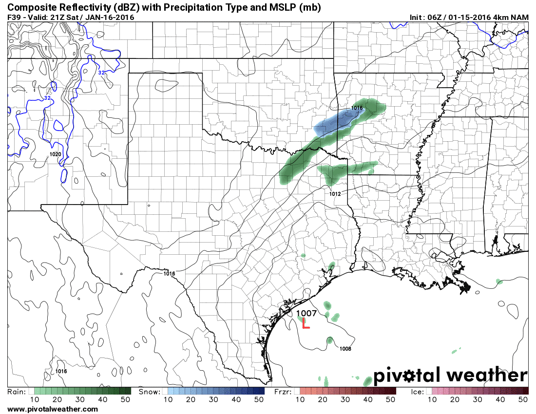
Much of today will be dry across the Texas Panhandle. The upper level disturbance responsible for the upcoming chance of snow will not arrive until tonight. At present indications are we should see snow begin to develop across the northern and eastern Texas Panhandle around midnight tonight. Snow will increase in coverage and intensity through sunrise. After sunrise the precipitation should start to exit the Panhandle to the east and southeast. At the same time it’ll be impacting Southwest Oklahoma and parts of Northwest Texas. Surface temperatures in Northwest Texas will remain above freezing but temperatures in the mid-levels of the atmosphere will be very cold. That could cause snow or a rain/snow mix to continue in parts of Northwest Texas Saturday Morning. Since surface temperatures would be above freezing most roads would remain wet or perhaps a bit slushy. Temperatures in the Panhandle will be below freezing so snow could accumulate on roads making them slick. Precipitation will continue to move east across southern Oklahoma and North Texas into the early afternoon hours Saturday. Rain is expected south of Interstate 20/30. A rain/snow mix is possible along and north of I-20/I-30 but surface temperatures will be well above freezing. Precipitation will exit North and Northeast Texas by Saturday evening.
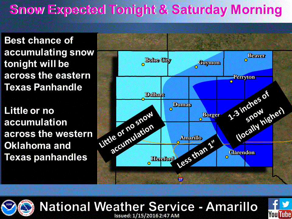
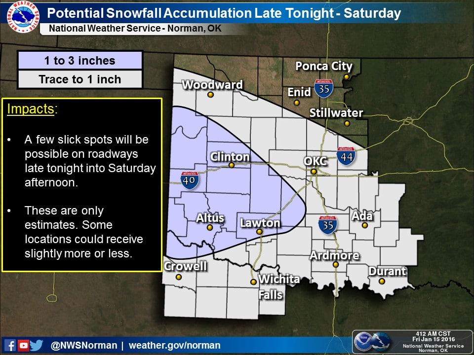
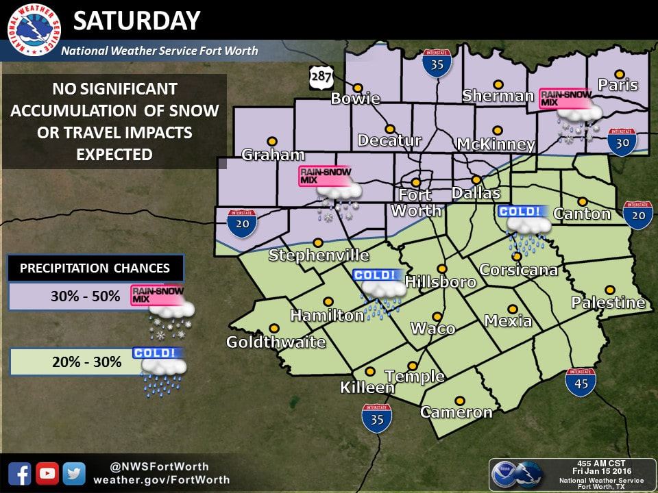
Snow accumulations of 1 to 3 inches will be possible across the northern and eastern Texas Panhandle late tonight through Saturday morning. Temperatures will be at or below freezing allowing snow to accumulate on roads. Conditions will quickly improve by early afternoon as snow moves out and road crews get everything plowed. There is the potential of a dusting to one inch of snow in parts of Northwest Texas and Texoma – generally along the Red River counties into Oklahoma. Surface temperatures should be above freezing so any accumulations would be limited to grassy and elevated surfaces. Roads should stay just wet but could be slushy as the snow is falling. A rain/snow mix is possible in the D/FW Metroplex and points north but accumulations are not expected at this time. It’ll be all rain south of Interstate 20. Compared to yesterday the path of the upper level disturbance and associated precipitation has trended north – hence the shift in precipitation chances. This will be a minor event and definitely not much to get worried about.


0 Comments