
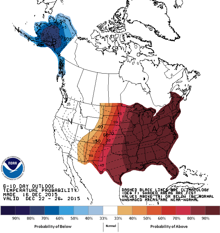
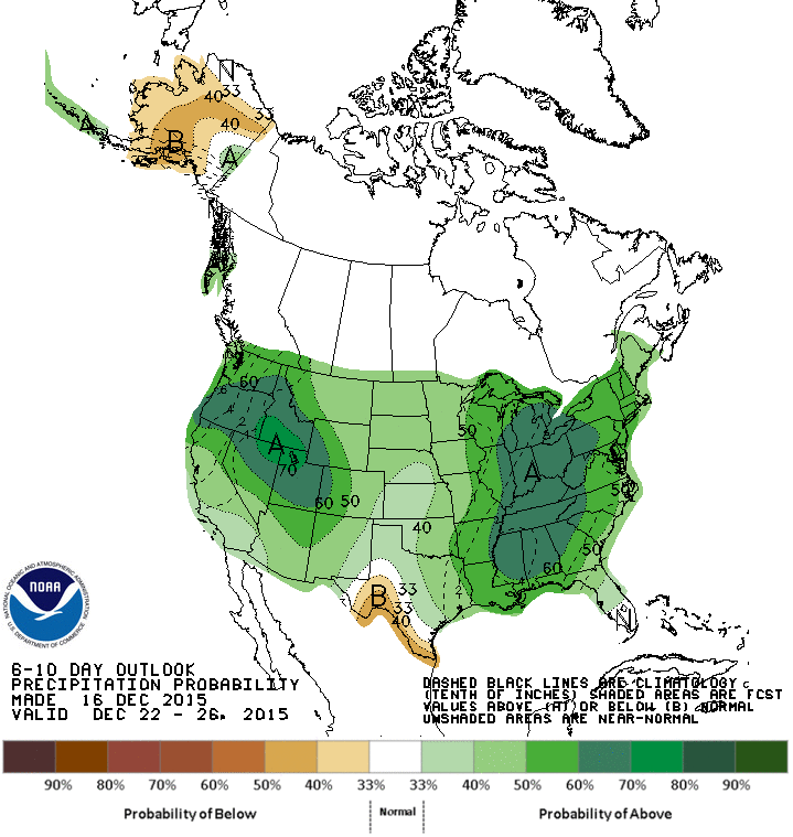
While the next several days will have temperature readings at or slightly below normal for this time of the year, next week will likely be one of the warmest Christmas weeks we’ve had in many years. Using Dallas as an example…because I happen to have its climatology data pulled up…it’s been since 2006 since we’ve recorded an 80 degree temperature in Dallas in December, and that was on December 17, 2006. We also saw several 80+ degree days in 2005: 88 on 12/3/2005, and 81 on 12/27/2005. Interestingly enough, both 2005 and 2006 were in weak El Nino years. I don’t think we’ll be seeing temps quite that high next week, but if the current forecast models stay consistent, we’ll be seeing daytime highs a good 10 to 20 degrees above normal with some highs in the mid to upper 70s not out of the question for a number of areas! The Climate Prediction Center Outlook for December 22 – 26 continues to show high probabilities of warmer than average temperatures across the entire state. It also continues to keep moderate probabilities of above average rainfall for the northern and eastern regions of the state while keeping the Rio Grande Valley region on the dry side.
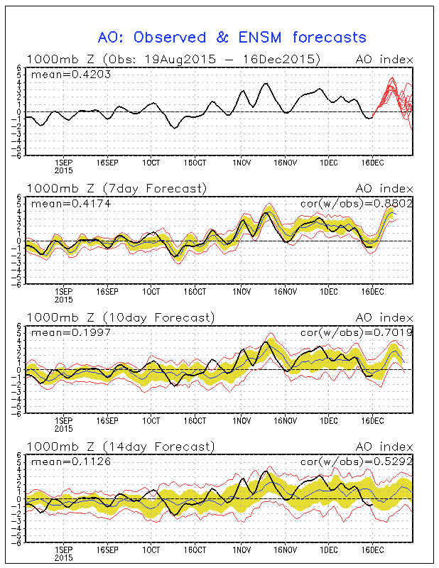
So why all the warm weather? Wasn’t El Nino supposed to keep up cooler than normal? The answer is yes and no. It’s important to understand the El Nino is not a storm. It’s a weather pattern…one that establishes itself over several months with conditions that are averaged out over time. It’s also important to understand that there are many other factors that determine our weather here in the US and in Texas. The Arctic Oscillation is one of them, and it’s having an impact on us…and especially the eastern half of the US…right now. So what is the Arctic Oscillation? It’s basically a river of wind that travels counterclockwise around the Arctic at around 55°N latitude. When we have a strong Arctic Oscillation, characterized by strong low pressure, it traps the cold Arctic air further north. This is known as a Positive AO phase. When we have a weak Arctic Oscillation, characterized by higher pressure over the Arctic region, it allows the cold air to bleed further south and deeper into the US. This is known as a Negative AO phase. This probably doesn’t make much sense until you consider low pressure regions are similar to pulling the drain plug in a bathtub. When the plug is pulled, the bath water circulates counterclockwise and draws everything towards the center. During a positive AO, strong counterclockwise winds are keeping the cold air trapped further north. During a weaker Arctic Oscillation pattern, pressure becomes higher and the winds weaken a bit, making it easier for the cold arctic air to escape and spill south and into the US…sometimes all the way down to Texas. Currently, the AO forecast has us heading into a strong positive phase into next week which will likely mean Texas, and much of the eastern continental US, will see temperatures remain above average through much of next week.


0 Comments