
A broken band of light to moderate rain is moving northeast this morning across Northeast Texas and Central Texas. A few lightning strikes have been detected but otherwise this activity isn’t much to fuss over. This general corridor is where we expect continued rain chances to continue through today and into tonight. At the same time upper level dynamics will increase thanks to a powerful storm system. The expectation is we should see a gradual uptick in thunderstorm intensity.
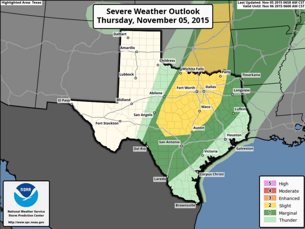
A few severe thunderstorms will be possible this morning through the afternoon and evening hours. A level 2/possible severe weather risk is in place for North Texas, Central Texas, and the Hill Country. A level 1/marginal risk is in place for East Texas, the Brazos Valley, and Southwest Texas. The strongest storms this afternoon will be capable of producing damaging wind gusts and perhaps some hail. A tornado is possible but the threat for tornadoes overall is low.
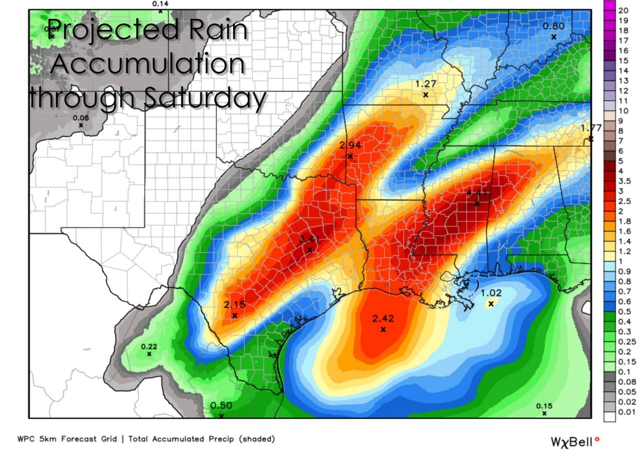
Through Friday Night and Saturday we’re anticipating widespread 1 to 3 inch rain accumulations across Northeast Texas, East Texas, the Brazos Valley, Central Texas, into Southwest Texas around Del Rio. Localized higher amounts will be possible. Saturated soils won’t be able to handle much rain and we generally expect anything over two inches to cause problems. Of-course if we see one to two inches of rain fall in an hour that’ll quickly cause flash flooding issues. Flash Flood Watches are in effect in areas expected to receive the most rainfall.


0 Comments