
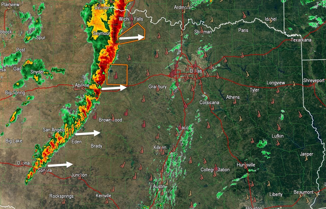
The leading edge of a strong to severe line of thunderstorms extends from Wichita Falls south to Olney, Breckenridge, Coleman, to Sonora. This line of storms is now several hundred miles long extending from Kansas south into Southwest Texas. The overall line is moving east at about 30 to 40 MPH. Individual cells in the line are moving more northeast. The National Weather Service in Fort Worth launched a weather balloon about an hour ago. That launch was to determine how favorable the atmosphere ahead of the squall line is for severe weather. The ‘sounding’ as its called found extremely strong wind shear in place across North and Central Texas. The atmosphere is also fairly unstable with only a weak cap in place. The result is we expect the line to maintain its intensity – if not actually strengthen some – as it approaches Interstate 35. Damaging wind gusts of 60 to 75 MPH will be possible in the most intense portions of the squall line through 5 AM. There is the potential for a few brief tornadoes in more intense line segments but the primary issue will be straightline winds with the squall line. There is some concern that isolated/discrete thunderstorms may develop a bit later this morning in parts of North and Central Texas. With extremely favorable wind shear any organized discrete storm has the potential to become tornadic. Its not guaranteed that isolated cells will fire ahead of the line this morning but its something we’ll keep a close eye on. Current timing projections place the squall line near Interstate 35 from the Red River south through North and Central Texas between 3 and 4 AM CT. Stay weather aware this morning!
The High Resolution Rapid Refresh (HRRR) weather model seems to show the ongoing and upcoming situation fairly well. Here is a simulated radar output from that model through the morning hours.


0 Comments