
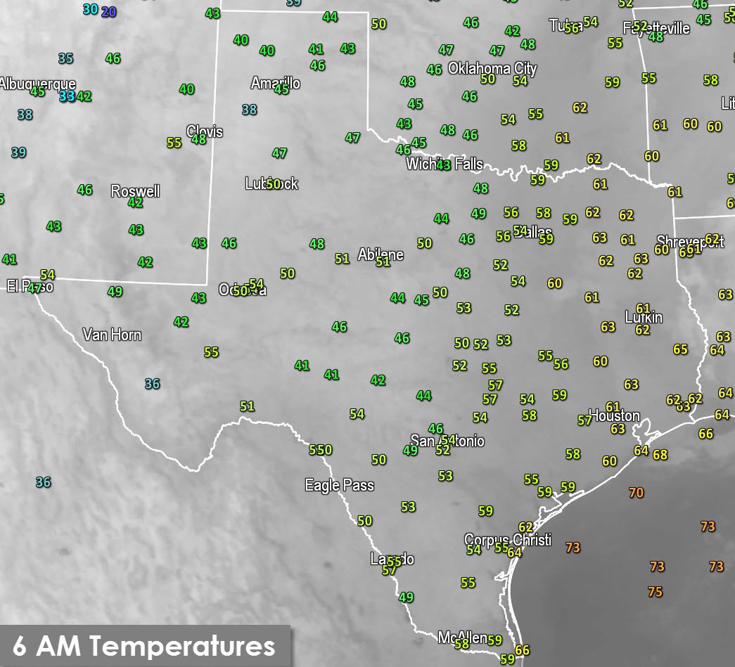
The second day of November is starting out quite gloomy across the eastern half of Texas. While skies are actually crystal clear we’ve seen widespread fog form. All the rain over the past two weeks combined with clear skies has allowed widespread fog to form. In some cases the fog is only a few hundred feet thick. Some locations are experiencing dense fog reducing visibility to below a quarter mile. Dense Fog Advisories are in effect for North Texas, Central Texas, the Brazos Valley, and Southeast Texas. Plan on giving yourself extra time for your morning commute and use your headlights low beams. Airport delays are probable in D/FW, Austin, San Antonio, and Houston thanks to the low visibility. Current projections have most fog burning off by mid to late morning.
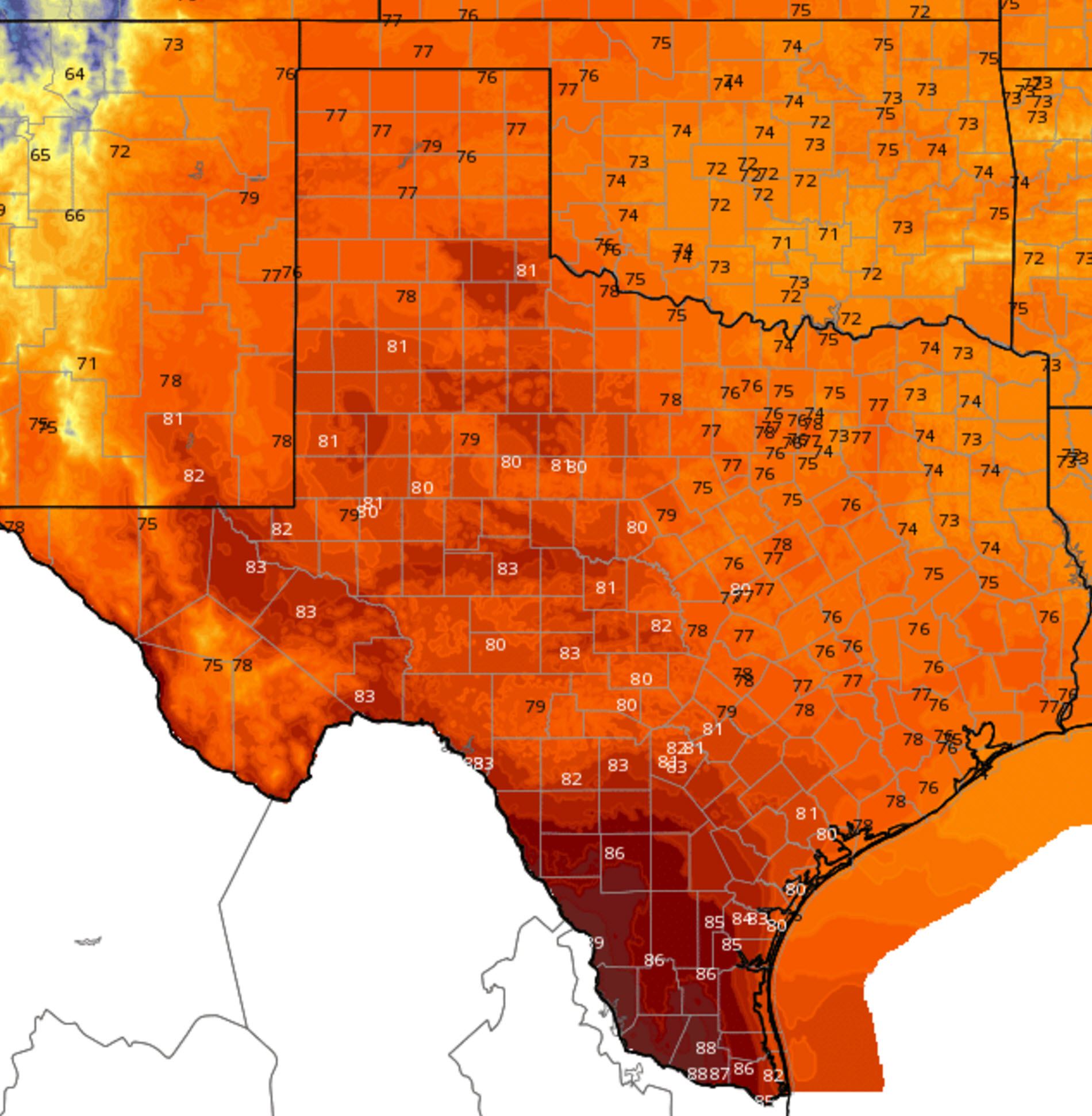
Monday, November 2, High Temperature Forecast
Once the fog burns off later this morning temperatures will climb up into the upper 70s to 80s across Texas. These seasonably warm temperatures are a good five to ten degrees above what we would usually see in early November. A few of the hottest locations in the Rio Grande Valley may approach 90 degrees.
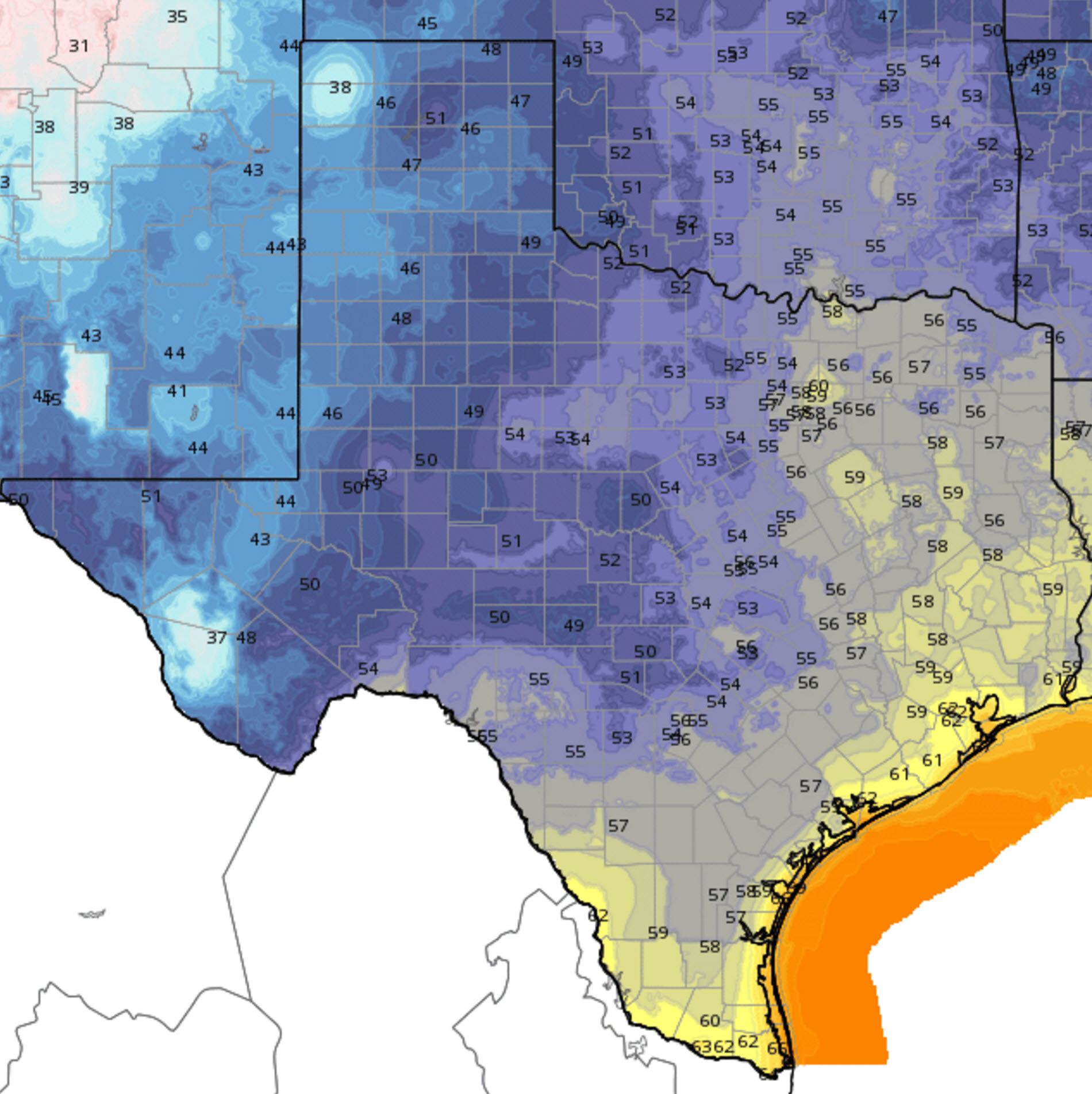
Monday Night/Tuesday Morning Low Temperature Forecast
For your Monday night we’ll see temperatures fall back into the low 60s in the Rio Grande Valley, along the coast, and in Southeast Texas. The hill Country, Big Country, Concho Valley, North Texas, Northeast Texas, East Texas, Central, and South-Central Texas can expect 50s overnight. Cool weather fans will enjoy the upper 30s to 40s in the Texas Panhandle, West Texas, and the Permian Basin.
Our next storm system will bring a return of rain chances on Wednesday Night. By Thursday we’re expecting scattered to numerous thunderstorms across Northwest Texas, North Texas, and Central Texas. Numerous showers and storms will continue across North Texas, Northeast Texas, Central Texas, and the Brazos Valley Thursday Night. Scattered activity will continue on Friday, Friday Night, and Saturday across Central Texas, South Texas, Southeast Texas, and East Texas.
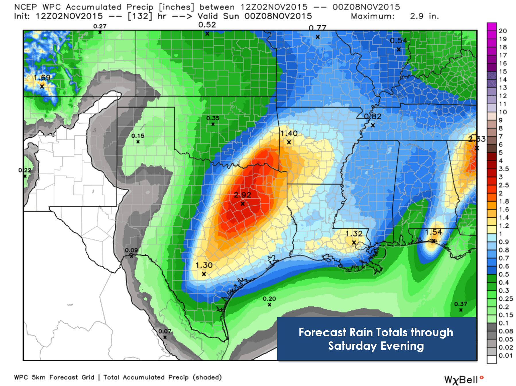
Forecast rain totals are lower than the past two systems. Our upcoming system looks to be weaker than the one last week and the one before that. Still we’re going to have a bunch of moisture in place and rain totals will reflect that. This morning’s official rain total forecast from Wednesday Night through Saturday has widespread 1 to 2.5 inch totals across North Texas, Northeast Texas, Central Texas, and the Brazos Valley. Isolated 3 to 4 inch accumulations will be possible. We’ll also have to watch for any localized heavier bands of rain that train/move over the same areas. Saturated soils mean we’ll once again have to watch out for a localized flooding threat. A marginal severe weather risk looks possible on Thursday across North and Central Texas as well.


0 Comments