
I’m happy to report that this weekend’s rain has completely cleared the state. Bye Patricia! The forecast for the next several days looks rain-free which will, thankfully, allow us to dry out a bit before our next rain-maker arrives by the end of the work week. Before then, nice fall weather is expected with another weak cold front arriving early Wednesday.
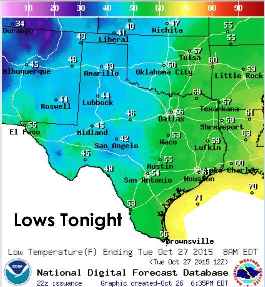
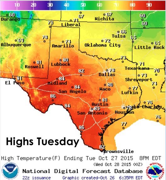
Lows tonight will be chilly across western Texas and the panhandle, warmer and in the 50s elsewhere. Nice weather to leave the windows open…even in the 40s with enough blankets piled on the beds! Highs Tuesday will quickly jump into the 70s and 80s…a few degrees above where we should be for this time of the year, but nothing too extreme.
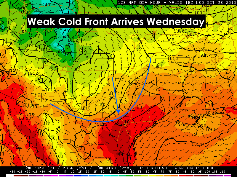
A cold front will begin working its way into the state early Wednesday. It won’t make a huge difference in temps Wednesday during the afternoon, but it will send a reinforcing shot of dry continental air into the state. However, by Thursday, winds will be coming around from the south again and pumping gulf moisture back up into the state in advance of our next rain maker.
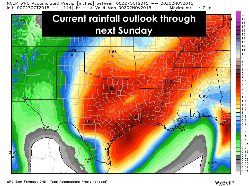
By Thursday, a trough of low pressure is expected to develop across the desert southwest, dip down into northern Mexico and then eject northeast over the state this coming weekend. The mid and long-range models still need to duke it out, but as it stands right now, we are still expecting another widespread rain event to impact the state Thursday through Saturday. There’s differences in the timing of the system, and with how much rain will fall, and who will be in the target area for the greatest amount of rain showing up in all the different long-range models right now…so we will need to continuously update the graphics below as the forecast refines itself. In the meantime, here’s what we have right now in the way of model forecast graphics, which…depending on which one you look at…is bringing the heaviest rainfall in two sections: North central Texas and across southeast Texas which was inundated with rain just this past weekend; or, it’s just bringing the heaviest rain in a swath across north central down into west central/southwest Texas, with very little on the map for southeast Texas. Don’t get too focused on that for right now as this is likely to change during the week, but any amount of heavy rainfall is likely to cause additional flooding issues as it arrives Friday into Saturday.


0 Comments