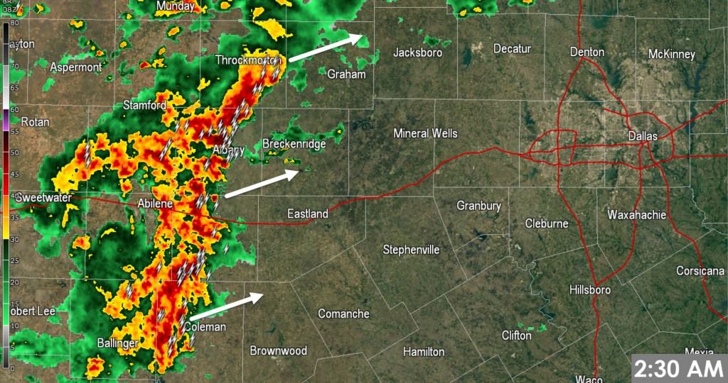
- A line of thunderstorms has developed over the past hour across the eastern Big Country. The leading edge of this line extends from Throckmorton south to Albany, Rowden, to Coleman. Frequent cloud to ground lightning and heavy rain is being produced in this line. An east/northeast movement with this line means portions of western North Texas will be impacted through 4 AM. Continued development is expected as activity moves into North Texas.
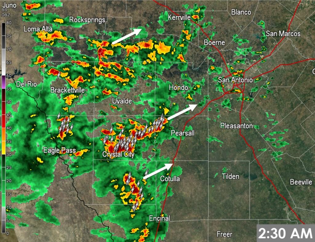
- Scattered to numerous showers and thunderstorms are moving northeast across Southwest and South-Central Texas. Coverage has increased significantly over the past two hours. This activity will move into the San Antonio Metro by 4 AM along with Interstate 10 from Sonora through Junction and Kerrville. Frequent cloud to ground lightning and heavy rain is expected with the strongest activity. A low-end severe weather threat is also possible and we’ll watch for any sustained rotating storms as we continue through sunrise.
- A few showers are moving north across the Texas Panhandle, South Plains, and the Permian Basin. A few storms are also possible. Localized brief heavy rain will be possible.
Texas Faces Several Days Of Severe Thunderstorms Ahead
https://youtu.be/zy9FD0hSq28 Daily chances for rowdy thunderstorms and windy conditions will be two weather concerns...


0 Comments