
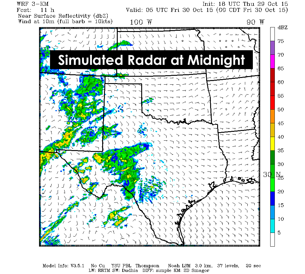
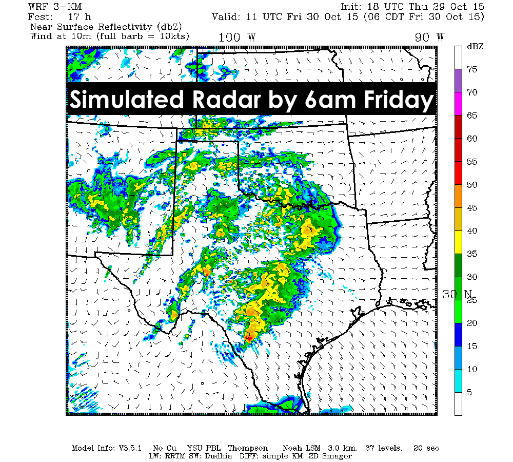
Our next rainmaker is on our doorstep this evening. Scattered showers have begun development across far west Texas this afternoon and evening. A look at current radar isn’t very impressive at the moment, but we expect this activity to increase overnight into tomorrow morning. Thunderstorms will also be on the increase tomorrow afternoon as well. The severe threat is on the low side, but this system is presenting some impressive wind shear (winds turning with height), so we will have to keep a close eye on things by tomorrow afternoon. First, here’s a look at how things will shape up this evening and overnight. Rain will be on the increase overnight and zipping off to the northeast as it expands its coverage area across the state. It’s likely we’ll have a few claps of thunder mixed in here and there, but the severe threat will not be all that great until we begin to get into the afternoon hours tomorrow.
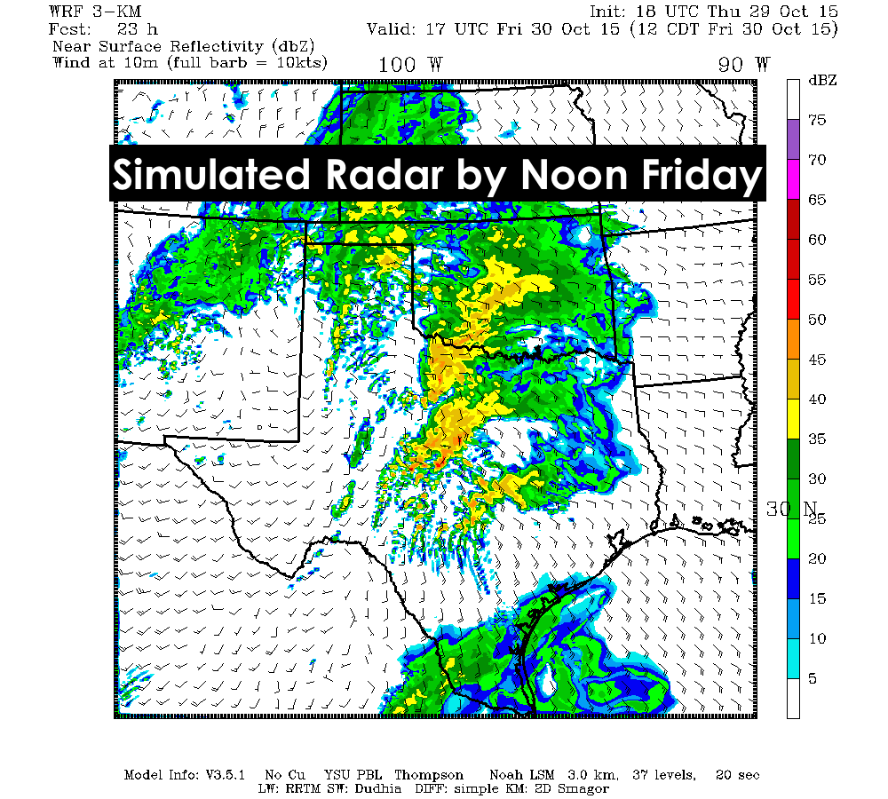
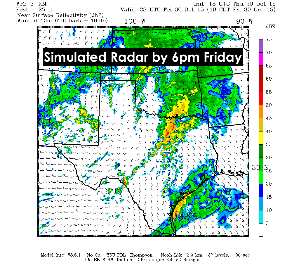
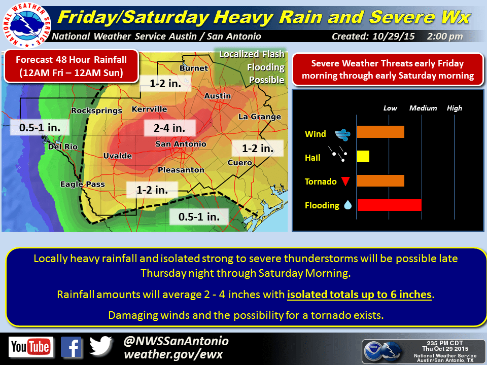
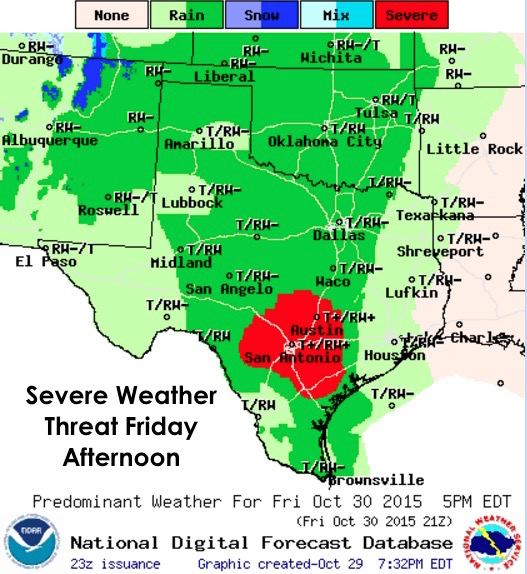
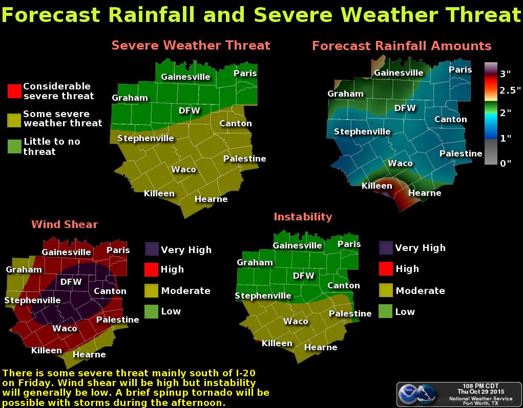
While we will have a lot of wind shear, what we like to refer to as “spin in the atmosphere”, across north central Texas tomorrow, it will be pretty displaced from the better instability which is forecast to be further south. Best chances for seeing severe weather, including an isolated tornado or two, will be south of I-20 and most likely from around Waco down toward San Antonio and surrounding areas. This system will be tracking rather quickly across the state tomorrow and into Saturday, which doesn’t allow for mega-rainfall accumulations like we saw last weekend; however, we expect to see folks across northern Texas picking up anywhere from 1-3 inches and folks across central Texas to pick up anywhere from 1 to 4 inches. There could be some pockets of higher rainfall totals depending on where training of storms sets up which could lead to some localized flash flooding. That’s nearly impossible to predict more than a few hours in advance, so we’ll have to see how things set up tomorrow.
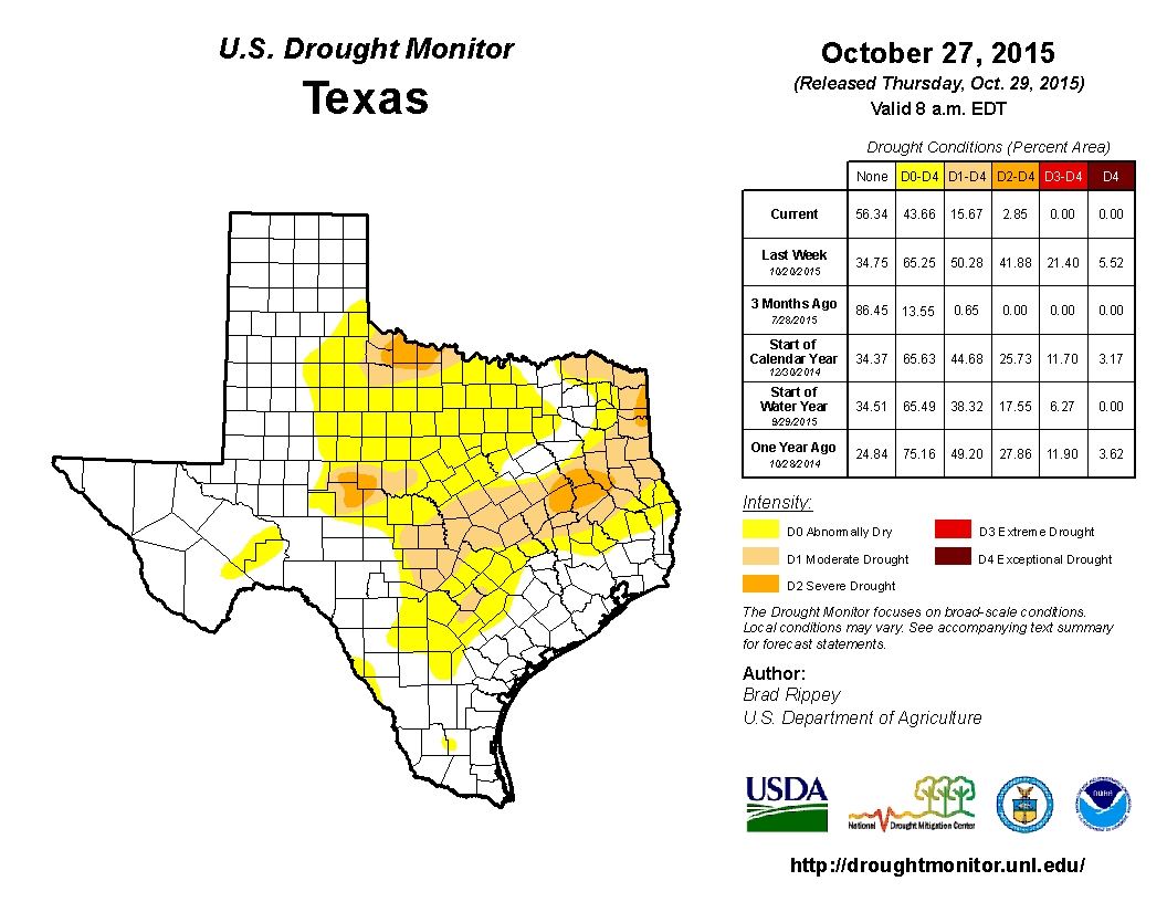
The bulk of the system should be moving out of the area, west to east, by Saturday afternoon. That being the case, all but the eastern half of the state should see decent conditions for Halloween activities on Friday evening. One thing for sure, this rain has been great for our drought conditions. In case you missed it, the latest Drought Monitor was released this morning…and what a difference a week can make! We have another potential system moving in mid week of next week…so hang on! Looks like the well-advertised El Nino pattern is finally showing itself!


0 Comments