
An impressive trough over the eastern United States brought a northerly flow over most of Texas this past weekend. The result was the surge of much drier air with comfortable nighttime temperatures. I hope you enjoyed the fall preview because we’ve transitioned back into a summer-type pattern. The trough to our east has been replaced with a ridge of high pressure over the southern United States. A tight pressure gradient thanks to a low pressure in eastern Colorado will result in gusty south winds this afternoon. With the southerly winds originating from the Gulf of Mexico and Deep South Texas we’ll see rapid advection of moisture transport north tonight. Humidity and the summer tropical airmass will return to most of Texas by mid-week.
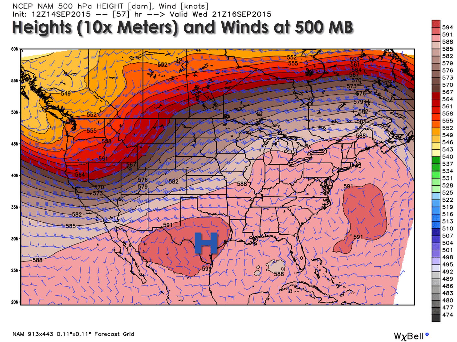
By Wednesday Afternoon the high pressure aloft will be well established over Texas. A negative-tilt trough will be impacting the northwestern United States but most of Texas will remain under the influence of the high pressure. Overall the upper-air pattern should result in fairly benign pattern for most of the work week.
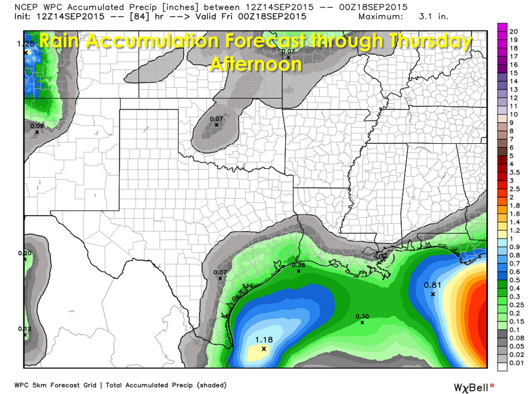
The precipitation forecast through Thursday afternoon from the Weather Prediction Center highlights the dry weather forecast quite nicely. Folks along the coast and in Southeast Texas will have isolated to widely scattered storm chances during the afternoon hours this week. With tropical moisture in place along with the benign pattern aloft it’s no surprise that we could see a few afternoon popcorn storms along the coast.
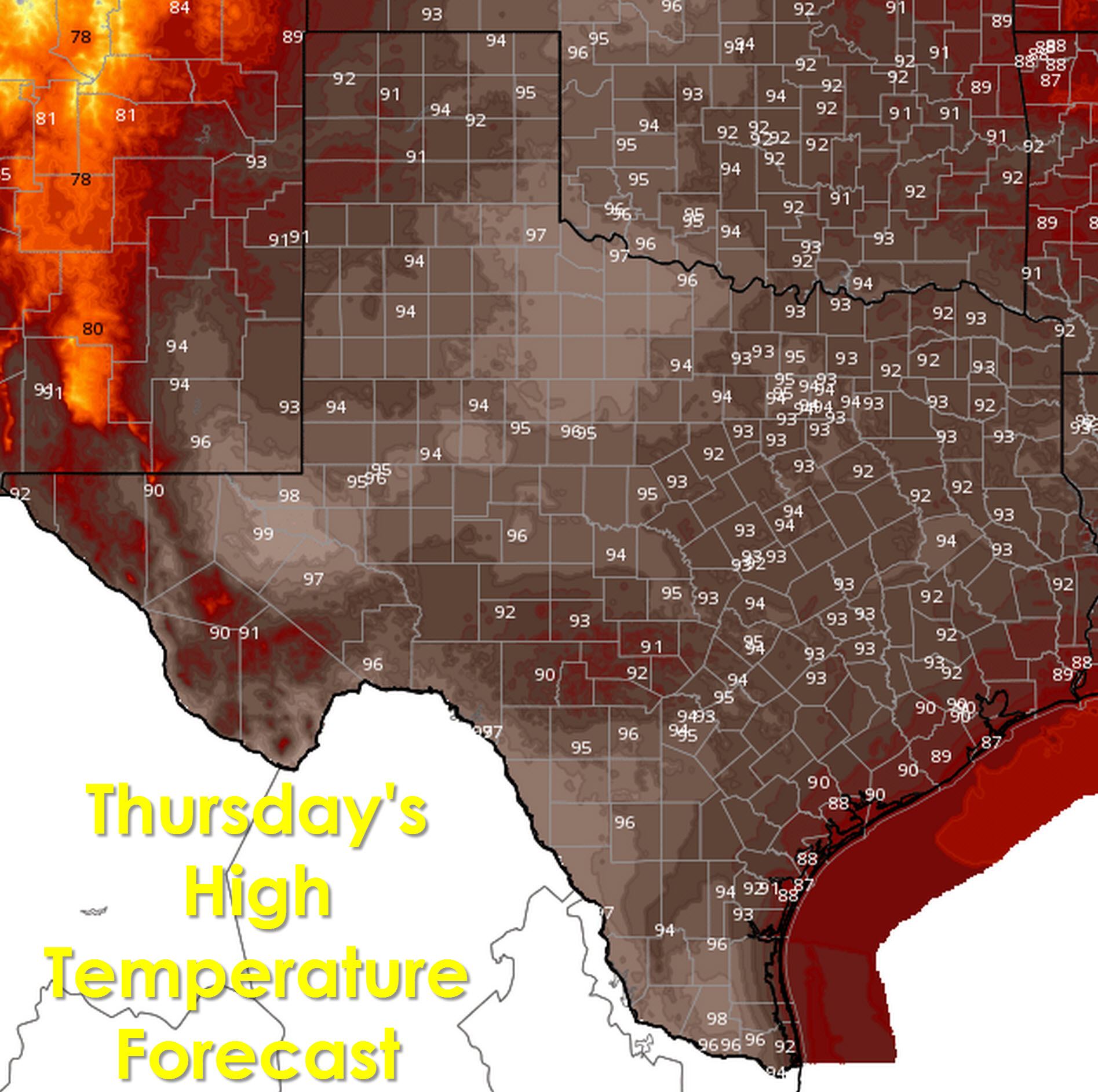
Temperatures will be above normal this week with the high pressure in place allowing for ample warming during the daylight hours. With dewpoint and humidity values increasing there will also be a noticeable heat index in addition to the toasty afternoon temperatures. Low temperatures will also be a bit above average for mid-September in some locations.


Weather models are indicating we may get our next cool front around Friday but the overall timing/strength will depend on several factors. Temperatures probably won’t drop much but we may see a few storms in conjunction with the front. An increase in precipitation chances next week may occur as we head back into a more active weather pattern – but thats off in weather model voodoo land and subject to change.


0 Comments