
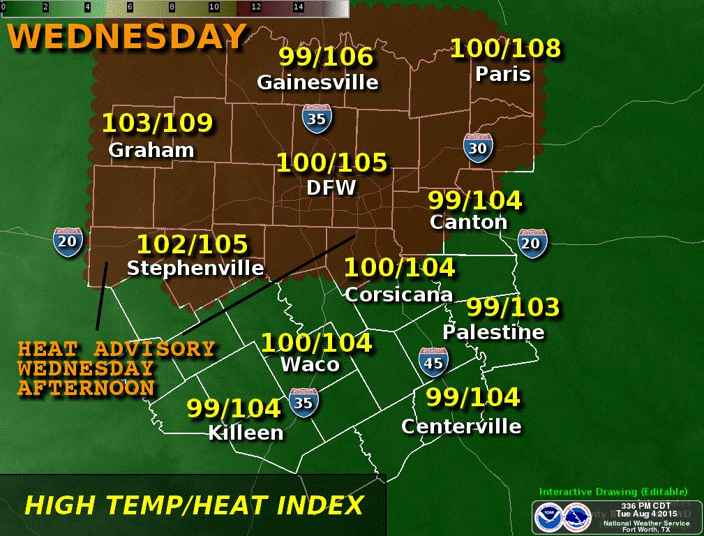
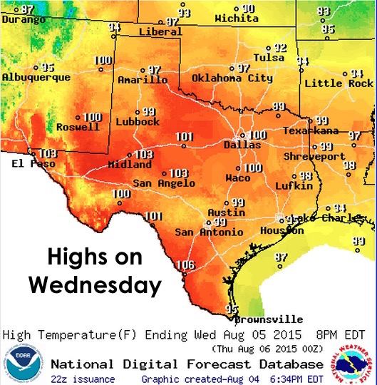
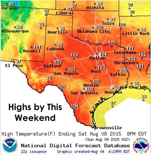
As high pressure continues to build back east across the state, temps will be on the rise to dangerous levels by tomorrow and likely through the weekend. Some parts of the state will see temps higher than they’ve been in quite some time. Heat Advisories have been put into effect beginning tomorrow at 1pm across parts of north Texas, including the Dallas/Ft. Worth metroplex. With the increase in moisture and humidity over the past 24 hours, Heat index values tomorrow and again on Thursday will be topping out close to 105 across the region…and tipping 110 by the weekend. This certainly has the potential to become deadly for anyone sensitive to the heat, or to those working outdoors during the afternoon hours.
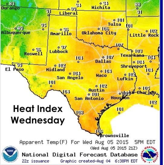
Thursday doesn’t look much better with temperatures climbing an additional couple of degrees and Heat Index values following along right behind. It’s this time of year that we talk a lot about the heat index which is basically how hot it “feels” outside at any given time. How high the humidity values become plays an important role in calculating the resulting heat index value. The more humid it is, the less evaporation occurs when you sweat. That evaporation process is what helps to cool you off. If the sweat can’t evaporate quickly enough, you’re much more likely to experience heat illness or heatstroke. You also have to keep in mind that heat index values are calculated based on being in the shade, which means that if you’re out in direct sunlight, you can easily add a good 10 to 15 degrees to it. Also a factor this year…we didn’t heat up as early in the summer season as we usually do, so we’re not really as acclimated to this as we normally would be by the first of August.

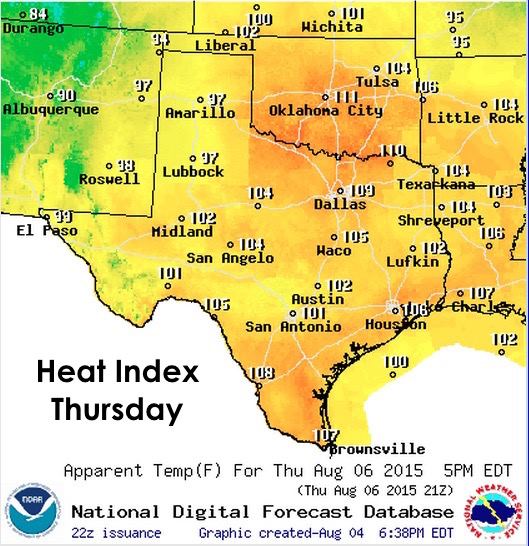
Beyond Thursday, high pressure will center over the state and temps will continue to climb through the weekend and heat index values will top out near 110 for some parts of northern Texas. That’s going to feel hotter than fried h-e-double hockey sticks!
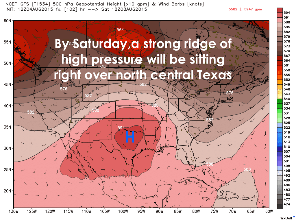
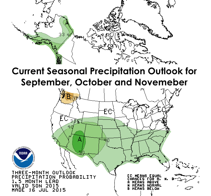
I’d like to say things will get better going into next week, but current mid to long-range forecast models are staying consistent with keeping this strong ridge of high pressure over Texas for at least the next 7 to 10 days. Beyond that, there’s really no (reliable) way to determine when we’ll get our next break from the heat and see rain back in the forecast. All we can do now is wait it out and see how we do as we get into meteorological fall…September through November. The Climate Prediction Center outlooks below for those months are certainly looking optimistic!


0 Comments