

The hot off the press weekly drought monitor does not bring good news. This past July along with the past 30+ days have been some of the driest on record along and east of Interstate 35. Even with record rains in May the likewise impressive ongoing dry streak has resulted in the rapid development of drought conditions. Even in the past week we’ve seen drought conditions quickly deteriorate across East Texas, Southeast Texas, and even Central Texas. Local fire departments and the Texas Forestry Service have been responding to numerous grass fires – some of them becoming quite significant. Very hot conditions over the past few weeks has helped accelerate the redevelopment of drought conditions and drying of grasses. The rain in May helped grow grasses and now they’re almost bone dry. Until our weather pattern shifts conditions will only worsen. A bit of good news is that we should see the heat abate slightly next week. Afternoon storm chances may also return. While those afternoon storms won’t be big rain-makers at least some folks may get a bit of rain.
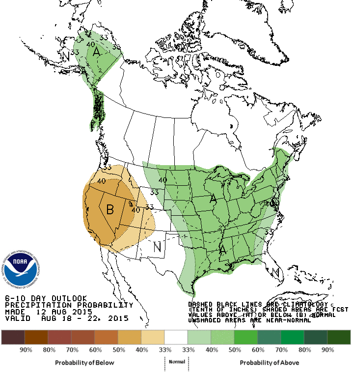
The Climate Prediction Center is forecasting an average to above average chance for precipitation in the 6 to 10 day timeframe. With more clouds we should see temperatures fall back to seasonal averages. For most of Texas that means high temperatures in the low to mid 90s.


0 Comments