
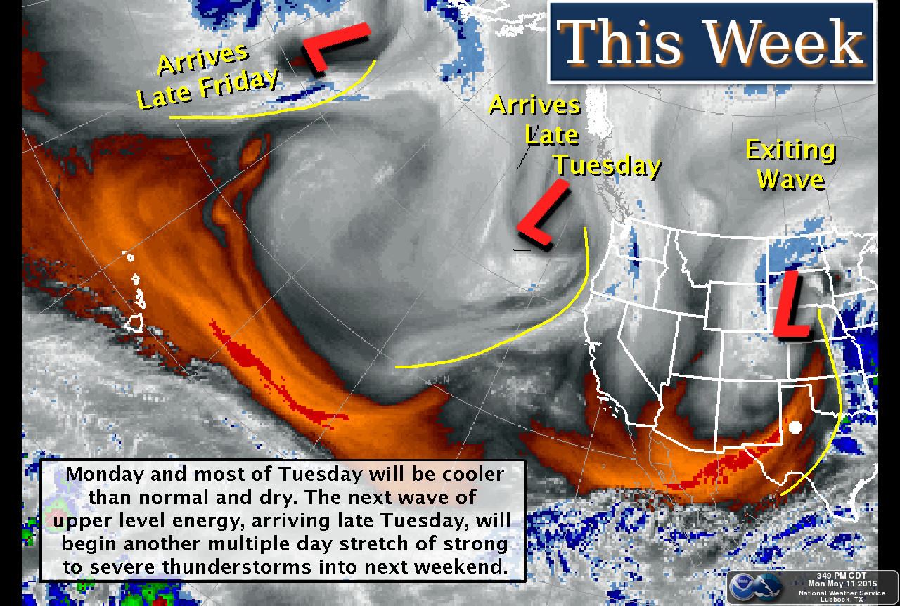
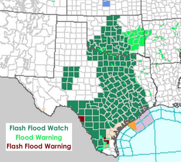
 Multiple chances for rain and storms this week as the state is impacted by several different upper level impulses. Our already saturated soils can’t hold much more without some pretty major flooding issues. A good 1/3rd to nearly 1/2 of the state is currently under some sort of flood watch or warning. It’s been years since we’ve seen this happen! As much as we’re sick and tired of the flooding rains, they are working to help end our long-term drought. Even with all this, there will still be some parts of the state which will remain in at least some level of drought. The next Drought Monitor arrives this Thursday, so it will be interesting to see how much of a dent has been made this past week and this week.
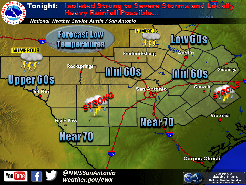
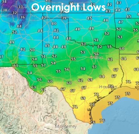
Rain and strong to severe storms tonight will remain concentrated across parts of south central and deep south Texas. The heaviest rainfall is expected over the Rio Grande Plains and Brush country as a weak disturbance moves in from Mexico. Strong to severe storms are ongoing across the region with hail and gusty winds being the main threats. Overnight flash flooding is also a concern, so drive carefully if you have to be out and about overnight in this region.
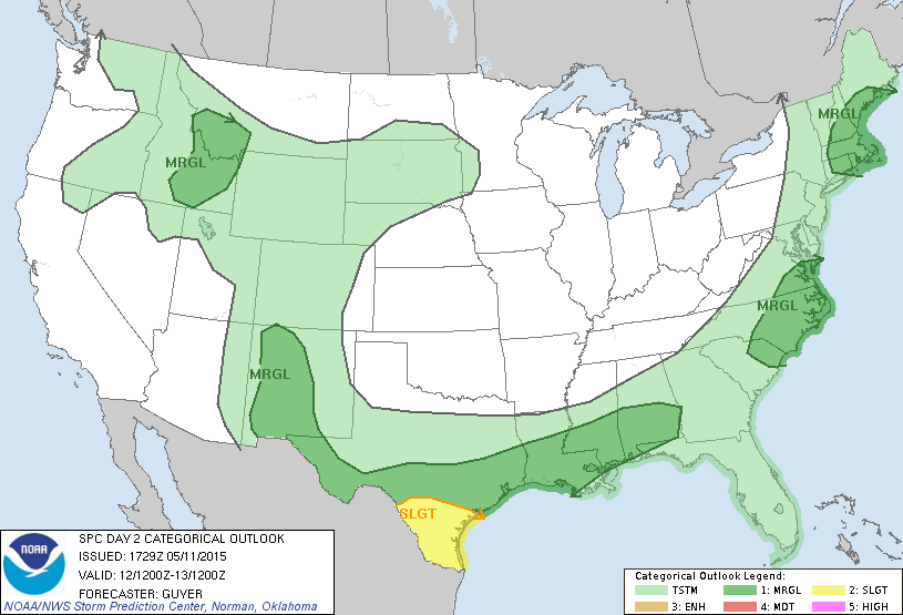
 Tomorrow’s severe weather threats will be concentrated across deep south Texas with a Slight Risk of seeing a few strong to severe storms with hail and wind threats develop tomorrow afternoon. The tornado threat is low, but not zero. And with the amount of moisture available, we could also see a few tropical funnels in the area. Elsewhere, calm and dry behind the stalled cool front which is currently draped across south central Texas.


0 Comments