
With a very active period weather-wise I’m going to divide this up into severe weather and flood potential. I do believe the primary and most high-impact hazard this weekend will come from flooding. Some flooding will likely end up approaching record numbers along the Red River. With rivers and lakes already near or above capacity we’re going to have serious issues this weekend. Soils are completely saturated which means whatever rain falls will runoff and quickly produce flash flooding. High-end flooding is a concern as the evacuations in Wichita Falls demonstrate. At this time we will not be posting all evacuation information but I do invite you to use our social media outlets (Facebook page and Twitter) as a way to share information about local evacuation shelters and other helpful tips.
Severe Weather Possibilities
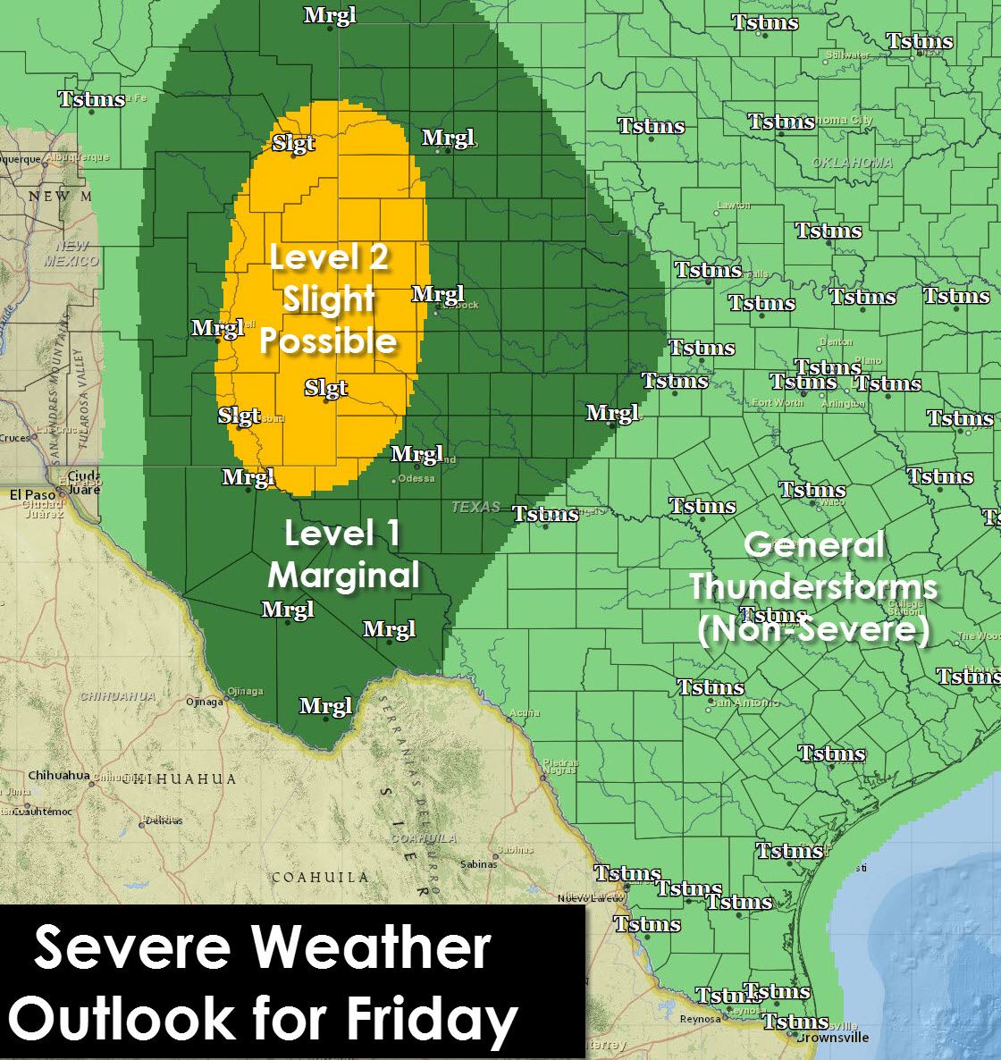
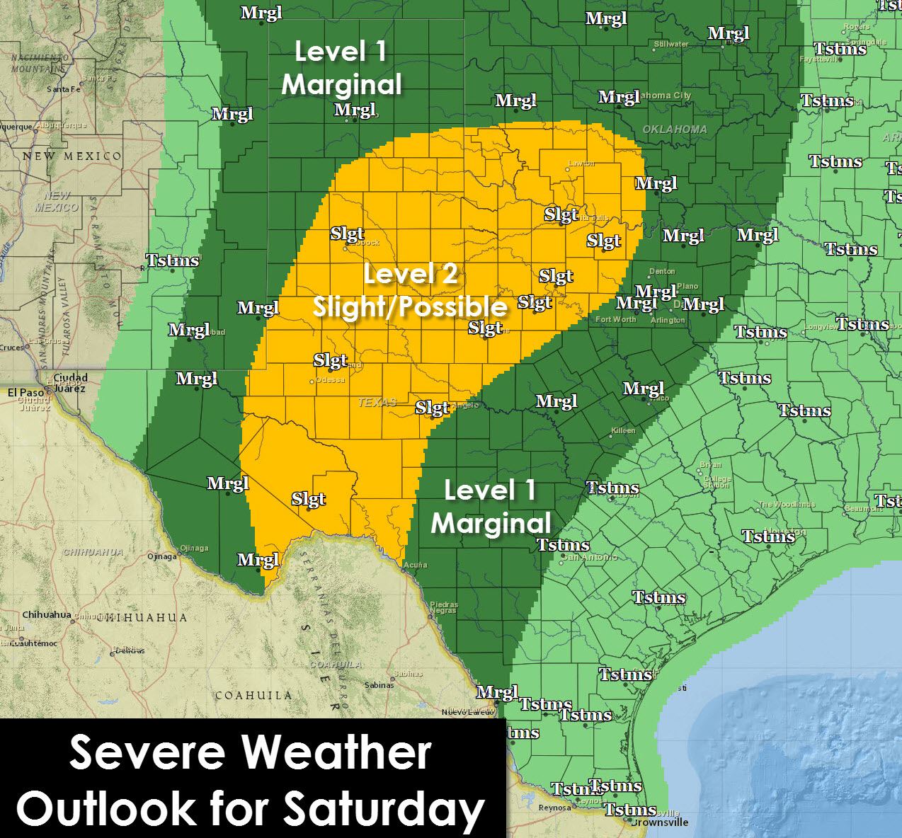
A few severe thunderstorms with large hail will be possible along the Mexican border in Southwest Texas this afternoon. A southward moving cold front will keep most of Texas clear of severe weather chances today as the atmosphere will be more stable. Severe weather will be possible on Friday in West Texas east of a dryline. The strongest storms will be capable of producing large hail, damaging winds, and perhaps a tornado. Saturday looks to be the most concerning regarding severe weather chances based on the latest weather model data with all modes of severe weather possible – including tornadoes – as we see slightly more impressive wind fields. As always the forecast will likely change so check back for updates on Friday.
Day-by-Day Rain Chances
Even with relatively high probabilities for rain that does not mean it’s going to be raining all the top. There will be breaks in-between multiple rounds of thunderstorms and heavy rain. The chances depicted on these graphics don’t indicate how much of the time period will be wet/raining – but the chance of rain as a whole. Nevertheless it’s going to be very wet over the coming days with a significant threat for flooding in areas that already are inundated.
Overall Rain Total Forecast
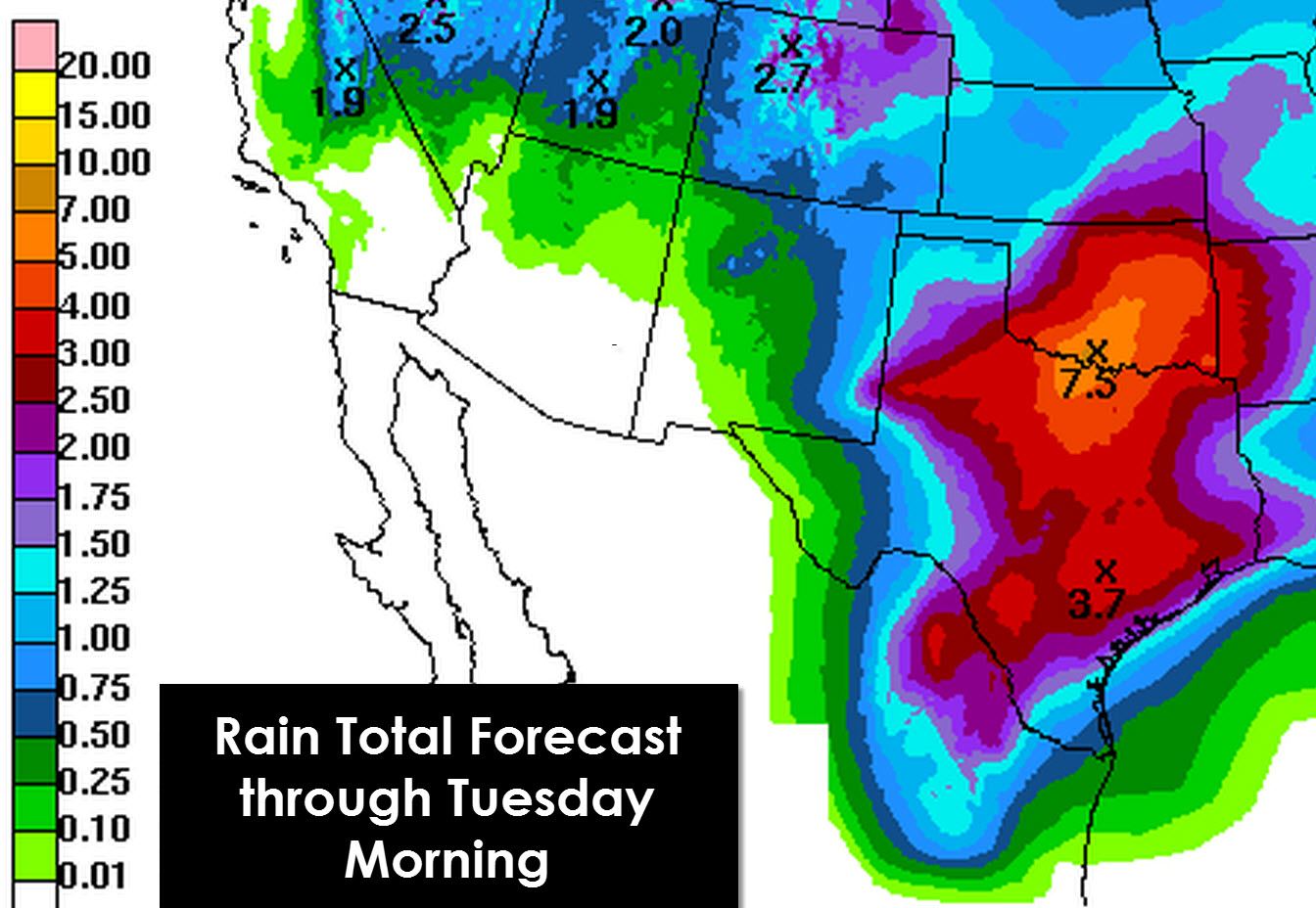
The primary timeframe for heavy rain will be Friday through Monday based on current data. Rain will not be falling the entire time but in multiple waves. Moisture in the atmosphere will be very high and thus storms will be efficient heavy rain producers. The heaviest storms may produce 1 to 3 inches of rain per hour at points. Rivers/lakes across the Red River Valley into North and Central Texas are near or over capacity/in flood. Based on the upcoming rain forecast through Monday a potentially significant and widespread threat for flooding could develop. Evacuations have already been ordered for a few neighborhoods in Wichita Falls and I wouldn’t be shocked to see more evacuations this weekend. Saturated soils will ensure any rain that falls will runoff and quickly cause flash flooding. The Concho Valley and Big Country still have plenty of room in their lakes which need filling. We’re expecting a good soaking in those areas as well so at this point they still need all the rain they can get. Make no mistake about the past few weeks and upcoming weekend – this is a drought buster. We’ve not only filled many lakes but many are flooding. Its taken a few weeks to end a multi-year drought in parts of Texas. The drought is not over for ALL of Texas – but those still experiencing major drought problems are certainly lower in number than early April.


0 Comments