
The blog title says it all. I’ll just leave this right here for y’all.
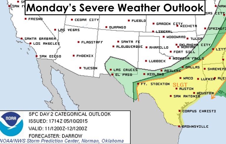
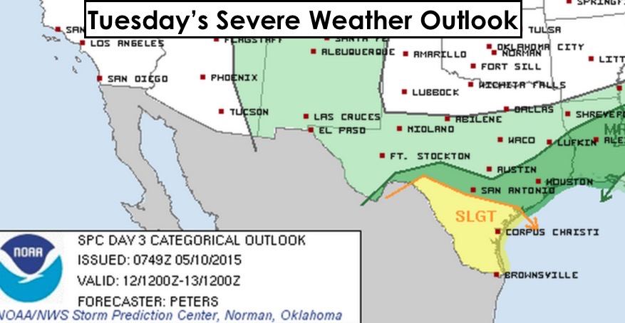
 Mother Nature isn’t done with us just yet. We’ll be looking at continued heavy rainfall potential across the state this week as another low pressure system develops across the west and works its way east during the week. Our soils are already soaked across much of central and northern Texas, so any additional rainfall across the area will just add to the ongoing flood issues. A majority of the rainfall Monday and into Tuesday will be across central and southern Texas as a weak cold front moves into northern Texas. On Tuesday, the front lifts north and dissipates opening the door to additional widespread rain and storms for west central, central and northern Texas Wednesday through Friday. For Monday, the areas with the greatest risk of seeing severe weather will be across central and southern Texas. For Tuesday, mainly south Texas. We’ll have updates each day this week outlining the specific threats and areas, so be sure to check back!


0 Comments