
The forecast for tomorrow afternoon still depends on how much clearing we get by the afternoon along with how quickly clouds clear out. If we have the morning storms along with clouds remain in place well into the afternoon than we’ll have a lower severe weather threat. On the other side of the spectrum if we have plenty of clearing skies and the atmosphere is able to become strongly unstable we could have problems tomorrow afternoon and evening.
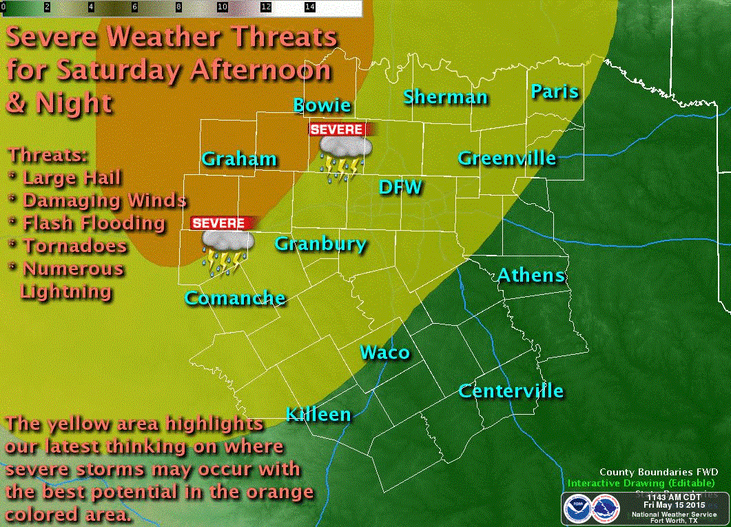
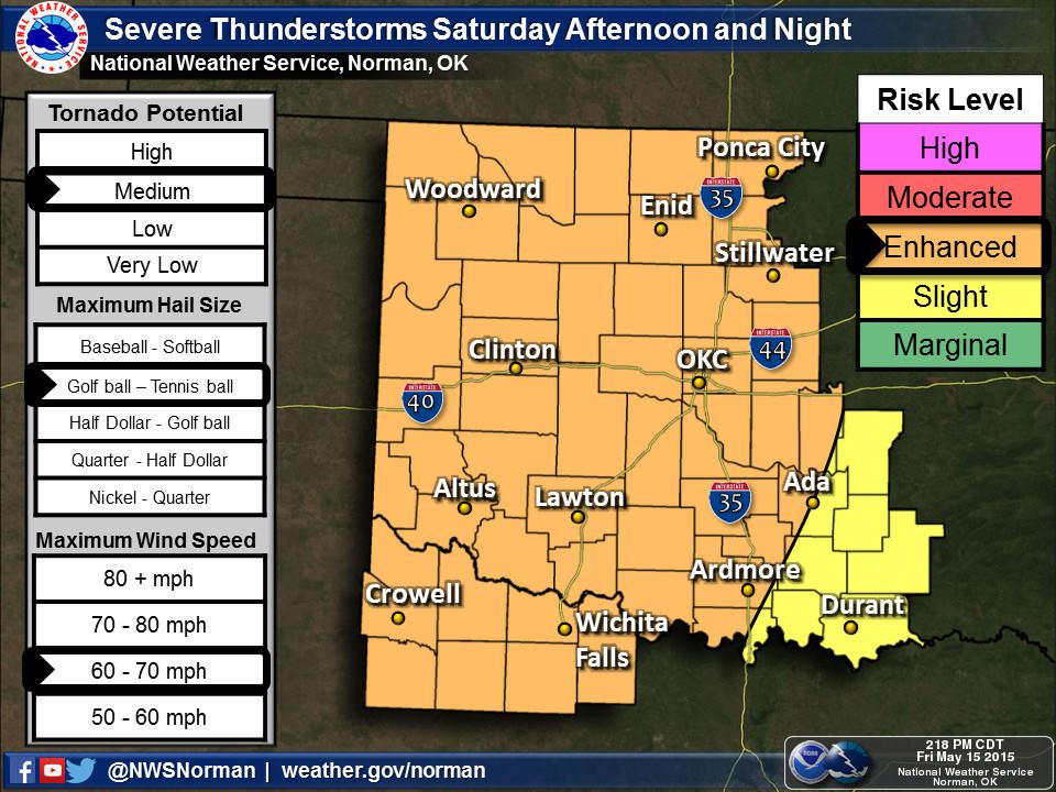
Tonight’s high resolution North American Model develops severe thunderstorms in the eastern Panhandle around 3 PM Saturday. These storms would move east into Oklahoma. Additional thunderstorms will develop further south in Northwest and West-Central Texas in addition to the storms in western Oklahoma. The strongest of these discrete storms are expected to be supercellular with very large hail, damaging wind gusts, and a tornado threat. By tomorrow evening we should see a larger cluster of thunderstorms moving east with a hail, wind, and flooding threat.
That’s all assuming the NAM is correct – which it probably isn’t 100 percent. We’ll have to watch things tonight and see how things set up tomorrow. If everything comes together a rather substantial severe weather risk will setup across Kansas, Oklahoma, and perhaps Northwest Texas with all modes of severe weather. As this spring has reminded us it only takes one storm to make big problems.


0 Comments