
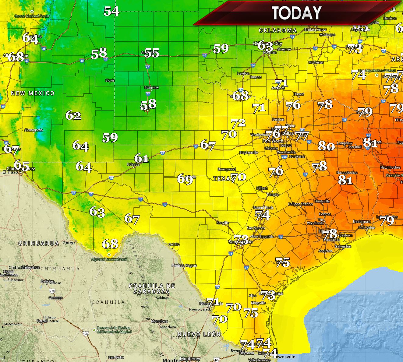
An advancing cold front will result in much cooler temperatures today across the Texas Panhandle, West Texas, and Permian Basin. For most of Texas we’ll see clouds on the increase as we prepare to begin a precipitation event. High temperatures will be warmest across East Texas where Lufkin is currently forecast to hit 81 degrees this afternoon. 70s can be expected across Northeast, North, Central, South-Central, Southeast, Deep South Texas into the Rio Grande Valley. We’ll see 50s and lower 60s across the Panhandle, West Texas (South Plains, Rolling Plains), into the Permian Basin, Concho Valley, and Big Country.
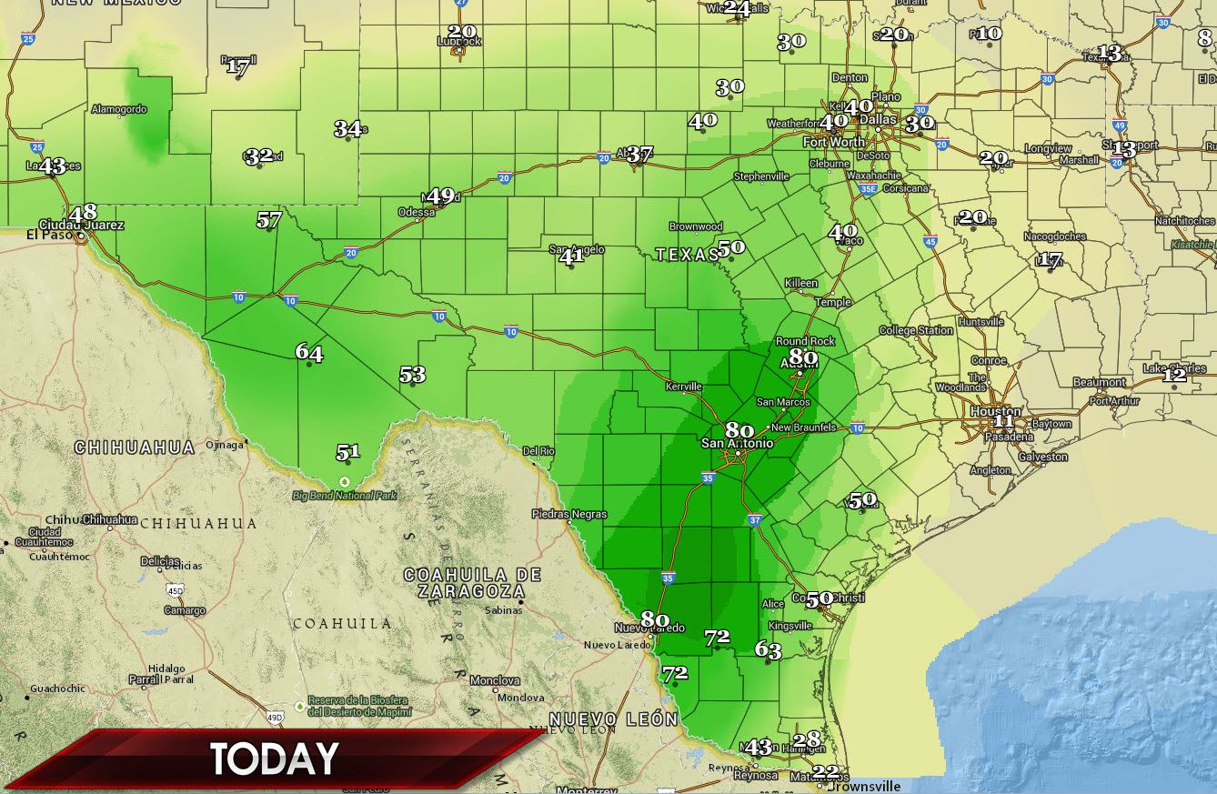

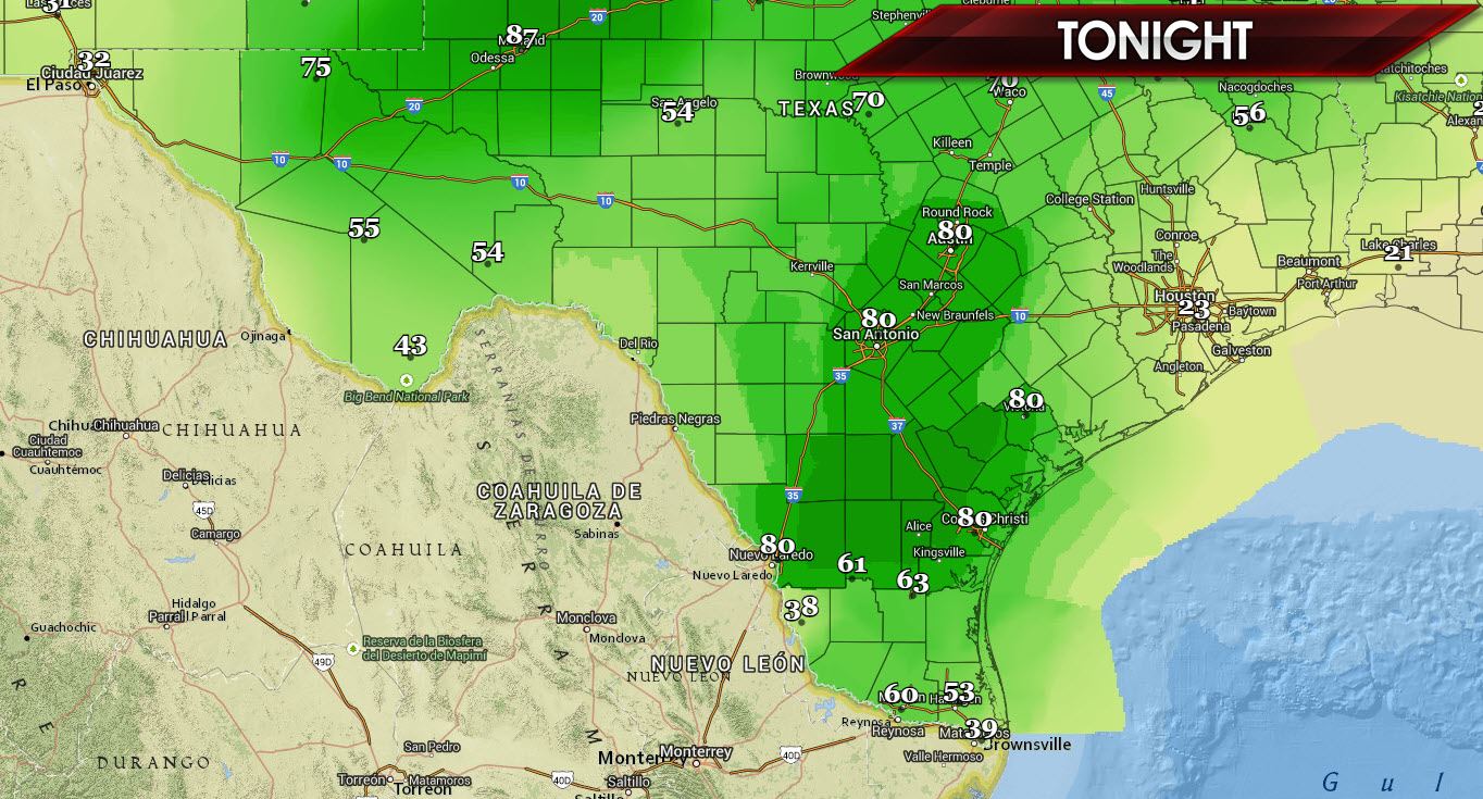
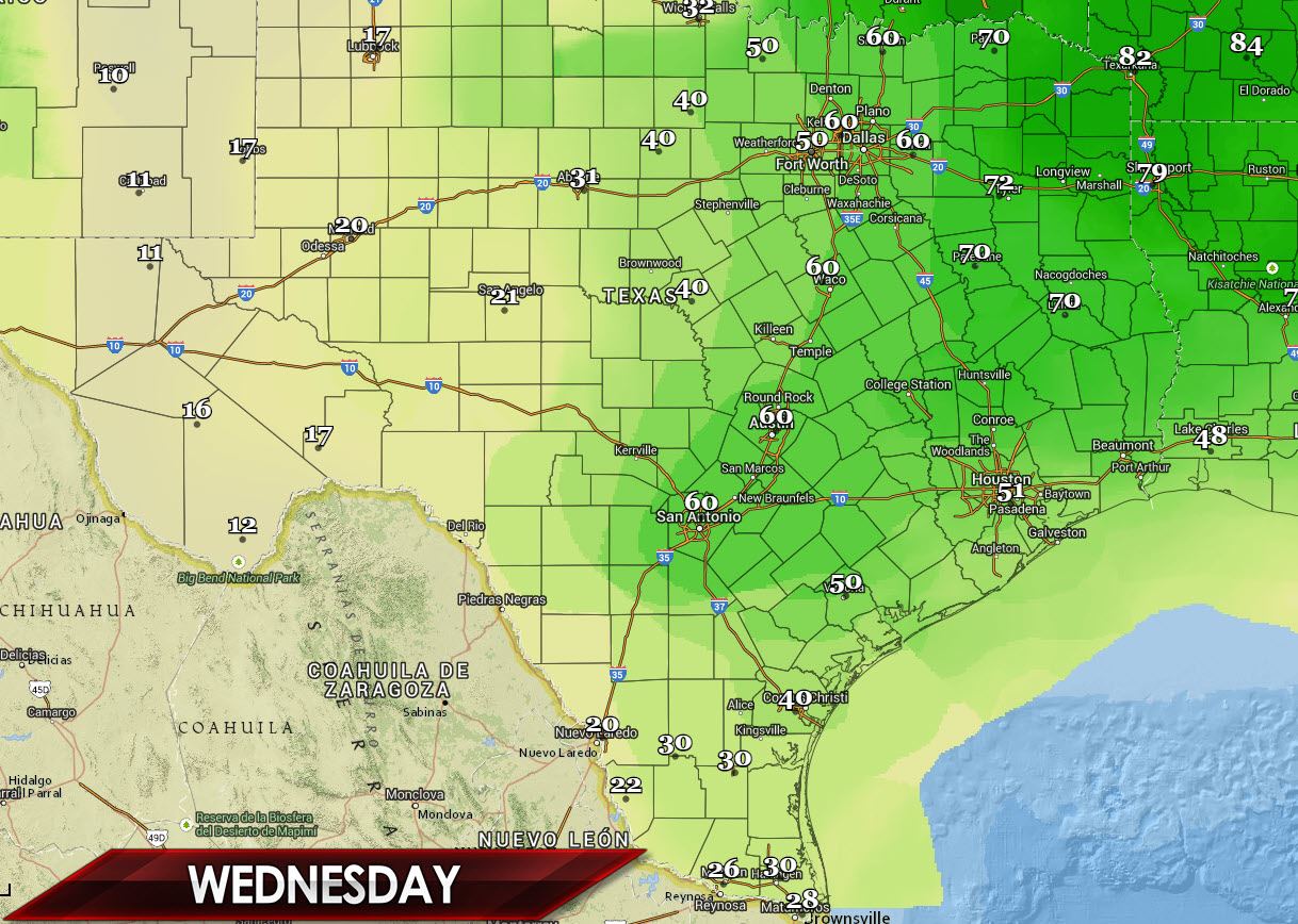
Rain chances through this afternoon will be highest across South-Central and Deep South Texas where rain will become more widespread by this afternoon. Rain chances will also be high across the Alpine and Davis Mountains with moderate chances in the Permian Basin and Concho Valley. Widespread precipitation will overspread a large chunk of Texas tonight as an upper level storm system combines with plentiful moisture to squeeze out the rain. Most everyone except the northwestern Texas Panhandle and Southeast Texas should see rain in their vicinities tonight. Rain chances will begin shifting east on Wednesday but it still looks like a wet one for the I-35 corridor from San Antonio north into the D/FW Metroplex into Oklahoma and points east. Southeast, East, Northeast, North, Central, and South-Central Texas will all continue to see some rain on Wednesday.
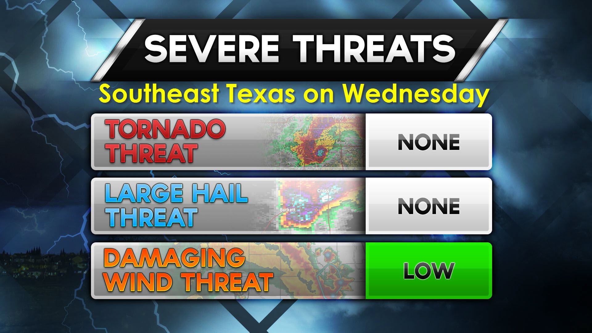
At this time the severe weather threat is minimal today and tonight. There is the chance we may see a few stronger storms across Southeast Texas on Wednesday if we can get a little sunshine. Should that occur a few storms may produce locally gusty winds up to 50 MPH and small hail in additional to heavy rain. Widespread severe weather is not expected on Wednesday. Localized flash flooding may occur tonight in areas that see heavy rain train over the same locations. Phrased differently I mean to say that if we see heavy rain move over the same areas tonight we may have localized flooding issues.
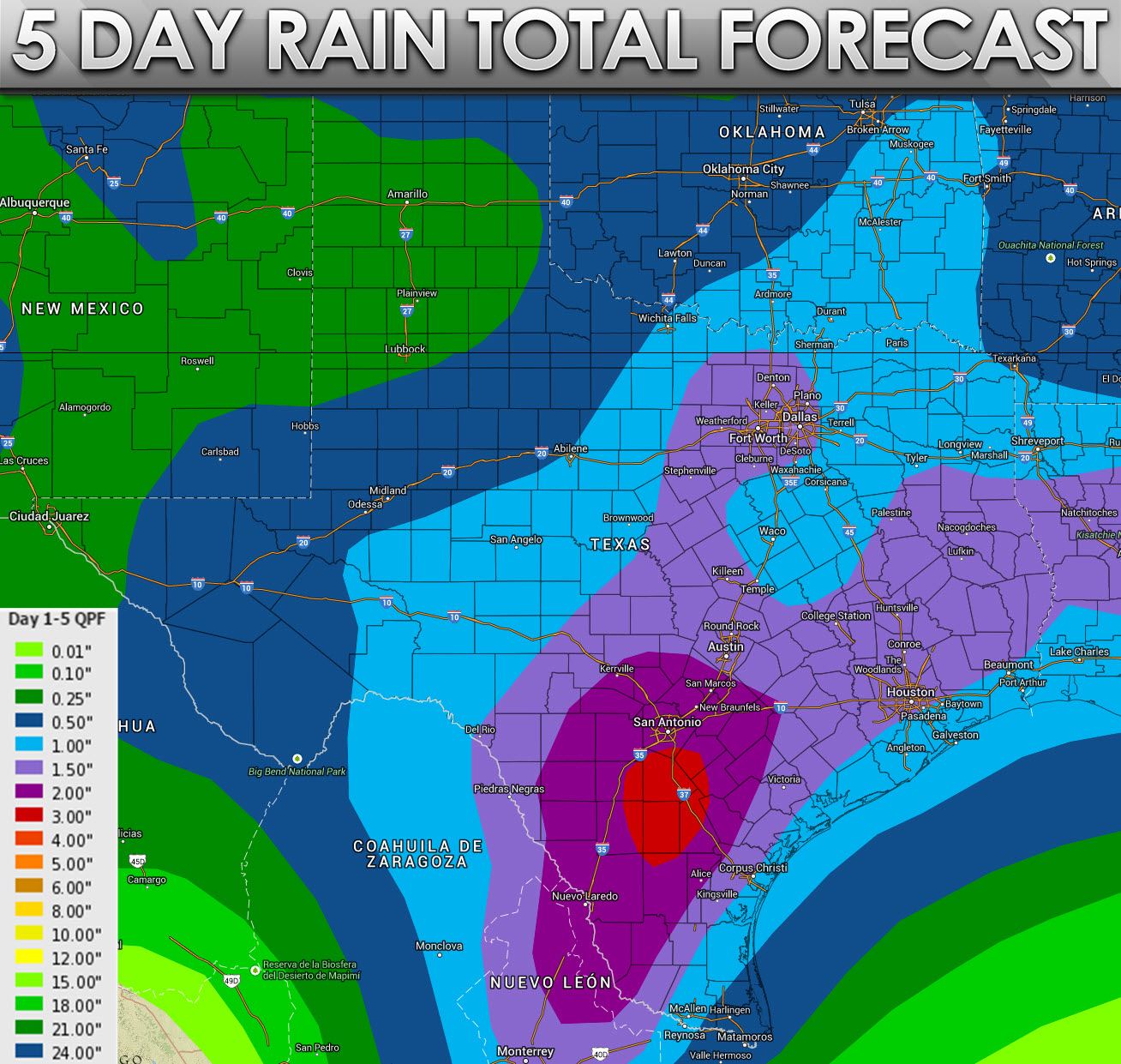
By the time all is said and done plus with another chance of rain later this week in the Panhandle I do expect nearly all of Texas to see rain over the next five days. The heaviest rain totals should be across South-Central Texas but beneficial rain is expected from the Permian Basin across the Big Country into North and Central Texas including the Hill Country. Hopefully we can add a little water to some lakes this week. If nothing else I bet the bluebonnets will really start coming out next week after all the rain!


0 Comments