
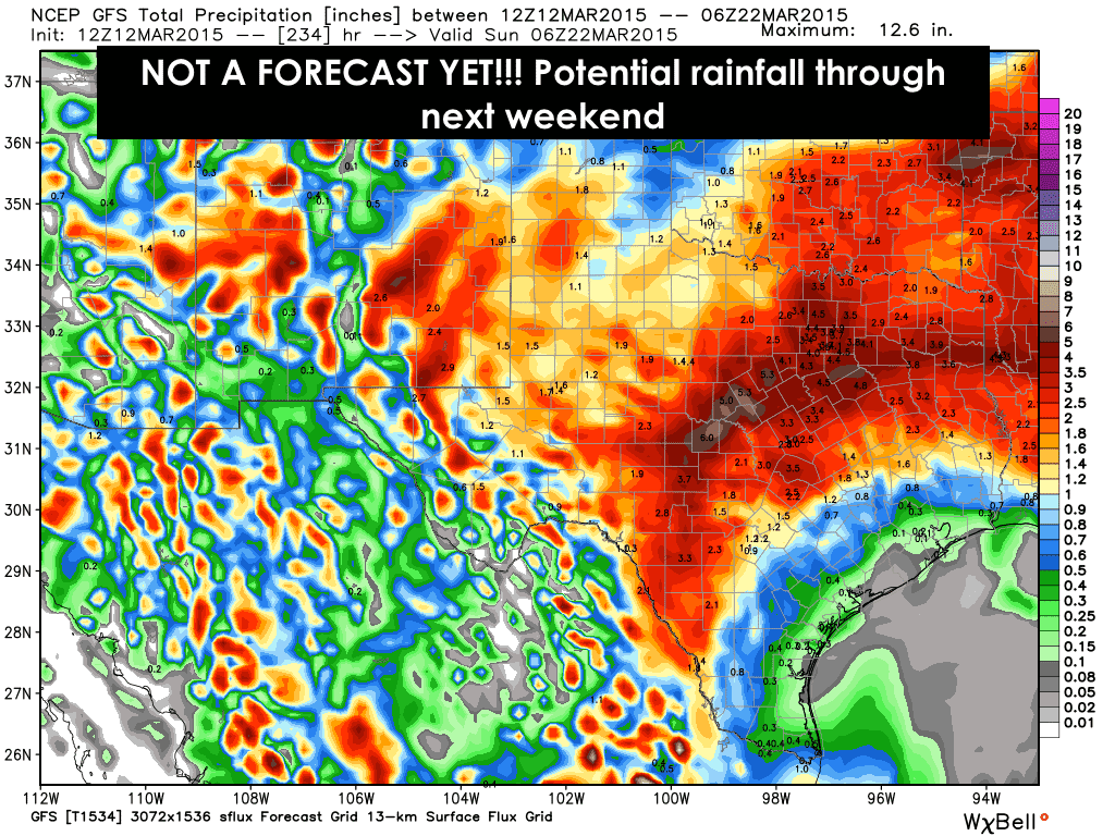
I always thought it was April showers…but anyway, it does look like we return to a wetter than normal pattern next week with a couple of upper level disturbances developing off the Baja California coast and tracking east into northern Mexico and the desert southwest and across Texas during the week. The counterclockwise motion of these lows will tap into a good bit of pacific moisture and draw it up into the southern portion of the state beginning next Tuesday. The rain chances look to begin by next Tuesday and expand north and eastward Wednesday with the first upper level disturbance. We’ll probably have a small break from rain on Thursday, then rain returns again Friday into Saturday as the second upper level disturbance passes overhead. We might even see the return of thunderstorms across southwest and west central Texas. None of this is etched in stone yet with some disagreement in rainfall amounts and timing showing up in the current long-range models, but both are consistent with bringing much healthier rain chances…and yes, more gloomy weather…back into our state next week. And after looking at the latest drought monitor which came out today, there are still many areas of the state in at least some amount of drought and they need this rain. I’m also hopeful this will help out the bluebonnet crops in April! As always, we’ll continue to monitor the latest data and keep you informed as the forecast refines.


0 Comments