
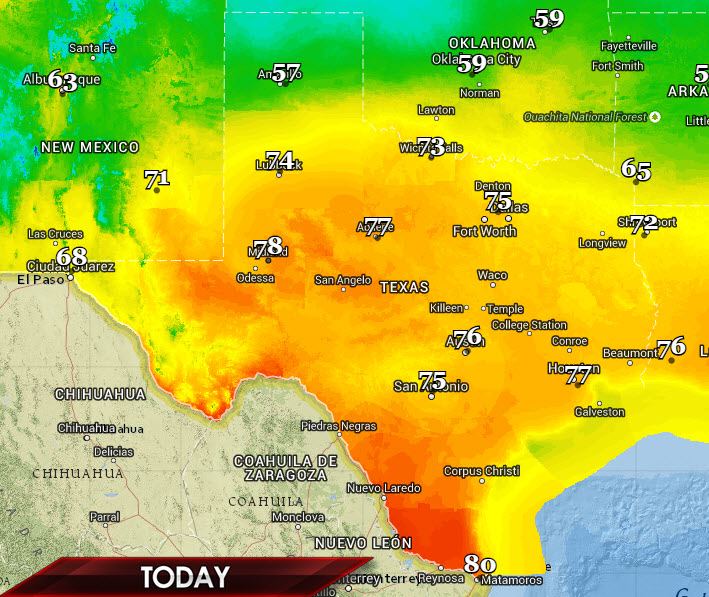
Today will essentially be a ‘changing’ day as an upper level low sits across far West Texas. A cold front will slowly progress southward across the Texas Panhandle into West and Northwest Texas. North of the front temperatures will be on the cooler side but a majority of the state will see another spring-like day. High temperatures will be in the 70s across the Permian Basin into all of North, Central, South, East, and Southeast Texas. Lower 80s are expected in the Rio Grande Valley with south winds. Enjoy the weather because that upper level low will help bring another round of increased precipitation chances beginning tonight in Northwest Texas and spreading south and east on Friday and Saturday.
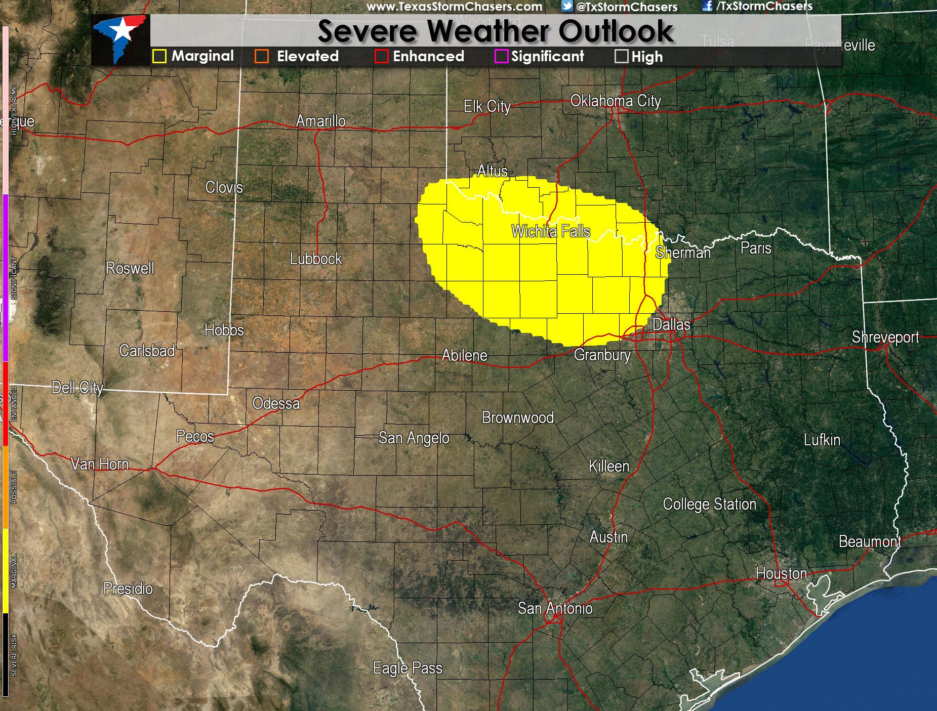
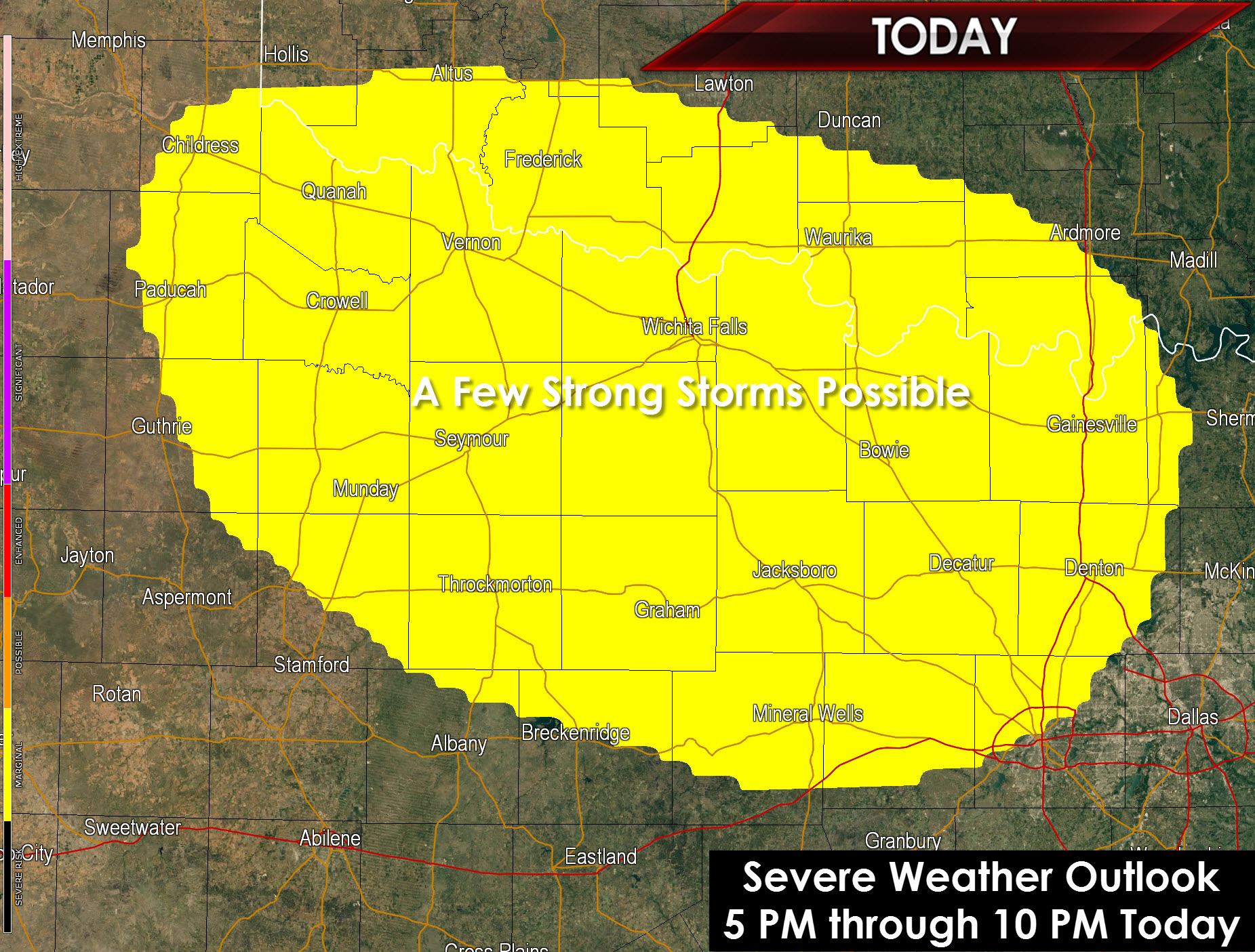
As the surface cold front progresses south it will interact with a more unstable airmass. Mid-level winds aloft will be moderately favorable to support organized thunderstorms. These ingredients will be in place across Northwest Texas this afternoon. Without going into a complete and long-drawn out post I’ll simply say we expect a cap to keep thunderstorms at bay except right on the cold front. With the cold front moving south in direction and storms moving east it makes sense that the cold front will ‘undercut’ the storms. That means storms will be elevated in warm air above a cooler, more stable layer of air within a few thousand feet of the ground. Elevated thunderstorms typically are less intense then those storms that are ‘surface’ based (or rooted in the instablity just above the surface). Storms rooted above the surface layer, elevated storms, can still pose a hail threat. Strong wind gusts are also not out of the question with elevated storms. Today’s storm setup is marginal with more negative factors than positive. With that said there could still be a couple stronger storms in Northwest Texas late this afternoon to just after sunset.
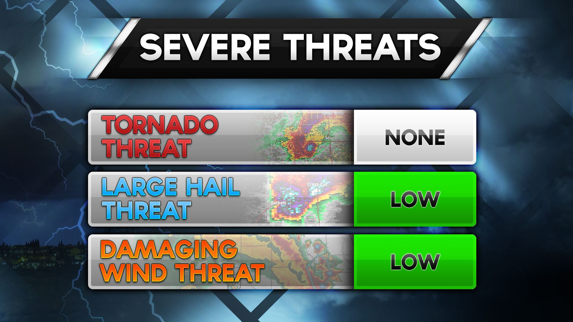
These storms would move east with the most intense storms capable of producing quarter size hail and 55 MPH wind gusts. Any severe weather threat should be relatively short-lived with storms struggling to maintain their intensity thanks to the cold front’s undercutting tendency. On a 5-level threat system with 0 being lowest and 5 being highest today’s threat level is at a 1. The strongest storms may produce quarter size hail and localized wind gusts up to 55 MPH in Northwest Texas. Tornadoes are not expected to be a threat today.
Thunderstorms may become more widespread after sunset and mainly north of the cold front as upper level lift increases across Northwest Texas, Southern Oklahoma, and the Red River in North Texas. Storms north of the front are expected to be below severe limits but a few stronger storms with small hail may occur into the overnight hours.


0 Comments