
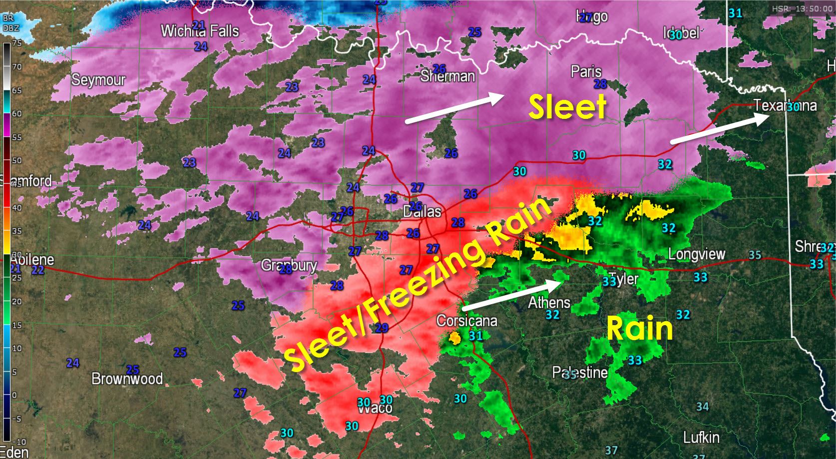
* A large area of sleet continues to move east/northeast across Northwest and North Texas this morning. This is a fast moving system and the back edge of the precipitation will move through the D/FW Metroplex by 9:30 AM bringing an end to heavier sleet. Road conditions in the D/FW Metroplex are slick and hazardous but with most folks at home things haven’t gotten too bad. Roads will likely not improve today as temperatures remain in the 20s.
* Sleet and freezing rain is moving into Northeast Texas where temperatures are at or below freezing. We’ll see accumulations begin to develop through 9:30 AM with some roads becoming slick.
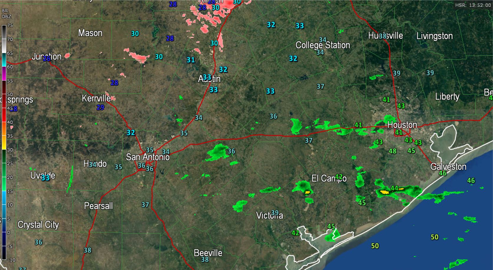
* Temperatures across the Hill Country into Central Texas are at or below freezing but the heaviest precipitation is north of the area. Localized light freezing rain or freezing drizzle may continue to deposit a thin layer of ice on elevated surfaces in spots this morning.
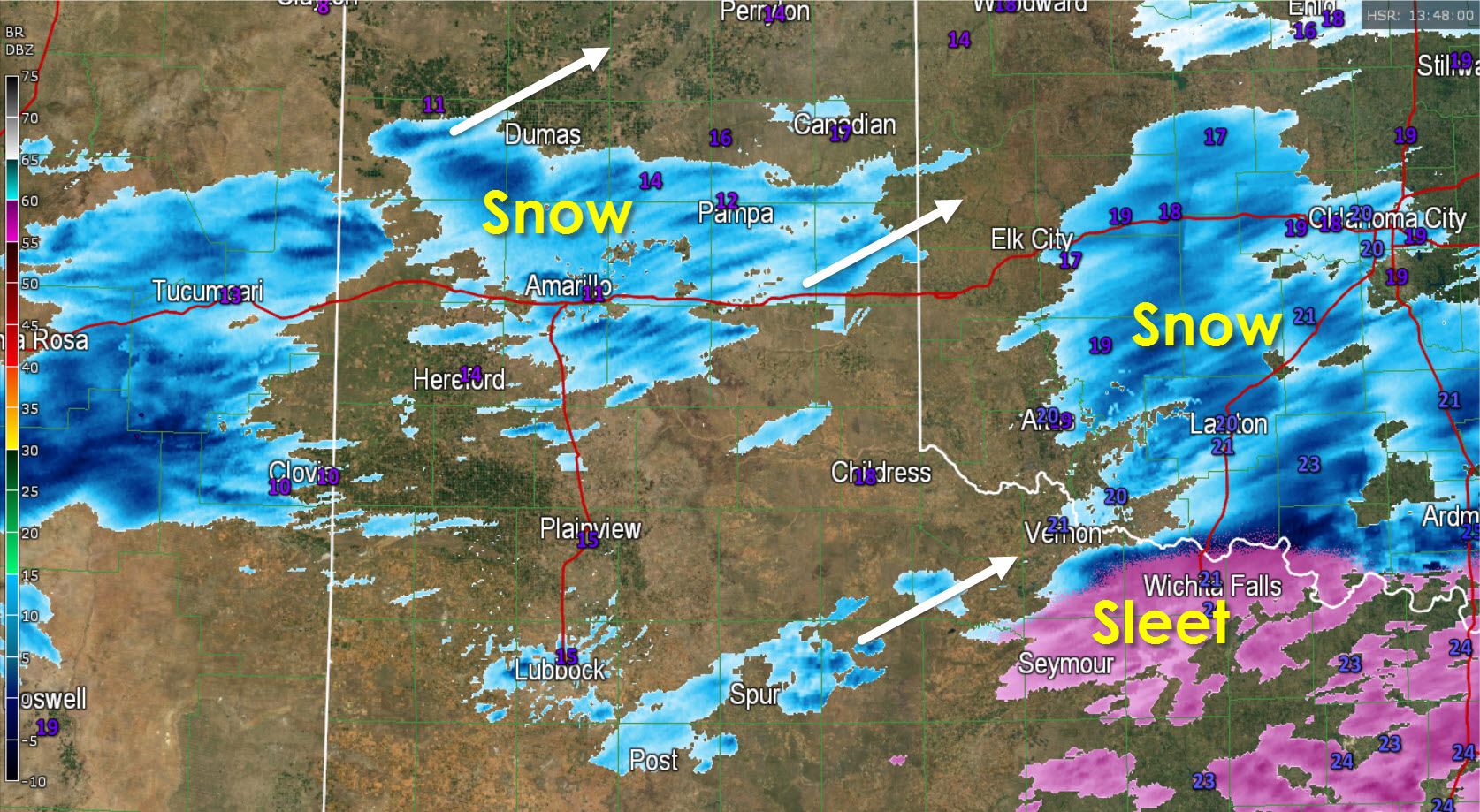
* Light to locally moderate/heavy snow is falling across the Central Texas Panhandle this morning into the South Plains. This activity is moving northeast and may deposit a quick inch of snow in spots.


0 Comments