
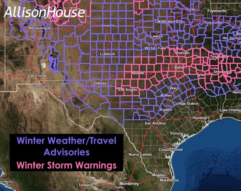
A few changes to let you know about. Additional counties across north central Texas/northeast Texas were added this morning to the existing Winter Storm Warning, in effect from 6pm this evening to 6pm Monday, across west central and north central Texas. The counties ADDED to the current warning are: Fannin, Lamar, Hunt, Delta, Hopkins, Rockwall, Kaufman, Van Zandt, Rains and Ellis. This would include the cities of Bonham, Paris, Greenville, Commerce, Sulpher Springs, Rockwall, Terrell, Kaufman, Forney, Wills Point, Canton, Grand Saline, East Tawakoni, Waxahatchie, Ennis, and Midlothian.
Numerous counties across central and northeast/east Texas were added or upgraded to Winter Weather Advisories which are in effect from Midnight tonight until 6pm Monday: Freestone, Anderson, Bell, Falls, Limestone, Leon, Milam, Robertson, Henderson, Mills, Hamilton, Bosque, Hill, Navaro, Lampasas, Coryell and McLennan. This includes the cities of Fairfield, Palestine, Killeen, Temple, Ft. Hood, Marlin, Mexia, Groesbeck, Centerville, Cameron, Athens, Gun Barrel City, Goldthwaite, Hamilton, Hico, Meridian, Hillsboro, Corsicana, Lampasas, Copperas Cove, and Waco.
The map below provides a comprehensive overview of the current Winter Weather Advisories (blue) and Winter Storm Warnings (pink) with most in effect through tomorrow evening.
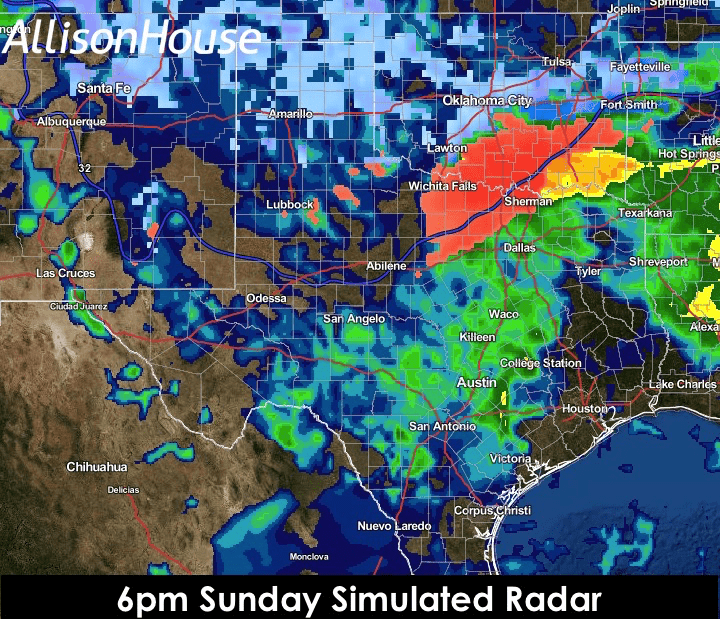
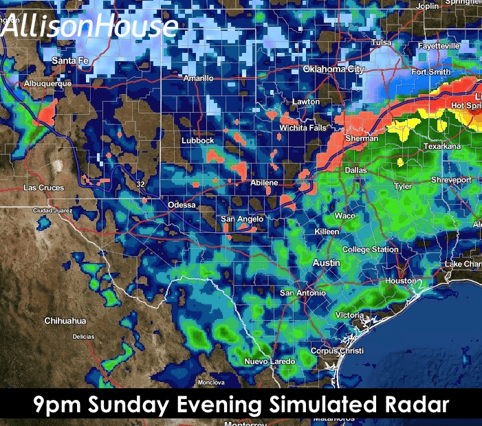
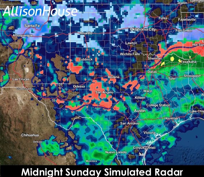
Widespread precipitation has already developed this morning across west central and north central Texas. Temperatures are above freezing across these regions so all of this precip is currently falling as just cold rain. We don’t anticipate temperatures falling to freezing (for areas receiving precip) until after sunset this evening…and that will happen first across northwest Texas then down into the immediate DFW metroplex around midnight. So again, you’re good to go traveling around today across central and north central Texas as only a cold rain is expected. It’s after dark this evening that temps will finally begin to dip below freezing and things will begin to get interesting.

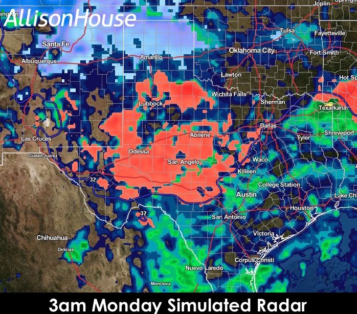
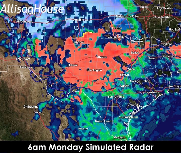
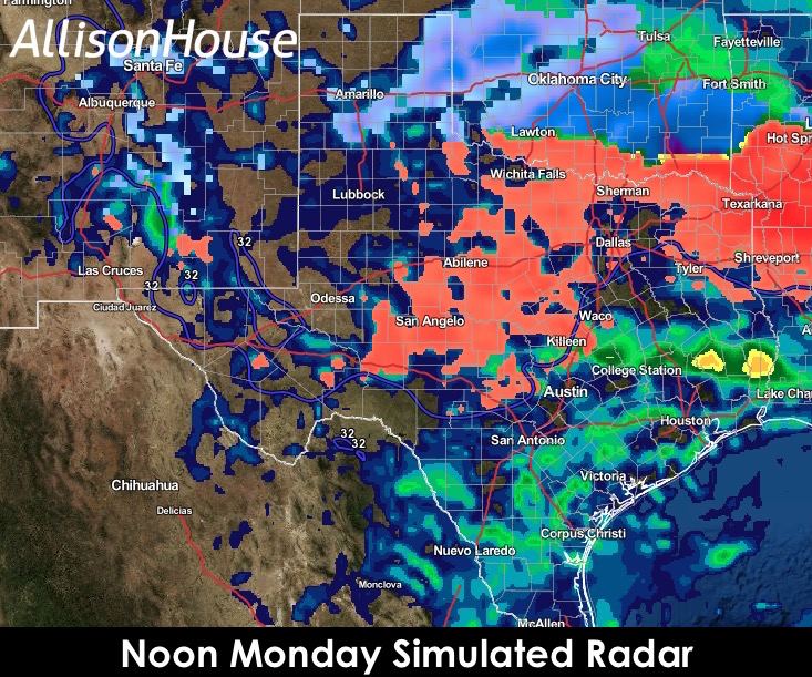
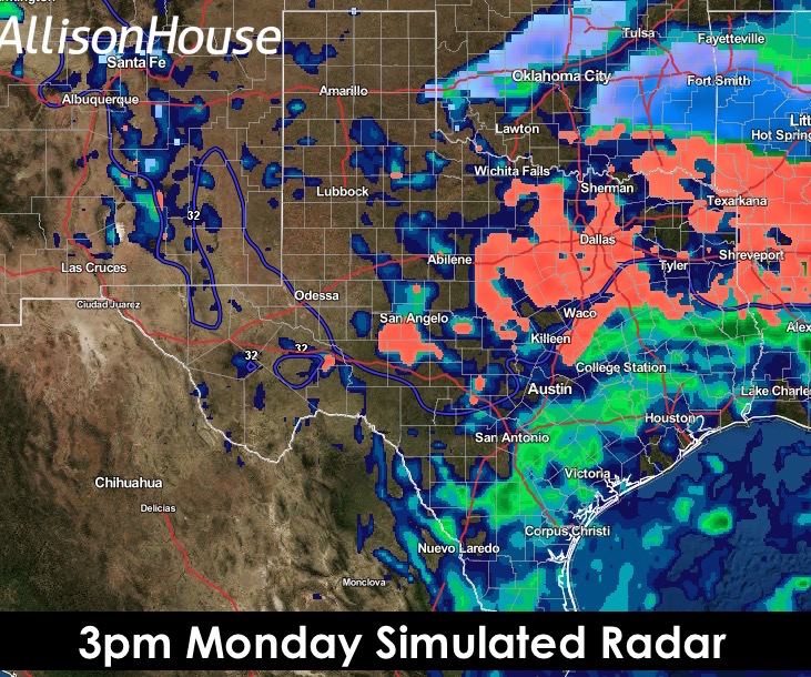
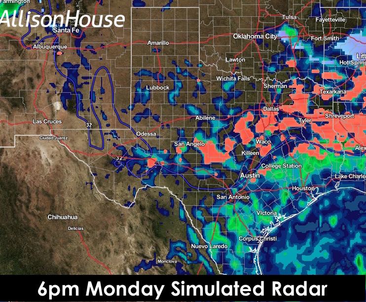
The precip will come in two waves over the next 24 hours…the first of which is happening right now, and thankfully when the temps are above freezing or we’d be in big trouble…and the second wave will arrive early tomorrow morning. We’ve provided a series of simulated radar graphics below which we feel will best depict the situation as its currently forecasted. Blue depicts snow, pink/red depicts sleet and freezing rain, and the yellow and green will depict heavy rain/rain. As always, there’s small scale processes that come in to play from time to time that the forecast models just can’t pick up on, so just keep that in mind anytime you’re looking at simulated radar graphics. “Thundersleet” has also been mentioned as a possibility early tomorrow morning, and this would certainly enhance the sleet totals over localized areas mainly north of I-20/I-30 in north central Texas.

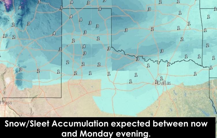
Here’s the latest overview of the Snow/Sleet and Ice accumulation expected to fall overnight and through Monday. It’s a bit confusing in that as we get into the heavier sleet event across north central Texas, the sleet is being combined with the snow totals on the 2nd graphic below. At any rate, it’s a lot of frozen stuff on the ground that is likely to cause significant travel impacts across the region early Monday and through the afternoon hours. We urge everyone to make preparations now and to avoid travel beginning tomorrow morning if at all possible. The fewer folks we have out on the roads, the safer it will be for those that have no choice but to be out there. Stay with us as we’ll have additional updates out later this afternoon as fresh forecast model data continues to roll in!


0 Comments