
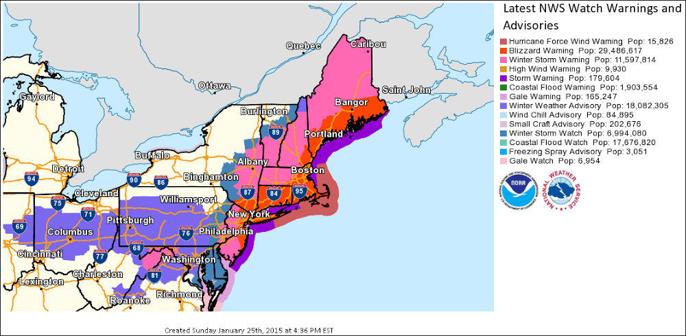
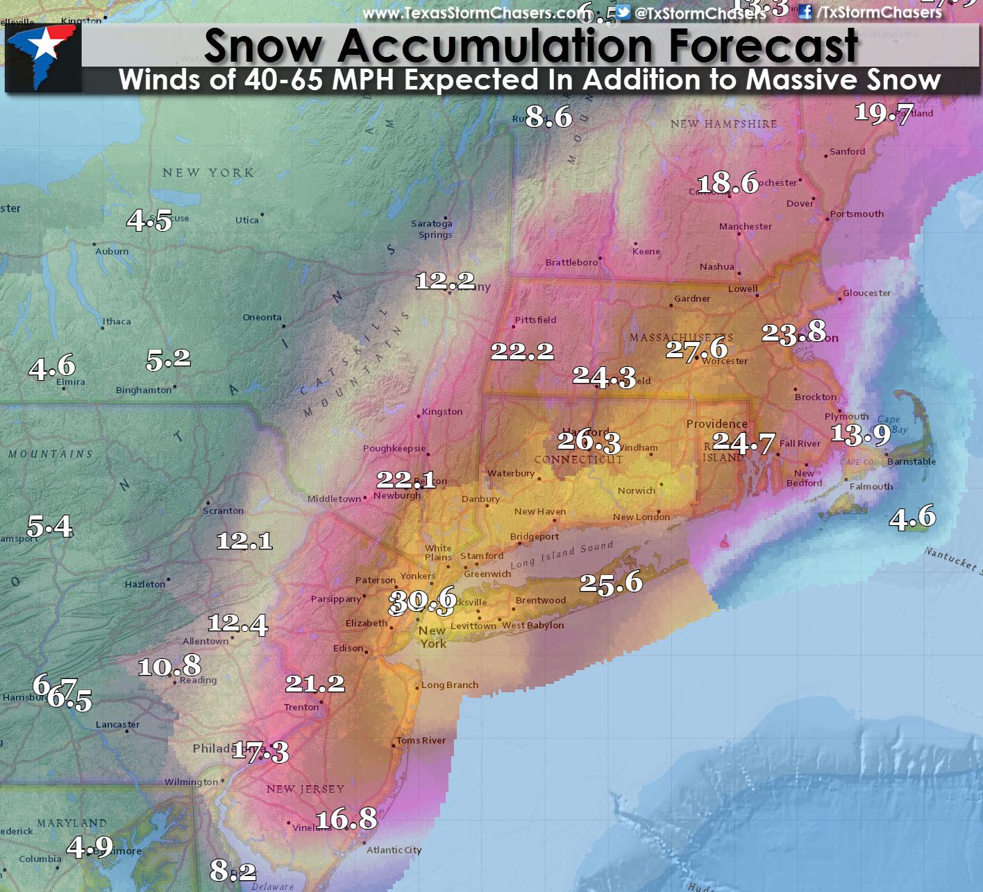
Heavy wet snow, strong winds, and blizzard conditions are forecast Monday into early Wednesday from Southern New Jersey northward into the NYC metro area and into the Boston metro area, with snow as far south as Washington, D.C. This crippling storm likely cause treacherous travel conditions, widespread power outages and infrastructure damage, downed trees, and coastal flooding. The remarkable fact about this system will be the amount of moisture in place along with the rapid intensification of the system. There is a high probability this storm will set all-time highs at some locations for snow accumulations. Big snows are not unusual for the Northeast United States but what is going to make this storm truly dangerous will be the high winds and wet nature of the snow.
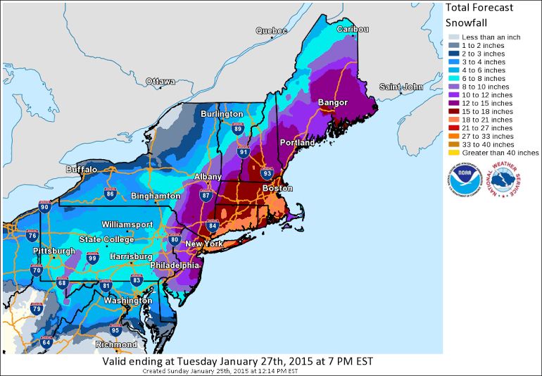
With such impressive moisture in place for a winter storm the snow that falls will be very wet versus the typical dry snows the Northeast experiences. The wet snow will coat powerlines and trees. With over two feet of heavy wet snow expected in parts of New Jersey, New York, up into New England there is definitely the potential for widespread power outages and significant tree damage. Combine the wet snow with 40-60+ MPH wind gusts and we’re talking about a high risk for a crippling blizzard in New York City, Boston, and all the cities in the impacted region.


0 Comments