
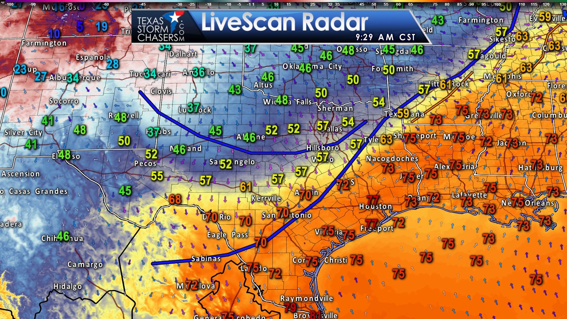
Surface analysis from 12Z indicated a cold front was near a line extending from Texarkana to College Station to the San Antonio Metro west/southwest to near Del Rio. This cold front will continue to push south through the day. The first indication of the cold front’s arrival will be a drastic drop in humidity values as dew points drop from the 70s into the 30s and 40s. The cooler air lags back behind the front, but temperatures are chilly in the Texas Panhandle and West Texas this morning.
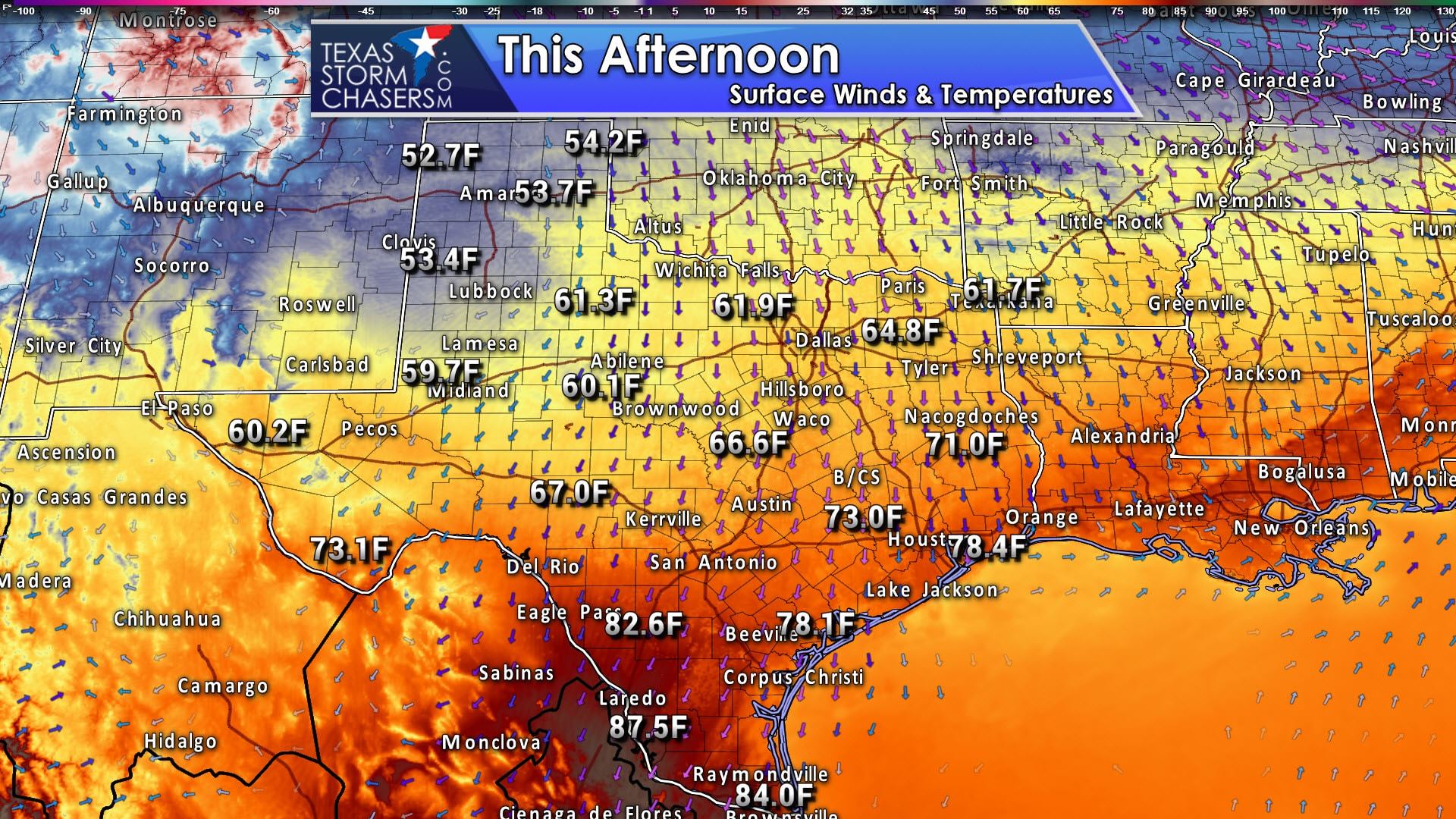
Cooler/Drier through Friday: Temperatures will be cooler across the state, although by no means are we talking about anything drastic for the first of March. Temperatures across South Texas will top out in the 80s with gusty northeast winds as a cool front. Humidity levels will be low with those gusty northeast winds, so there will be an elevated wildfire risk. Highs will range from the 50s in the Texas Panhandle up into the 60s across the Concho Valley, Central Texas, and East Texas as northerly winds continue. At least it’ll be a brief respite from our early spring. This northerly flow will continue into Thursday. A southerly flow will begin fetching higher moisture values back into coastal regions and South Texas by Friday night.
Weekend Rain Chances: We’ll see southerly winds return on Friday ahead of our weekend upper level disturbance. Those southerly winds will bring higher moisture content back inland to South Texas, the Coastal Plains, and Southeast Texas by Saturday. Scattered showers are expected on Saturday in Southwest Texas, Deep South Texas, the Rio Grande Valley, the Middle Coast, Coastal Plains, and South-Central Texas. During the evening hours Saturday we’ll see the chance for rain increase across Southeast Texas and East Texas. An isolated thunderstorm is possible. Severe thunderstorms are not expected at this time. Scattered showers will continue into Sunday in South Texas extending into Southeast Texas and East Texas. Lighter showers may start to develop further north on Sunday Night into Monday as isotropic lift increases ahead of a stronger cold front early next week.
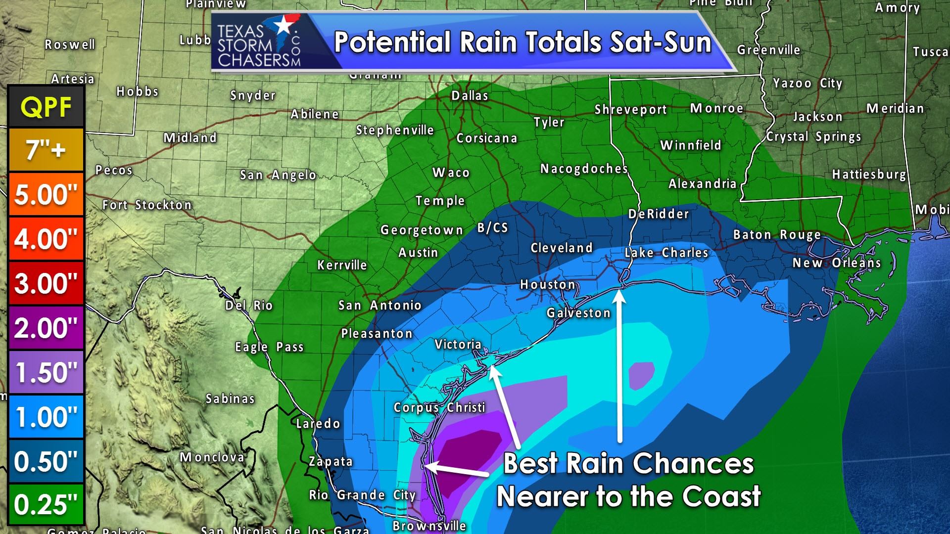
Rain Totals: One half inch to one inch of rain will be possible this weekend in the Rio Grande Valley, South Texas, the Middle Coast, Coastal Plains, into Southeast Texas. Lighter and more isolated rain totals are possible further north into the Hill Country, Central Texas, and East-Central Texas with our weekend system, mainly on Sunday and Sunday Night. Flooding shouldn’t be an issue unless we see rain totals jump above the 3 to 4 inch mark, which is not expected at this juncture. In other words, a good early-spring rain without the typical risk of severe weather or flooding.
Early Next Week: A strong upper level storm system and associated surface low will move east across the Central Plains and Midwest on Monday. On the back-end of that low we’ll see a decent cold front push south through Texas. There will be an uptick in thunderstorm chances in association with this front, but we’re too far out to be specific on any potential hazards. I’d anticipate a squall line in association with the cold front as it moves south on Monday and Tuesday across Texas. Some storms might be strong with gusty winds.


0 Comments