
Numerous record highs either tied or broken today across the state. DFW reached 88, beating their previous record of 86. Wichita Falls reached 92 breaking their old record of 85. Abilene tied their old record of 89. San Angelo reached 92 breaking their old record of 85. Brownsville tied their previous record of 92, and Del Rio tied their previous record of 93. Harlingen reached 96 breaking their previous record of 93. The hottest spots today…McAllen at 101, breaking their previous record of 98…and Laredo reached 100 breaking their previous record of 97. Definitely not a typical February day by a long shot! While not quite as warm, many locations across the panhandle region were dealing with numerous wildfires this afternoon…the largest of which appears to be a 2,000 acre fire which erupted earlier this afternoon near Channing, TX, northwest of Amarillo. No cause has been determined yet for that fire. Evacuations were ordered in a community south of Amarillo when a grille fire reportedly escalated out of control due to the high winds. The home was a total loss…and I really hope that steak was worth it. Seriously people…use some common sense and heed the high fire danger warnings!
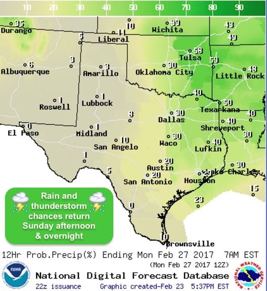
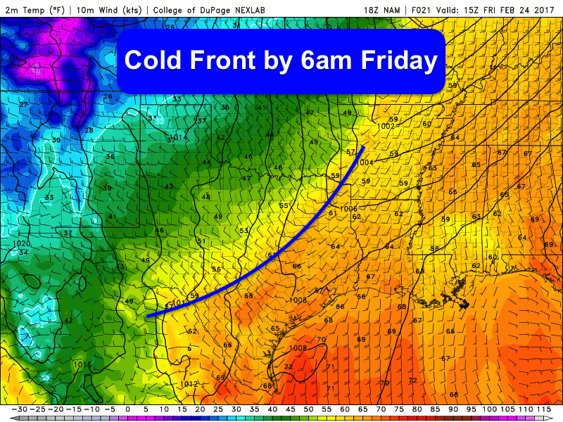 A cold front will move through tonight which will usher in cooler temps for tomorrow and Saturday. As I type this, the front is beginning to enter the northern panhandle region and is expected to reach north central Texas by early tomorrow morning, and central Texas before noon. The front will make it to the coast, but the cooler air behind it will take another 12 hours or so to really filter down that far south. Unfortunately this frontal passage won’t help fire weather conditions much across the panhandle and western Texas on Friday. We won’t be seeing any rain with this next front…and we’ll still be dealing with gusty west/northwesterly winds tomorrow and low humidity values both Friday and Saturday which will keep the risk of dangerous wildfires in the forecast for another couple of days. Rain chances don’t return again until late in the weekend with showers and a few thunderstorms likely by Sunday evening and overnight into early Monday.
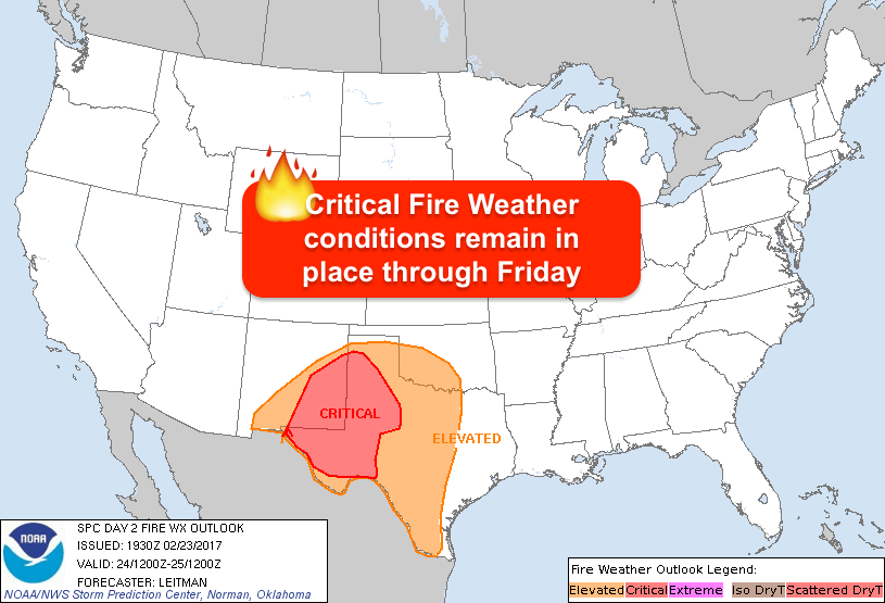


0 Comments