
Good Thursday morning folks! Instead of saying it’s going to be a hot day, which it will be, for the next two months I figured we could try something different. Instead of saying it’s going to be hot lets list the regions that could make it into the triple digits today. El Paso is going to be very hot today with a forecast high temperature at 105 degrees. Pecos is in the same boat with 104-105 a good bet. The third region with triple digit temperatures this afternoon will be in Northwest Texas. Vernon will make it up to around 101 today. Finally, our fourth lucky contestant to make it to the magical triple digit number will be Southwest Texas – around Laredo. The remainder of our wonderful state will top out in the middle to upper 90s. Heat index values across the eastern half of Texas will me 3 to 5 degrees higher than the actual air temperature. With that in mind heat index values should top out in the upper 90s to lower 100s during peak heating.
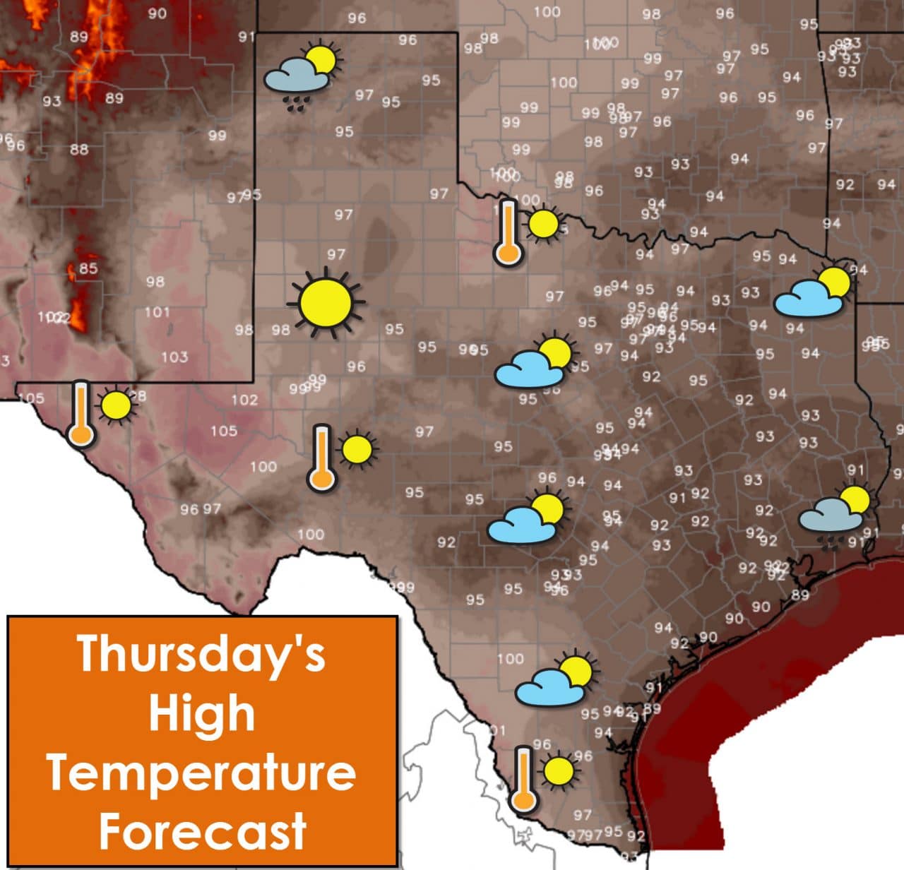
Compared to the past few days we at least have something to talk about besides the heat. After a week under the heat ridge of doom we’re now starting to see a return of afternoon popcorn storm chances. Two regions have the chance for isolated to scattered shower/storm activity today. The first is across Southeast Texas and right along the coast where a 30 percent coverage of storms are possible this afternoon. The most significant hazard from those storms will be lightning. We’ve had enough folks struck by lightning this summer across the United States. If thunder roars move indoors – you’re close enough to be struck. Our summer storms have a tendency to shoot lightning out several miles away from where its raining. The second region with a chance for isolated storms this afternoon and evening is in the Texas Panhandle. An outflow boundary left over from storms further north this morning. Isolated development is possible after 3 PM with the storms possibility producing localized damaging wind gusts and spotty hail. There won’t be many storms and a majority of folks will remain dry. Those that end up under a storm could pick up a quick half inch of rain.
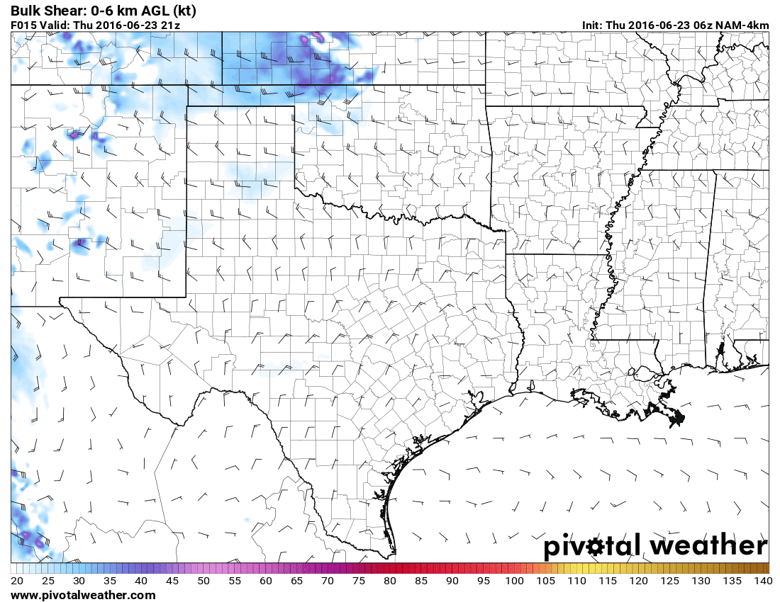
Wind shear values today are near zero. These very low values will continue into the weekend as a heat ridge remains in place.
The heat is with us for the foreseeable future. The chance for afternoon storms will continue in the Texas Panhandle and Southeast Texas into the weekend. In addition the chance for afternoon storms will spread into the Coastal Plains, South Texas, Middle Texas Coast, and the Rio Grande Valley on Friday, Saturday, and Sunday. Coverage of storms will remain under 40% and if you end up under a storm it should only last an hour or so. A strong storm may occur – but severe weather is unlikely.


0 Comments