
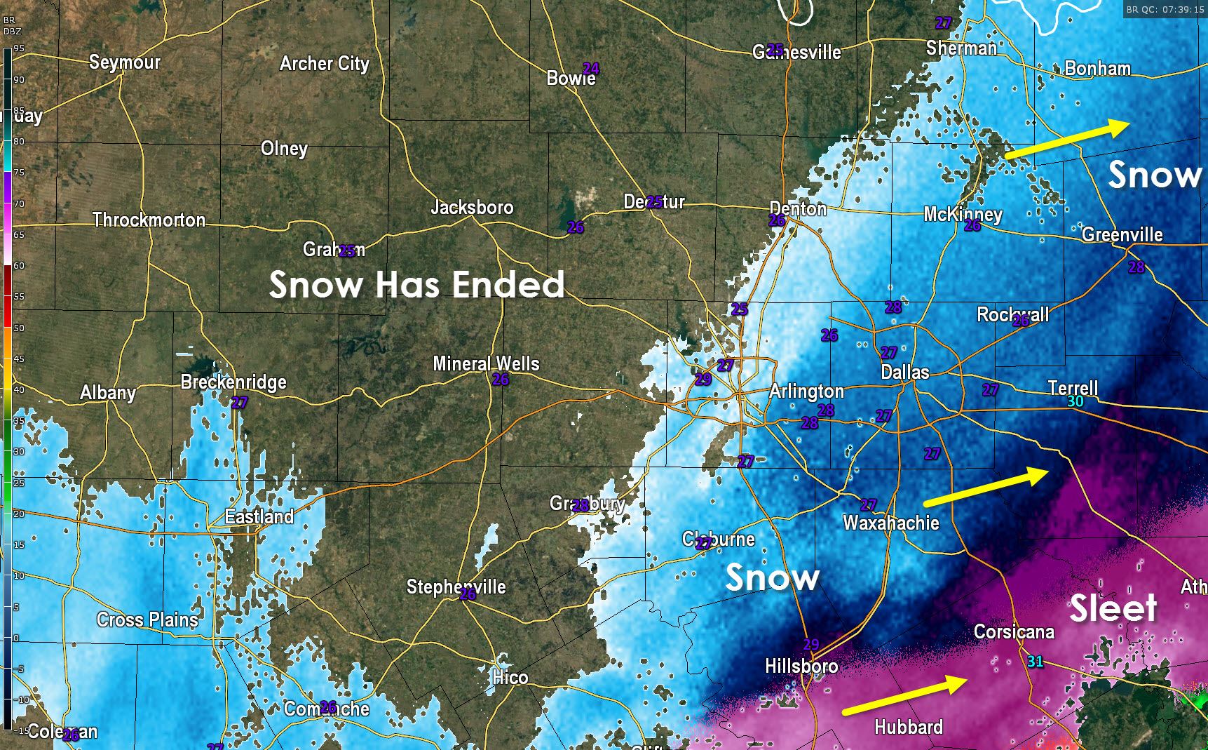
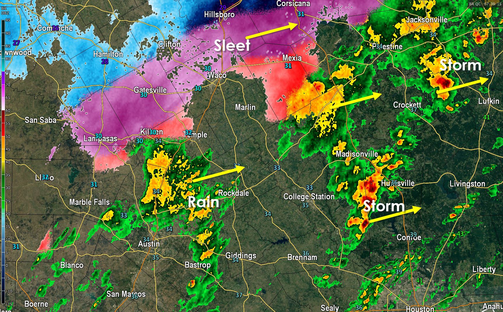
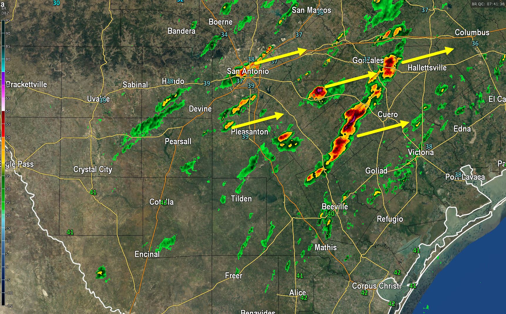
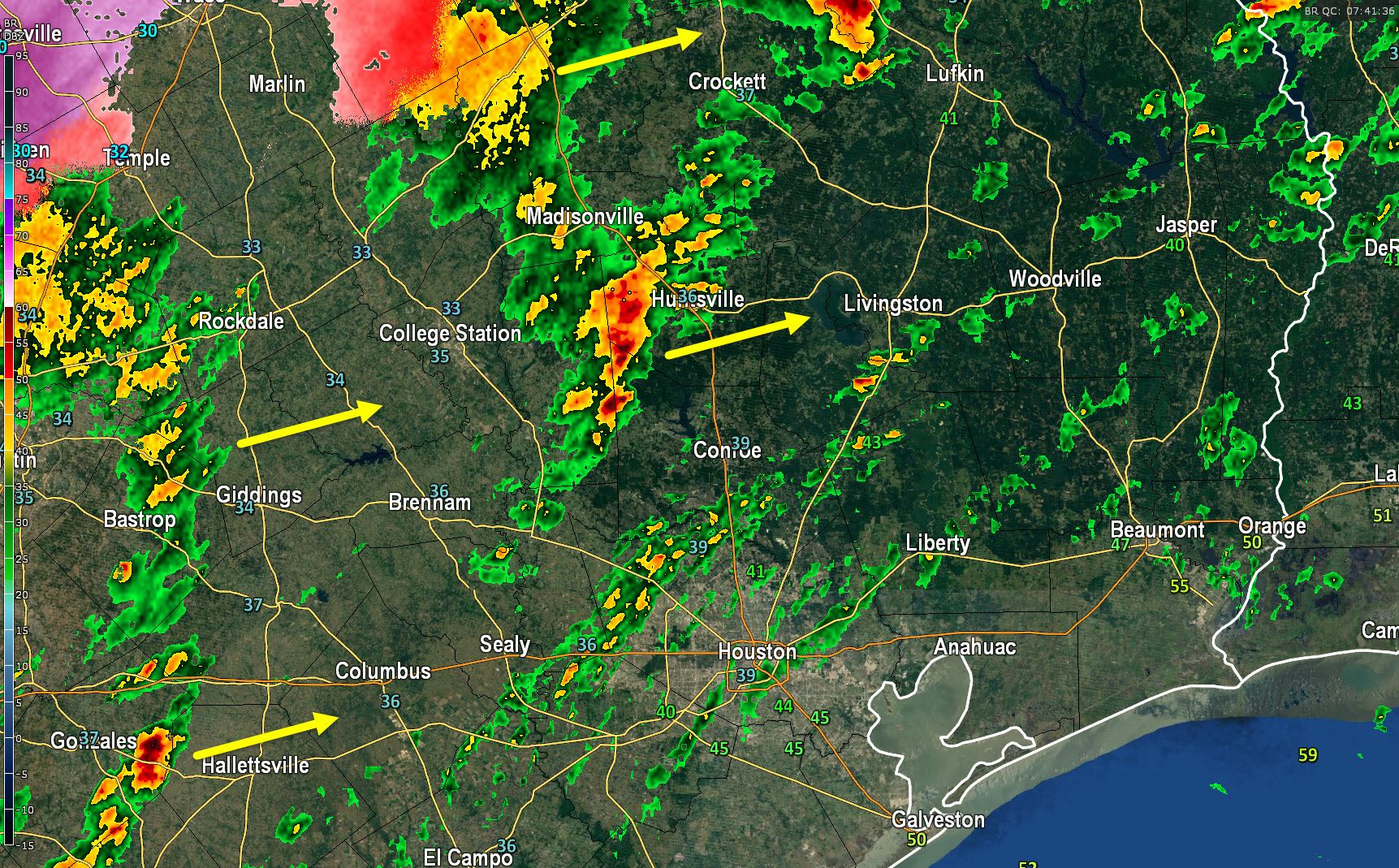
The back edge of snow extends from Sherman southwest to Denton and Cresson. This area of snow is moving east and thus we should see an end to snow in the D/FW Metroplex by 3 AM (sooner west). All roads are snow-packed and slick. Strong north winds is resulting in blowing snow. Snow continues to fall across Northeast Texas and we’ll see it continue through sunrise. Interstate 30 is slick and hazardous from the D/FW Metroplex into Arkansas among a number of other roadways. Overall snow accumulations in the D/FW Metroplex have averaged 2 to 5 inches. A mixture of sleet and rain continues across East Texas west into Central Texas including Waco where sleet is now accumulating. Sleet is also falling in Gatesville, Lampasas, into Killeen where some minor accumulations may be noted this morning. Temperatures have not cooled too quickly in South-Central Texas this morning and it looks like San Antonio will make it through without any winter weather issues. We may see a few icy bridges in Austin but a majority of roads will remain just wet. Heavy rain and a few storms are moving northeast across the Texas Coastal Plains into Southeast Texas. Some small hail may be noted under the strongest cores along with cloud to ground lightning strikes. It’s going to be a wet morning in Houston but no winter weather is expected.


0 Comments