
Storms and snow are forecast for Texas today. While it’s unlikely for the two to coincide in the same location, we can’t rule out the possibility of some thundersnow. This unpredictability keeps us on our toes and ready for any weather surprises.
This morning, a line of showers and thunderstorms is approaching the Interstate 35 corridor. There have been instances of pocket-change-size hail from stronger storms, and we can’t rule out a storm producing hail up to the size of quarters and wind gusts near 60 MPH. While most short-term weather model guidance weakens the line of storms, we’ll keep a close watch, ensuring you’re aware of any potential risks.
Texas Panhandle Snow
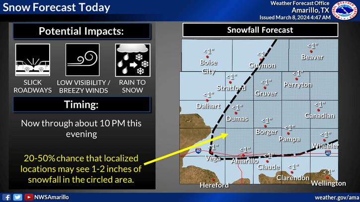
Very cold air aloft in the Texas Panhandle will result in another day of wet snow potential. Like last week, surface temperatures may be near or just above freezing. Rain is expected to change over to snow near and north of Interstate 40 from the New Mexico state line to the Oklahoma state line later this morning and through the afternoon hours. There may be bands of heavy snowfall. Even with warm soil temperatures, the rate of snow falling will overwhelm the melting rate. Thus, we may see one to three inches of wet snow accumulating on grassy and elevated surfaces today. Some travel impacts are possible, especially in the heavy snow band. Locally higher snow amounts are not out of the question. Snow will gradually diminish by late this afternoon. Once the snow quits falling, we should see any road issues start to improve since soil temperatures are warm. Accumulations won’t last past tonight or tomorrow morning.
East Texas Severe Storms
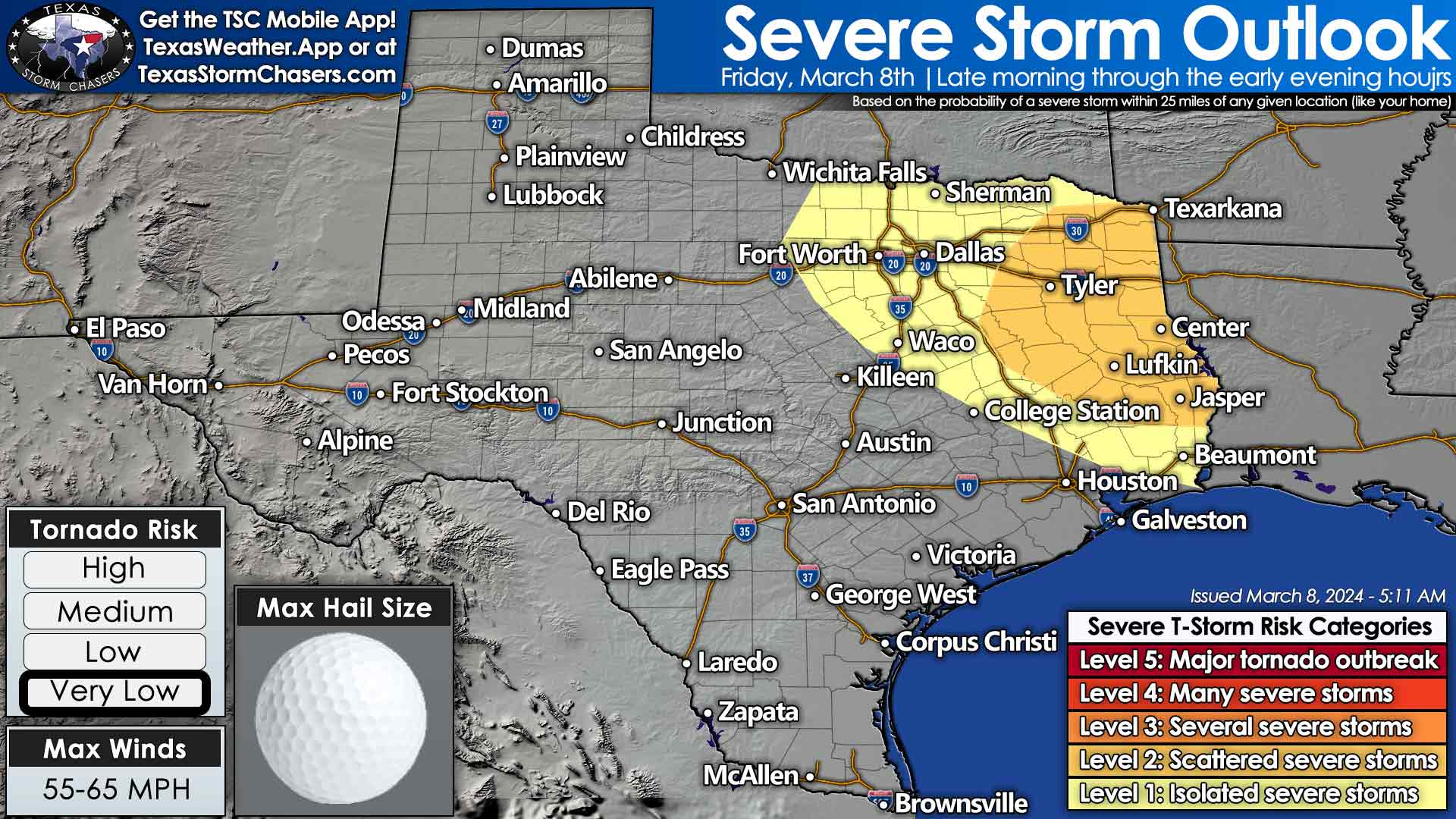
Scattered thunderstorms are expected to redevelop across portions of Northeast Texas, the Ark-La-Tex, and East Texas this afternoon. Some of these storms could become severe with a threat of large hail, localized damaging wind gusts, and perhaps a tornado. The tornado threat remains very low to low, but is a bit higher than yesterday out west. We’ll need to monitor any discrete thunderstorms that start showing mischief potential closely. The best chance for storms will be east of Interstate 35 this afternoon and east of Interstate 45 by tonight. We’ll see precipitation conclude in Texas late tonight or Saturday morning.
Crashy the Cold Front
A strong cold front will bring temperatures back down into ‘not April’ levels for the weekend across Texas. On average, we’ll see high temperatures about 20 degrees cooler than the past few days. A freeze is possible tonight in the Panhandle and West Texas. On Sunday morning, we may see a freeze as far southeast as sheltered areas of the Hill Country, Concho Valley, Texoma, and west/north of the D/FW Metroplex. Plan accordingly if you’ve already planted.
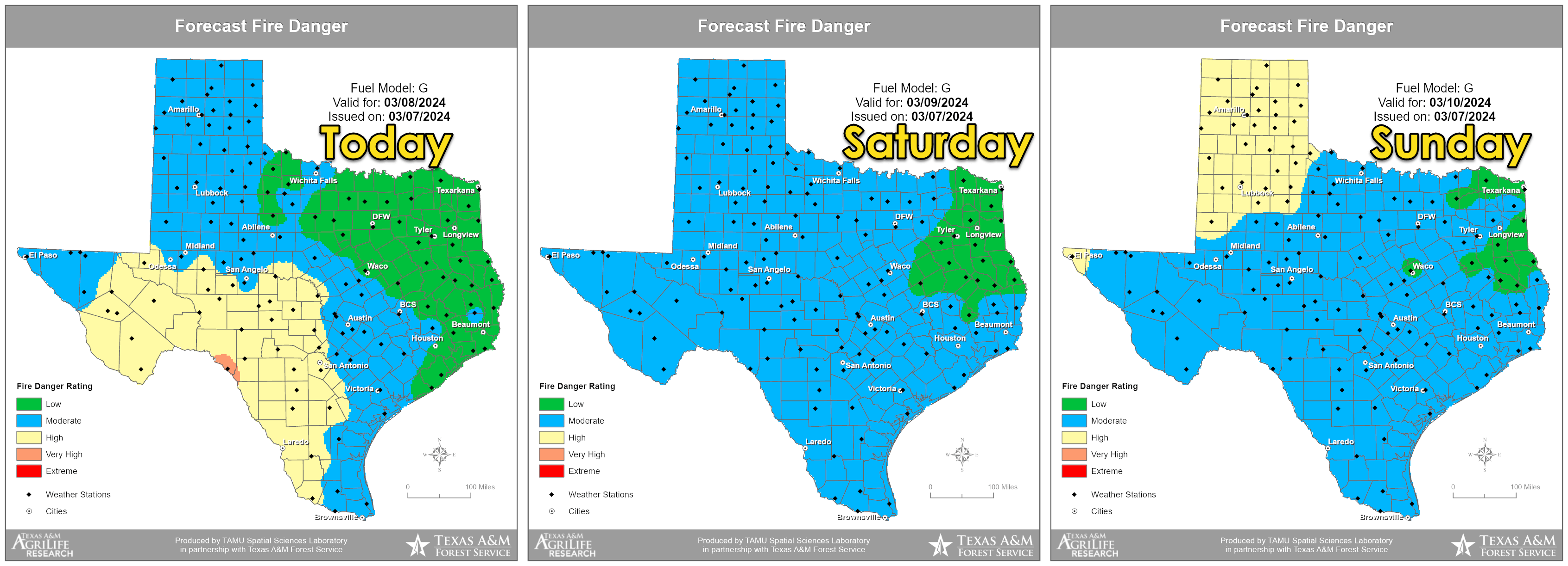
Dry weather is expected to occur across the state this weekend through early next week. The wildfire threat will be highest today in the Concho Valley, Hill Country, Edwards Plateau, into the Rio Grande Plains in South Texas. On Sunday, we’ll see an uptick in the threat return to the Texas Panhandle and West Texas. Temperatures across Texas will return to their typical levels over the past month by Tuesday – in the 70s and 80s.
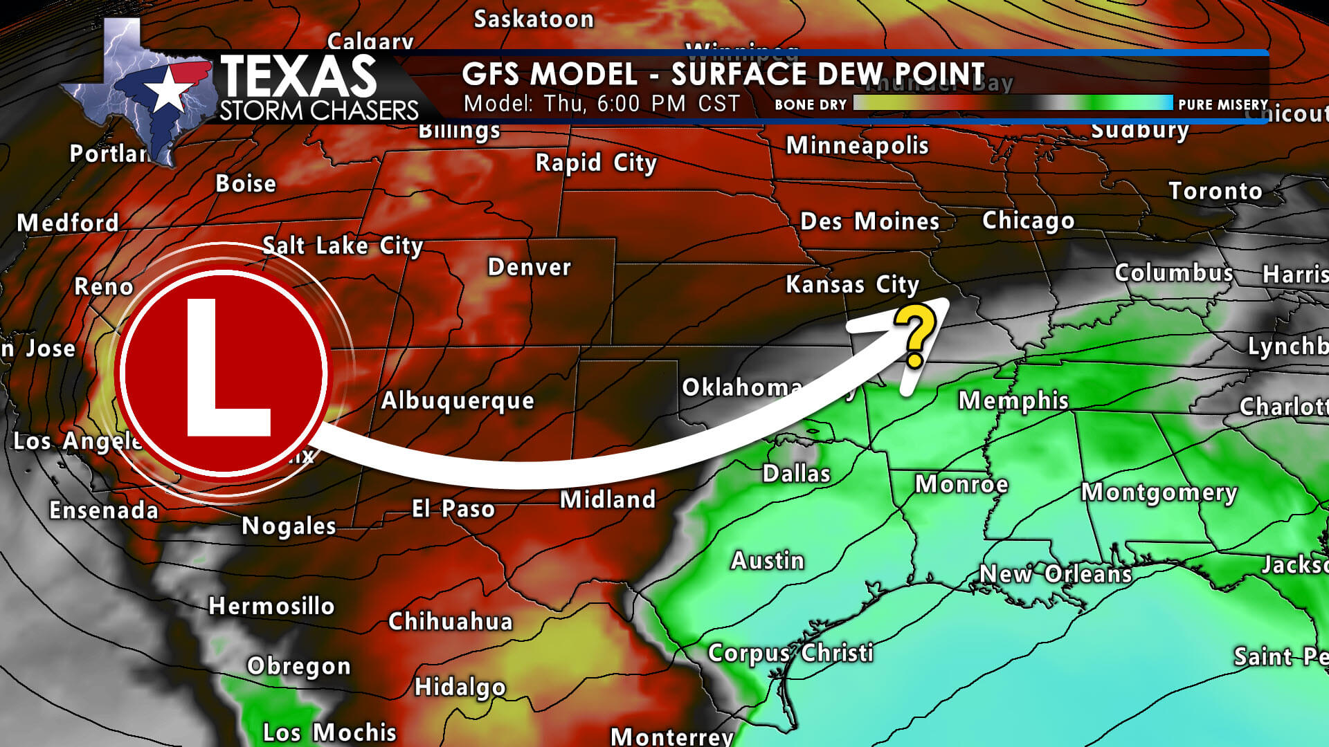
Our next weather-maker looks to arrive around Thursday of next week. Thunderstorm chances, some potentially on the rowdy side, may occur in the state’s eastern half as the dryline takes shape.
We’re almost up to 19,000 subscribers! Thank you so much to everyone who has helped us grow quickly over the last 14 months. Your love and interaction help us improve our content and plan for an even bigger future! Have a great weekend, and God Bless!
My FREE & AWESOME weather app for radar/alerts/more: https://texasweather.app/

0 Comments