
The whole #FalseSpring thing seems to have taken on a life of its own, as hashtags often do. It is a good way to describe the weather across Texas over the next week or so. At least no major cold fronts are expected through the first week of February. However, warmer weather can bring the chance for rowdier thunderstorms.
Storms Friday and Saturday
Our next rainmaker will arrive on Friday as the sub-tropical jetstream makes a comeback. This same weather pattern will bring multiple atmospheric river events to the West Coast. Scattered showers are possible Friday morning into early Friday afternoon across the western third of Texas. Friday afternoon into Friday night will feature numerous showers and thunderstorms across the eastern two-thirds of Texas.
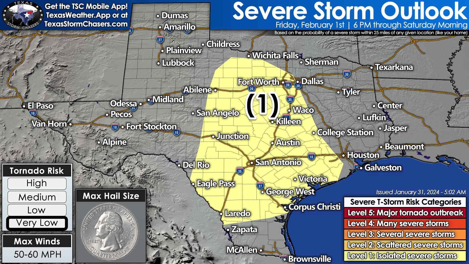
Some storms may produce pocket-change-size hail, gusty winds, and heavy rainfall. The heaviest rains will exit Texas to the east on Saturday afternoon. Plan on wet weather Friday evening through Saturday afternoon in the eastern two-thirds of Texas.
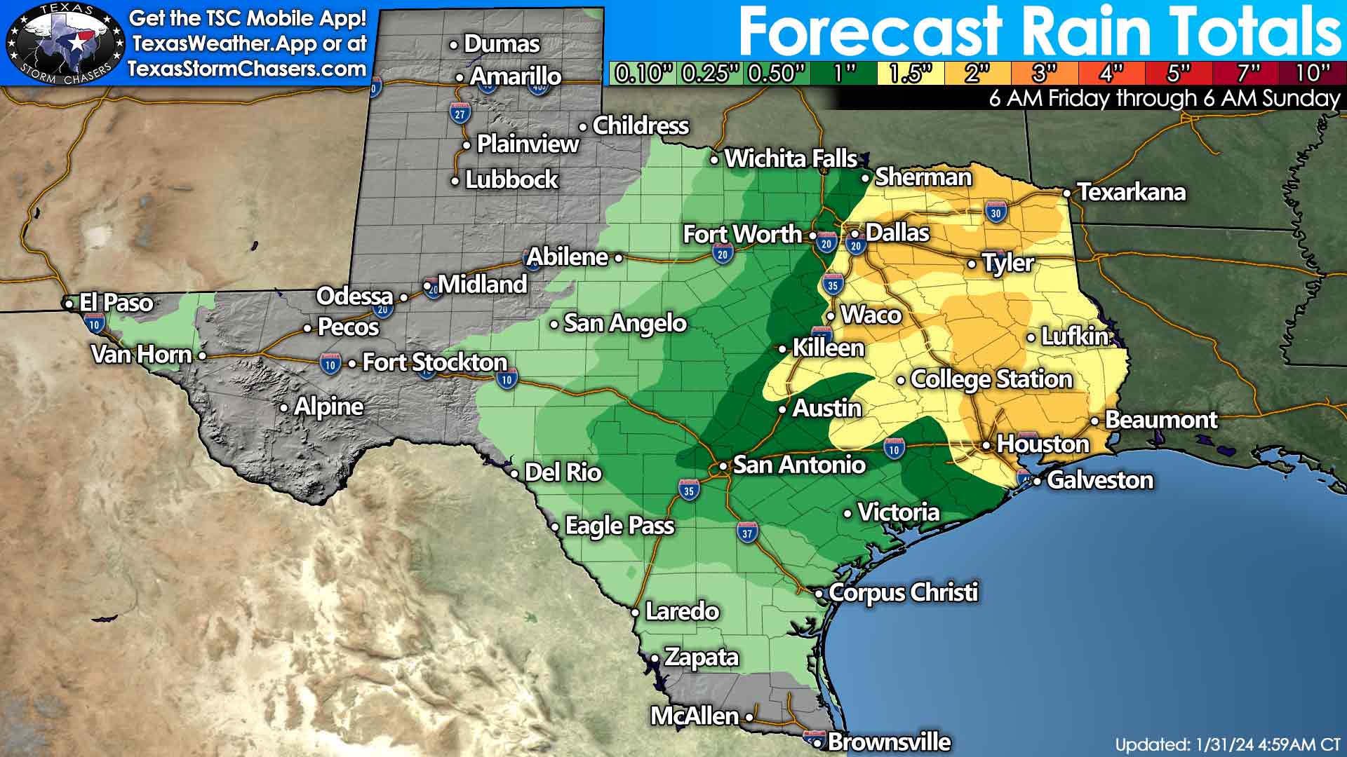
One to three inches of rain are expected to fall on Friday and Saturday across North Texas, Central Texas, Northeast Texas, the Ark-La-Tex, East Texas, the Piney Woods, Golden Triangle, Southeast Texas, and the Brazos Valley. Rain totals between one-tenth and one inch, possibly east of a line from Vernon to Abilene to San Angelo to Del Rio, down through Eagle Pass, Laredo, and Lapata. Soils remain saturated, so expect most rains to run off, leading to high water issues. Some flooding is possible across the eastern third of Texas, but most locations should be okay.
Light rain will remain possible Saturday night through Sunday night across Northeast Texas and East Texas. Severe storms and heavy rain are not expected during this timeframe.
No big crashy the cold fronts for a while…
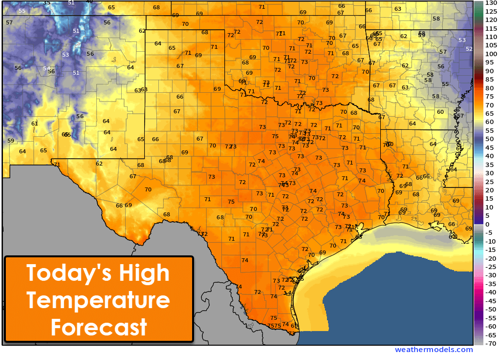
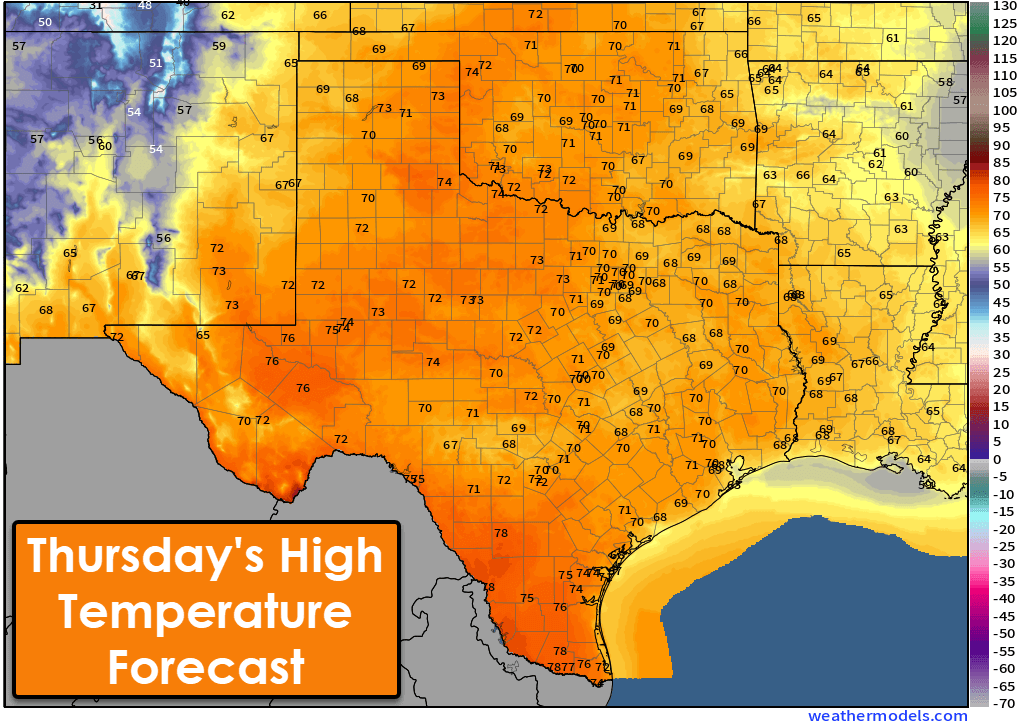
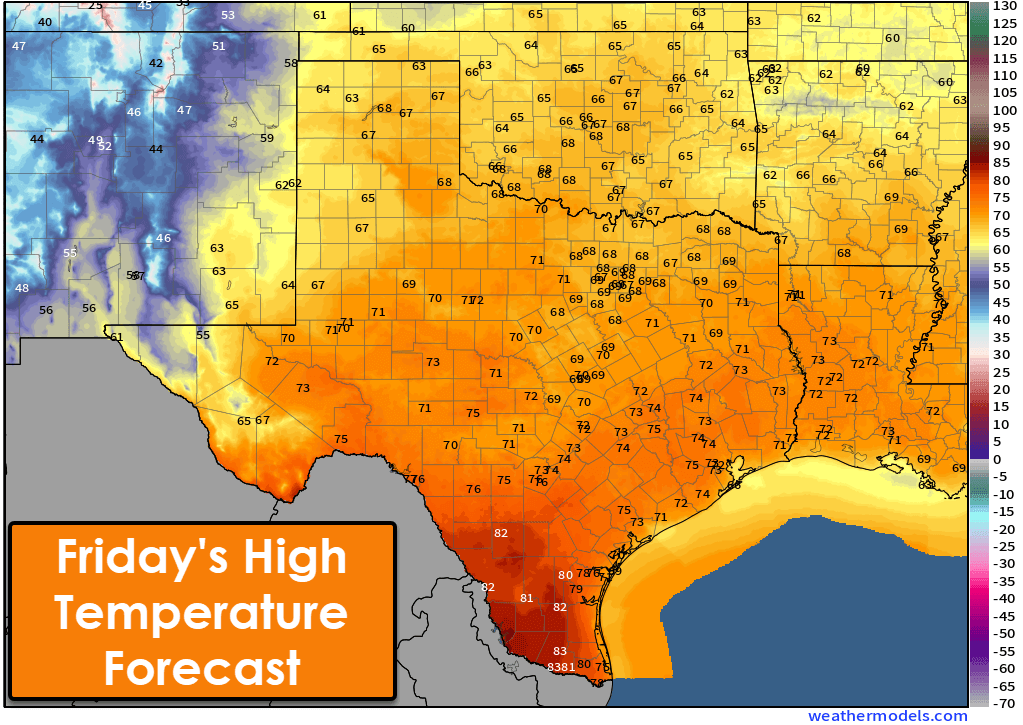
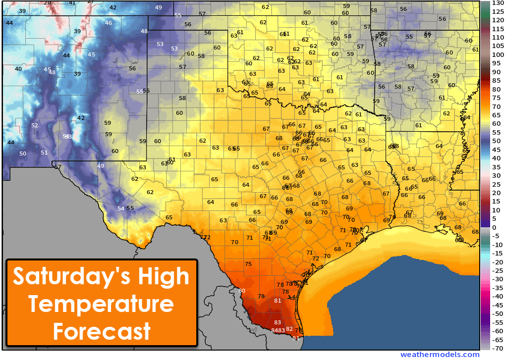
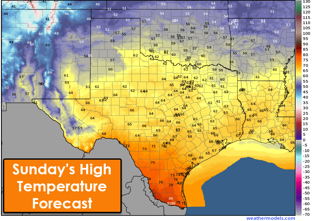
Cooler weather will arrive on the backside of Saturday’s system in the form of a weak, cool front. High temperatures will get knocked back into the 50s in the Panhandle and West Texas, with 60s across the northern two-thirds of Texas on Saturday and Sunday. The 70s and 80s will continue unabated across South Texas, the Lower Texas Gulf Coast, and the Rio Grande Valley. No significant cold fronts are expected over the next week, at least.
Get the FREE Texas Storm Chasers Mobile App for your local weather forecast, interactive weather radars, live Texas weather coverage, and more! Available in your device’s app store. Have a great Hump Day! We’ll see you tomorrow morning for our next Texas Weather Roundup!
Lauren Moore
Yes!!
Ashley Kay Allen🤦🏽♂️
I had to hunt for the dog and found him pretty camouflaged.
Are we expecting another Arctic blast in two weeks?
NO NO NO!!! It’s just now drying up at my place!