
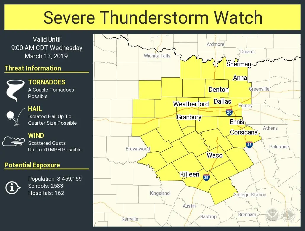
A severe thunderstorm watch is now in effect for all of North Texas. This watch includes the D/FW Metroplex, Waco, and Killeen. A line of strong to severe thunderstorms is entering western North Texas. These storms have a history of producing 50 to 75 MPH wind gusts over the last several hours. That will remain the primary threat, but brief tornadoes cannot be ruled out. Small hail may occur, but hail itself isn’t expected to be a major threat this morning. Storms should enter western portions of the D/FW Metroplex between 4 and 6 AM, and exit the eastern sections of the metroplex between 8 and 9 AM. Storms will be weakening as they move east of Interstate 35, but gusty winds will remain possible.

0 Comments