
A line of strong to severe thunderstorms now extends from Paris to Greenville to Dallas to Cedar Hill (hi mom!) to Grandview to Meridian to Hamilton. The strongest storms extend from downtown Dallas to Rio Vista. The line of storms proper is moving east at 50 to 60 MPH. This is the ‘mainline’ we’ve been expecting all night. The first round just so happened to overperform a bit. Those storms have now moved into southeastern Oklahoma.
Conditions east of this squall line across Northeast Texas and East Texas remain favorable for severe thunderstorms, especially where the atmosphere has remained untainted from earlier storms. Large hail up to the size of golfballs and localized wind gusts up to 65 MPH will be possible with the strongest storms over the next two hours as they fly east. An isolated tornado cannot be ruled out, especially as storms continue moving toward Northeast Texas.
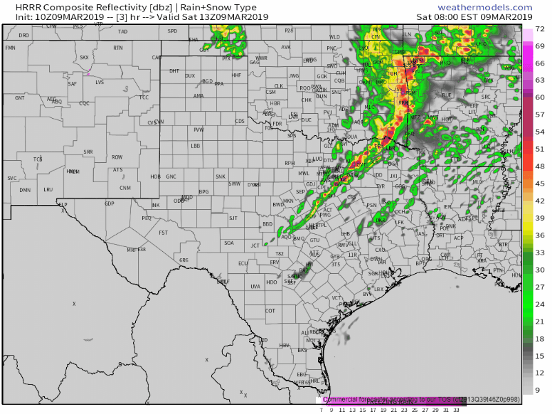
Simulated weather model radar from 8 AM to 2 PM today. This is only a simulation.
Given the fast forward rate of motion, it looks like the squall line should be exiting the state by lunch-time. Residual storms will remain possible across the Brazos Valley into Southeast Texas this afternoon, but with a much lower risk of being severe. I believe we’ll be done with most of the severe weather by lunchtime. Which is nice since I’ve been up since yesterday morning and don’t intend on being awake all that much past lunch-time.
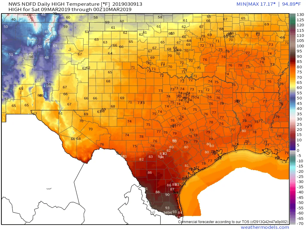
Today’s high temperature forecast
The weather will actually be pretty spring-like and pleasant behind the storms this afternoon. Temperatures will range from the upper 60s in the Texas Panhandle up into the middle 90s in the Rio Grande Valley. Yeah, I said the middle 90s. Who needs spring when you can just skip ahead to summer. Fire weather conditions will be elevated west of Interstate 35, so the western half of Texas, this afternoon as relative humidity values drop below 25 percent and winds increase to 15-25 MPH out of the west.

0 Comments