
Active weather will lead to multiple chances for severe thunderstorms across Texas over the next two days. If that wasn’t enough, we also expect snow in the Texas Panhandle on Friday.
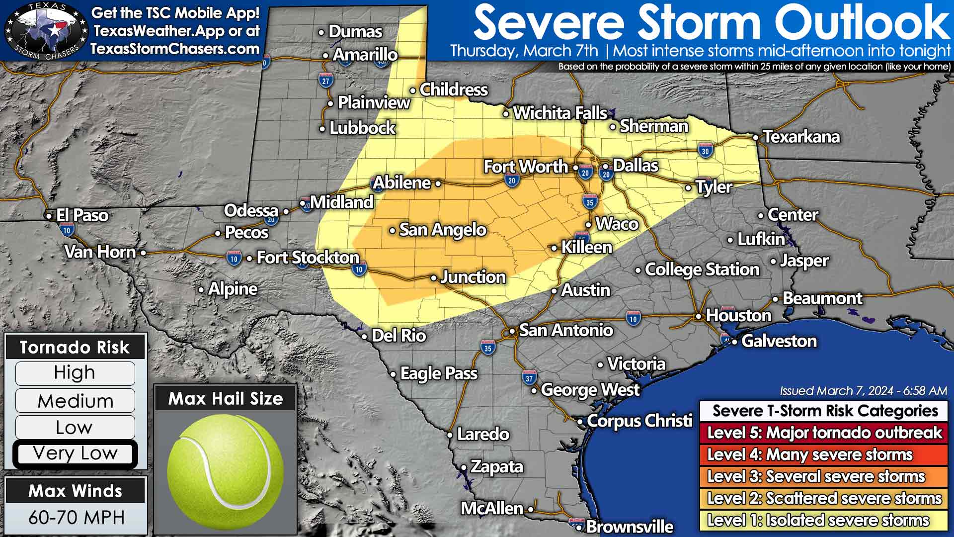
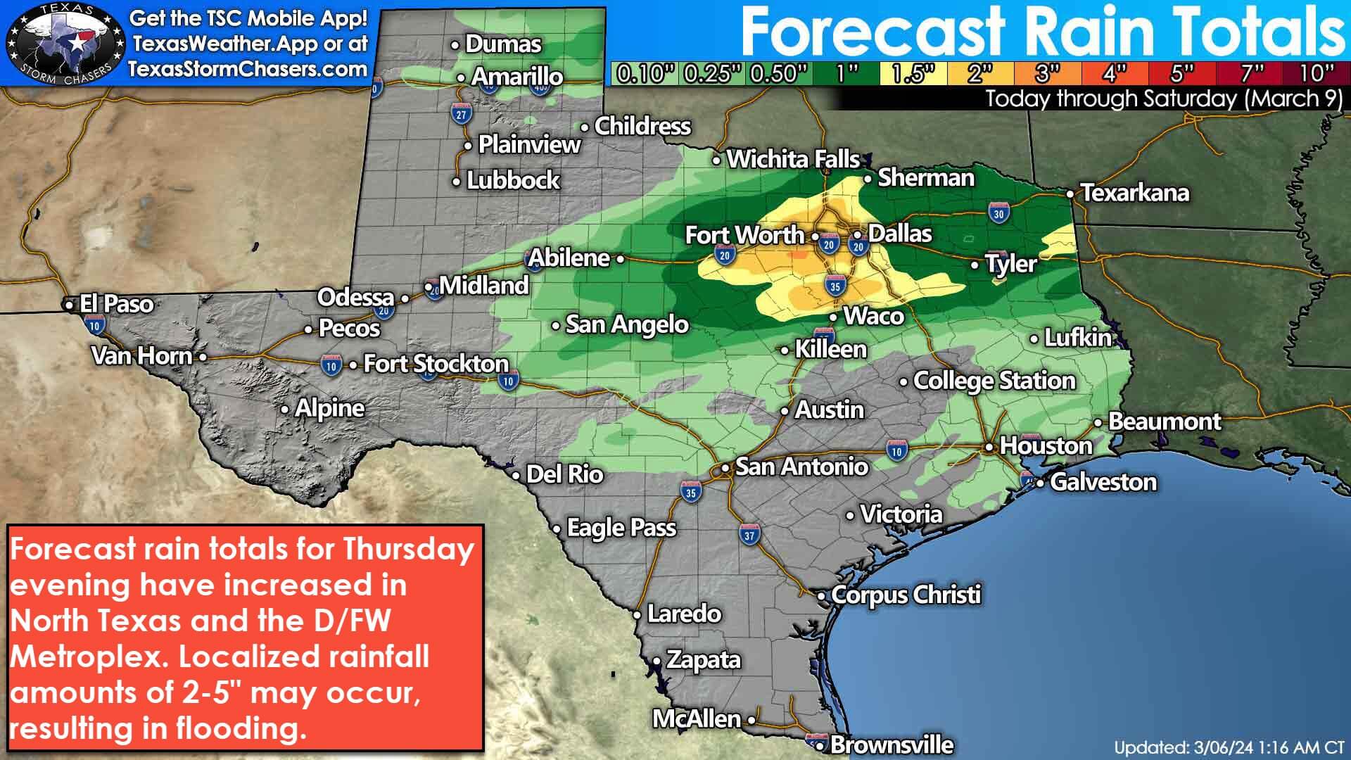
This morning, we may get a small break in storms across the Big Country, Texoma, and North Texas. That could change as soon as early afternoon. Isolated to scattered thunderstorms may develop after lunchtime. Some storms could produce large hail and heavy rain. There is increasing concern that several heavy storms may result in flooding around the D/FW Metroplex by the evening rush hour. Scattered thunderstorms will continue developing through the evening hours across the Concho Valley, Big Country, North Texas, Texoma, and Northeast Texas. Thunderstorms will generally move off to the northeast. The strongest storms may produce hail up to the size of tennis balls, localized damaging wind gusts, and very heavy rainfall. A tornado can’t be ruled out, but the overall tornado threat is very low today. No, that doesn’t mean the tornado threat is zero. Storms could continue on into the late evening hours.
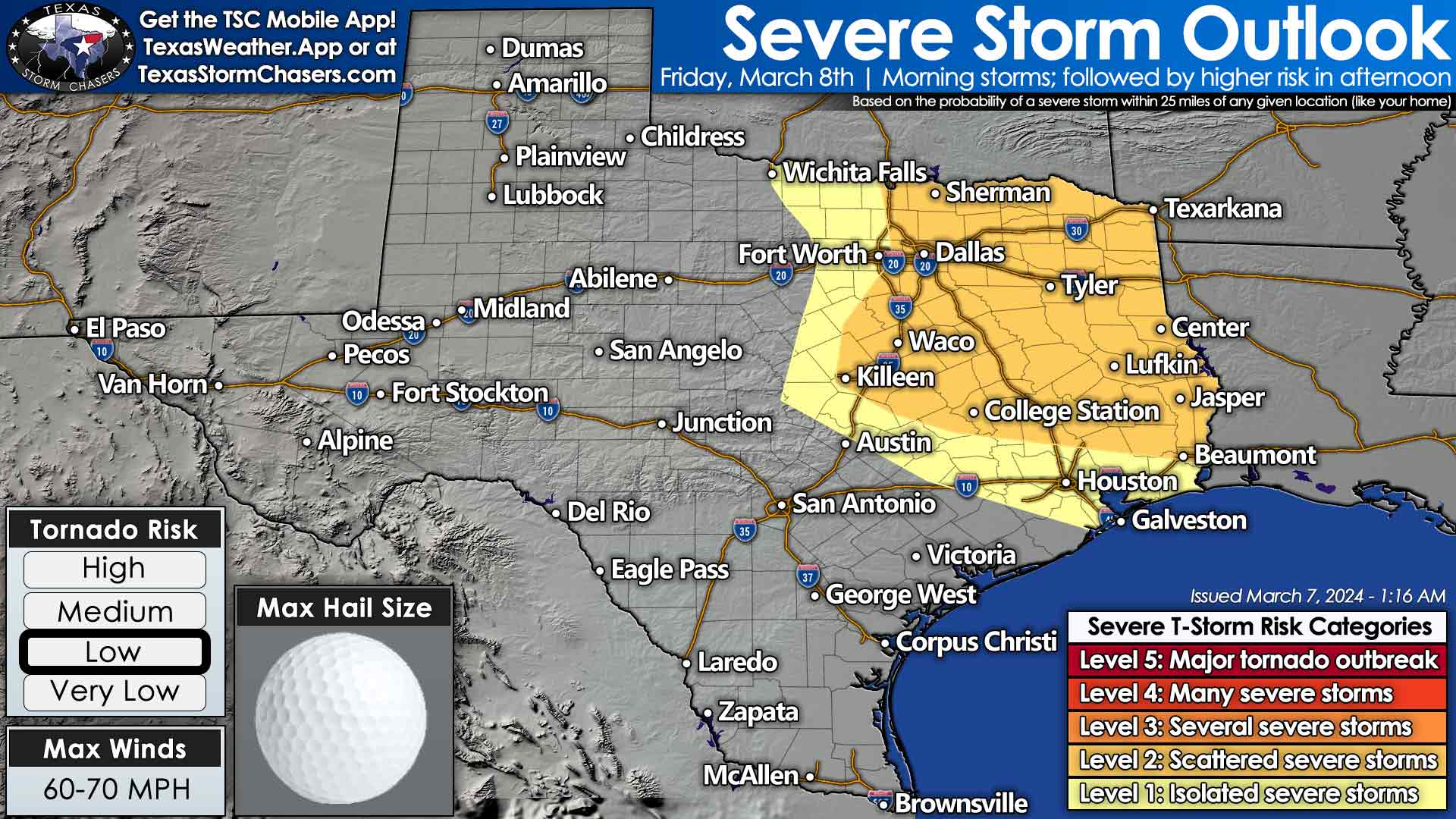
How the stormy situation evolves on Friday will depend on how worked over the atmosphere is from today. We believe there will be enough destabilization for a severe thunderstorm threat Friday afternoon in North Texas, Northeast Texas, East Texas, and perhaps as far south as the Brazos Valley and the Golden Triangle (Far Southeast Texas). While there’s time for things to change, the threat of a couple of tornadoes may be higher tomorrow in eastern North Texas, Northeast Texas, the Ark-La-Tex, and East Texas. Large hail and damaging winds would also be likely with the strongest storms. Unlike tonight, I’m hopeful the worst storms will move east of Texas by the mid-evening hours.
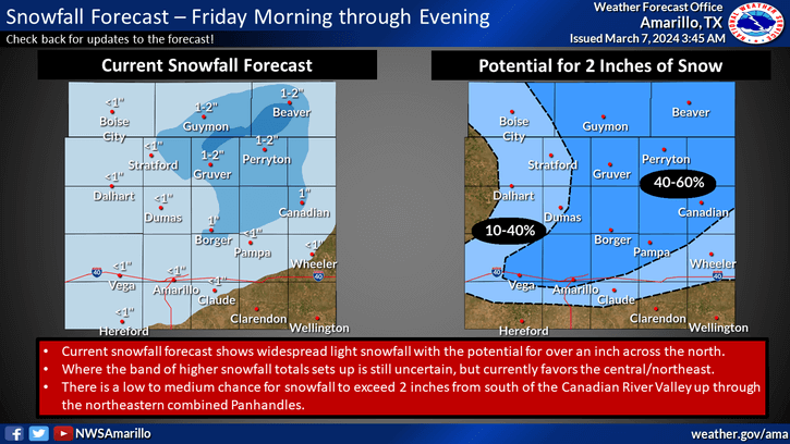
On the flip side, rain will change over to snow during the morning hours on Friday through the afternoon in the Texas Panhandle, especially along and north of Interstate 40. Like last week, very cold air aloft will overcome surface temperatures hovering near or a bit above freezing. A wet, heavy snow could result in one to three inches of accumulation on grassy surfaces and even some roads while the heaviest snow falls. We should see precipitation conclude in the Panhandle around sunset. Some travel impacts may occur, especially where heavier snows overcome the melting rate.
A cold front will arrive on the backside of tomorrow’s departing system. That front will knock our weekend high temperatures down into the 60s and lower 70s with a very dry airmass. Even with cooler temperatures, we may see higher fire-weather danger across most of Texas due to low humidity. I’m not talking about anything like we saw in the Texas Panhandle last week, but it won’t take much to get fast-moving grass fires.
My FREE & AWESOME weather app for radar/alerts/more: https://texasweather.app/
0 Comments