
The next couple days will be fairly pleasant with little to no weather hazards. There is the possibility of a few showers and storms on Sunday in the Rio Grande Valley, South Texas, and the Coastal Plains. At this time the severe weather threat isn’t expected to become significant. A few severe storms will probably develop in southern Kansas and northern Oklahoma during the late afternoon Sunday. Those storms will not impact Texas. There is a low chance an isolated storm may try to fire up on the Red River but that potential is low due to a strong cap. Monday will feature an unstable airmass across Northwest Texas and North Texas which would promote severe thunderstorms. However, a strong cap will likely prevent thunderstorm development on Monday. If by a small chance a storm was able to break the cap it would likely be severe.
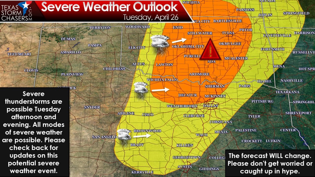
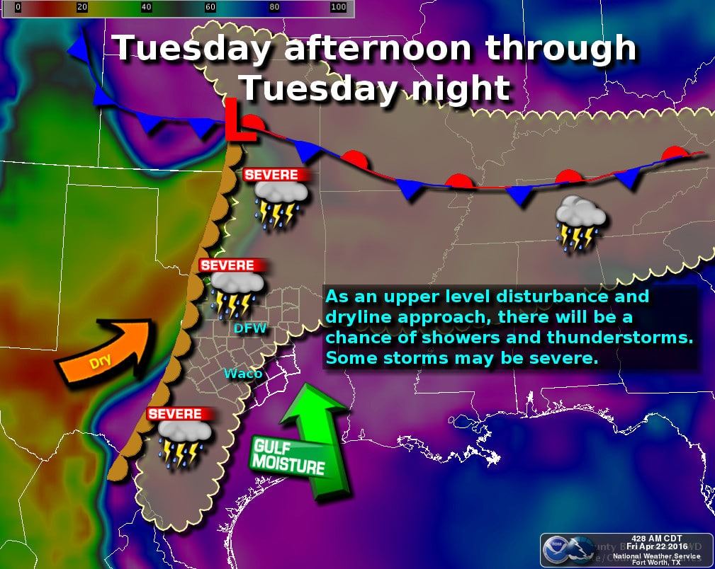
Tuesday is the day we’ll have to keep an eye on for severe weather potential. A strong upper level disturbance will interact with a very unstable airmass and strong wind shear values. The Storm Prediction Center has highlighted a severe weather potential on Tuesday across the Big Country, Hill Country, Central Texas, Texoma, and North Texas. The highest threat for significant severe weather appears to be in southern Kansas, central and eastern Oklahoma, extending south to Texoma. We’re still a couple days out so changes will likely occur to the forecast. Tornadoes, very large hail, and damaging wind gusts may occur with the strongest storms. I will say the highest tornado threat does appear to be north of the Red River based off current data. That data could change so we will be watching Tuesday closely. Another factor is the cap which may limit overall thunderstorm development. There are plenty of uncertainties which will be ironed out as we get closer to Tuesday. The upper level storm system isn’t even on the west shore of the United States yet.
The threat of severe thunderstorms will shift south on Wednesday to include North Texas, Northeast Texas, the Hill Country, and Central Texas. The primary storm system responsible for Tuesday’s severe weather threat will be well northeast of Texas. Low-level wind fields will be much weaker which will likely limit a tornado threat. The atmosphere will be quite unstable and a cool front could help spark off storms by the afternoon hours Wednesday. At this time the potential for large hail and damaging wind gusts seems to be the primary concern. We’ll also be on the watch for any localized flooding potential.
Thursday and Friday could feature another round of severe storms as another powerful upper level storm system rolls in. We’ll address this issue once we get through Tuesday’s threat. The upper air pattern should calm down around May 1 with a few days of calmer weather. Until then expect an active week of weather starting on Sunday.

0 Comments