
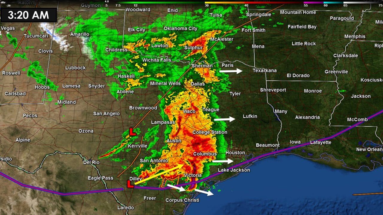
The threat for a few severe thunderstorms is currently confined to the southern Coastal Plains. A couple strong to severe thunderstorms are located from just northeast of Refugio with a second cell near Three Rivers. A third cell is located about 20 miles southeast of Pearsall. These storms are moving east to slightly south of due east at about 40-45 MPH. The stronger portions of those storms may produce hail up to the size of golfballs and winds locally exceeding 60 MPH. I expect that this activity will move out into the Gulf of Mexico by 5:30 AM bringing an end to the severe weather threat in the Coastal Plains and South-Central Texas. Widespread rain with a few thunderstorms continues across Central Texas, North Texas, and now entering the Brazos Valley. This activity is not severe and is not expected to become severe this morning. Widespread rain accumulations of half an inch to two inches is possible. Very minor flooding could occur in locations that received heavy rain earlier on Monday.

As a surface low moves northeast to around Houston later this morning an unstable airmass may advect inland from the Gulf of Mexico. With that a risk of severe weather may increase across Far Southeast Texas by mid-morning into the early afternoon hours. A few storms may become strong to severe with localized damaging wind gusts and hail. If we have discrete storms start to move in from the Gulf or develop inland across Far Southeast Texas they may have the potential to become tornadic. This threat is uncertain but bears close watching as low-level winds will strongly favor rotation. Don’t be shocked if a tornado watch is issued later this morning for parts of Southeast Texas.
0 Comments