
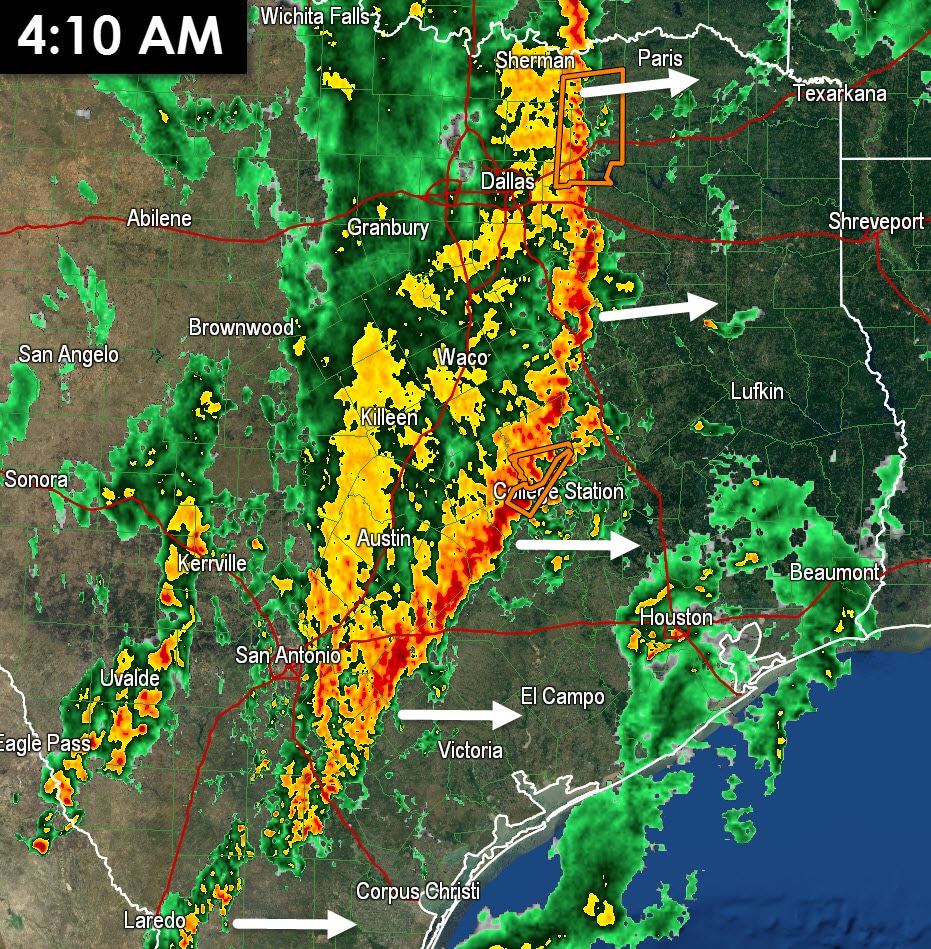
At 4 AM a squall line extended from Oklahoma south through Texas almost all the way to Mexico. The leading edge of the line runs from Bonham to Greenville to Buffalo to College Station to La Grange to Karnes City and to George West. A majority of the line is below severe limits with occasional wind gusts up to 50 MPH and heavy rain. A few stronger segments in the line have managed to become a bit stronger with wind gusts up to 60-65 MPH possible. We haven’t dealt with any sustained low-level rotation in about an hour. Hopefully that means we’re done with the tornado threat but I still can’t rule out a nonzero chance of a spin up until the line is out of Texas. With an eastward momentum of 25-30 MPH the line will continue moving into Northeast Texas, East Texas, and Southeast Texas this morning.
Instability values across Northeast Texas are pretty low thanks to all the rain that fell on Saturday. Hopefully this lack of instablity will keep the thunderstorms in a slow weakening state. Across East Texas and Southeast Texas there is some instablity albit only marginal amounts. With very strong wind shear in place the combination of marginal instablity may be enough to help the squall line maintain its strength as it moves into the region this morning. Widespread severe weather is not expected but a few wind gusts over 60 MPH will remain possible. A quick inch to inch and a half of rain is a more likely bet with minor nuisance flooding possible. We’ll keep an eye on things and post updates as needed this morning. Light to moderate stratiform rain will continue to fall for about two hours behind the initial squall line.
0 Comments