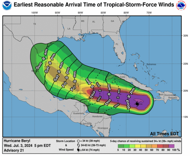
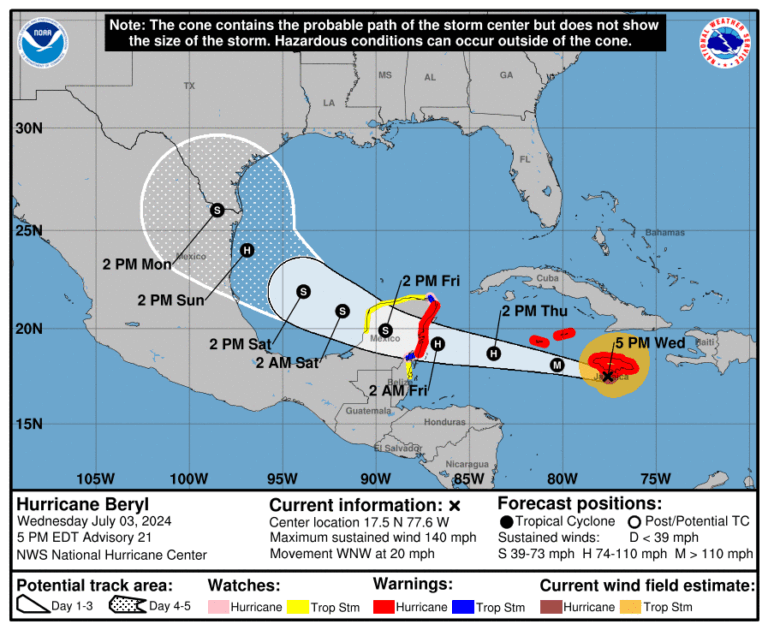
Major Hurricane Beryl directly impacted Jamaica this afternoon. Maximum sustained winds remain near 140 MPH. Weakening is anticipated over the next few days as the hurricane moves through an area of stronger wind shear. With Beryl moving westward at 20 MPH, it is expected to make landfall in the Yucatan Peninsula around lunchtime on Friday. Even with weakening, Beryl will likely remain a hurricane through its arrival near Cancun. More substantial weakening is likely as Beryl moves over the Yucatan on Friday, and it may weaken to a tropical storm.
However, re-intensification may occur once it moves into the Bay of Campeche and the Gulf of Mexico on Saturday. The long-range forecast after Friday remains uncertain, but confidence in impacts on the Lower Texas Gulf Coast by Sunday is increasing. These impacts may include strong winds, storm surge, beach erosion, heavy rain, and a tornado threat. If the track shifts further north, that would favor more substantial intensification and an expansion of the threats further north into the Coastal Bend. Heavy rainfall is expected in the southeastern third of Texas on Sunday through a good chunk of next week – even without Beryl.

Tropical storm-force winds (39+ MPH) may arrive along the Rio Grande Valley and South Texas coast by Sunday’s sunrise. Much will depend on Beryl’s eventual track, speed, and intensity. Hazards may also expand north to the Coastal Bend.
Helpful Links
Check out our current LIVE STREAM: https://texasweather.video/
Our FREE WEATHER APP: https://texasweather.app/
Our WEBSITE/RADAR: https://www.texasstormchasers.com
Our SOCIAL PLATFORMS: https://linktr.ee/texasstormchasers
Sponsored by Storm Pro Solution, visit them at https://stormprosolution.com


0 Comments