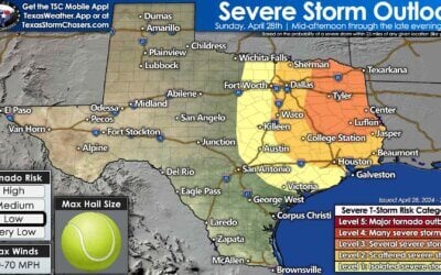
Thunderstorms will be the name of the game in Texas today, with continued chances of large hail and flooding rains in northern portions of the state. The chance of significant severe storms, with all modes of severe weather, may materialize tonight into Wednesday morning across the Edwards Plateau, Hill Country, Coastal Bend, South-Central Texas, Central Texas, Brazos Valley, Southeast Texas, and East Texas. However, there are several questions to answer – and those answers will determine whether or not we’re in for a rough night.
Storms continue this morning across the Permian Basin, West Texas, extending all the way east across North Texas and Northeast Texas. We had hailers, and strong wind gusts well into the early morning hours. We may see storms intensify by mid-morning across the northern half of Texas. Most storms will behave, but we may see some pocket-change-size hail, gusty winds, and heavy rainfall. Specifically, a significant flooding threat may reemerge across the Ark-La-Tex into parts of East Texas. Tyler to Shreveport received two to six inches of rain last night, and they may receive another three to six inches of rain by tomorrow.
Today’s storm chances are posing a challenge for weather models. The number of storms last night and this morning has led to scattered data regarding new thunderstorm chances today, tonight, and into Wednesday morning. This uncertain forecast increases the potential for unpredictability, emphasizing the need for constant vigilance and preparedness for potentially severe storms later today and into tonight.
Isolated supercell thunderstorms may develop along the southern periphery of the rain shield from storms farther north this afternoon. Where an outflow boundary sets up in the Concho Valley and Central Texas will determine where we may see isolated severe storms this afternoon. If the outflow boundary is pushed farther south by numerous ongoing storms, or we see fewer storms and the atmosphere can destabilize further, it will all play roles in what transpires. If we see isolated supercells, we’ll have to watch for very large hail, gusty winds, and perhaps a tornado.
Our most likely chance for more widespread severe storms will not begin until late this evening in the Edwards Plateau and Rio Grande Plains. A cluster of storms may begin developing late this evening, after 9 PM but perhaps closer to midnight, from Central Texas south toward Laredo. Weather model guidance, at least enough to support the chance, has a cluster of fast-moving thunderstorms evolving from that activity. That cluster of storms would quickly move northeast across parts of South-Central and Central Texas, through the Brazos Valley, Coastal Bend, Coastal Plains, Southeast Texas, and East Texas through about 8 AM Wednesday. If this scenario does evolve, the strongest storm is the thunderstorm cluster, which could produce large hail, damaging straight-line winds, and even pose a tornado risk given the possibility of powerful low-level wind shear. We’ll refine the forecast as we get into the early afternoon so we can better understand how the overall environment is setting up.
Regardless of how today plays out, the threat of significant severe storms should finally exit Texas to the east by late morning Wednesday.
My FREE & AWESOME weather app for radar/alerts/more: https://texasweather.app/
My website, also with radar: https://texasstormchasers.com
The 24/7 Texas weather tracker & music: https://www.youtube.com/watch?v=lNZuPEWS5AI&t=0s
Storm chaser videos: https://www.youtube.com/texasstormchasers
Facebook: https://www.facebook.com/TxStormChasers
TikTok: https://www.tiktok.com/@texasstormchasers
X (Twitter): https://twitter.com/TxStormChasers


Far from a slam-dunk forecast today, so we’ll have to keep a close eye on observations and trends this afternoon. Thanks for helping us reach 24,000 subscribers last evening. We appreciate all those who have placed their trust in us for Texas weather information! ~David
Good morning ❤
.31” of rain so far, east of Austin. We need another inch or two, please!