
Do you remember those unpleasant times in July, August, and September when we wished for summer to end? Well, an arctic blast has brought the polar opposite. Get it? Arctic and polar? I won’t quit my day job.
Crashy the cold front has made it down to Interstate 10. It’ll continue moving south until it stalls about 50 miles north of Brownsville this afternoon. Those of you in Far West Texas, the Borderland, and Big Bend will get a two-day suspension from winter as the mountains block the front from advancing west. That’ll change Tuesday night, by the way.
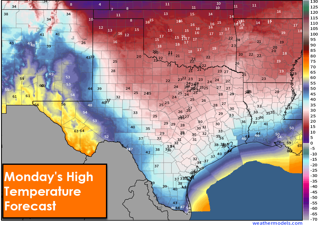
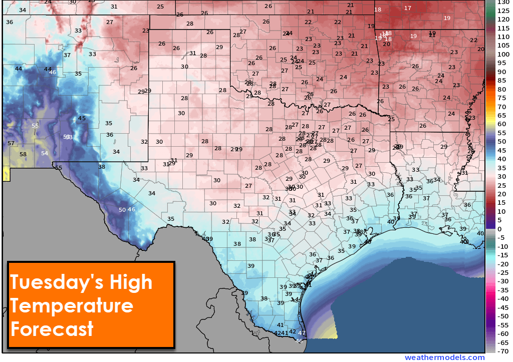
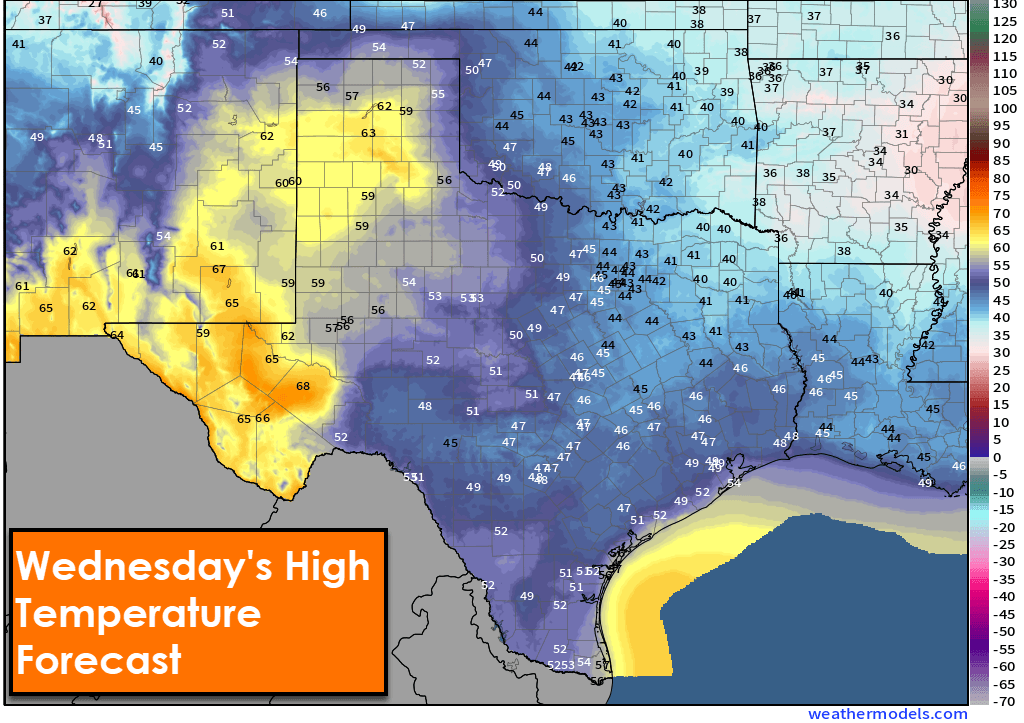
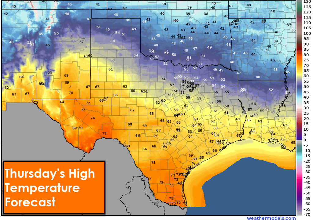
Those below-freezing across the northern half of Texas are unlikely to climb above that magical 32 degrees Fahrenheit (0 degrees Celsius for our metric friends) until Wednesday afternoon. The multi-day stretch below freezing, combined with very hard freezes at night, will strain exposed pipes, water mains, and all that stuff you typically don’t want breaking. We’ll begin warming up on Wednesday. High temperatures on Thursday will be in the 60s, 70s, and 80s across the southwestern half of Texas!
Ice Ice Baby!
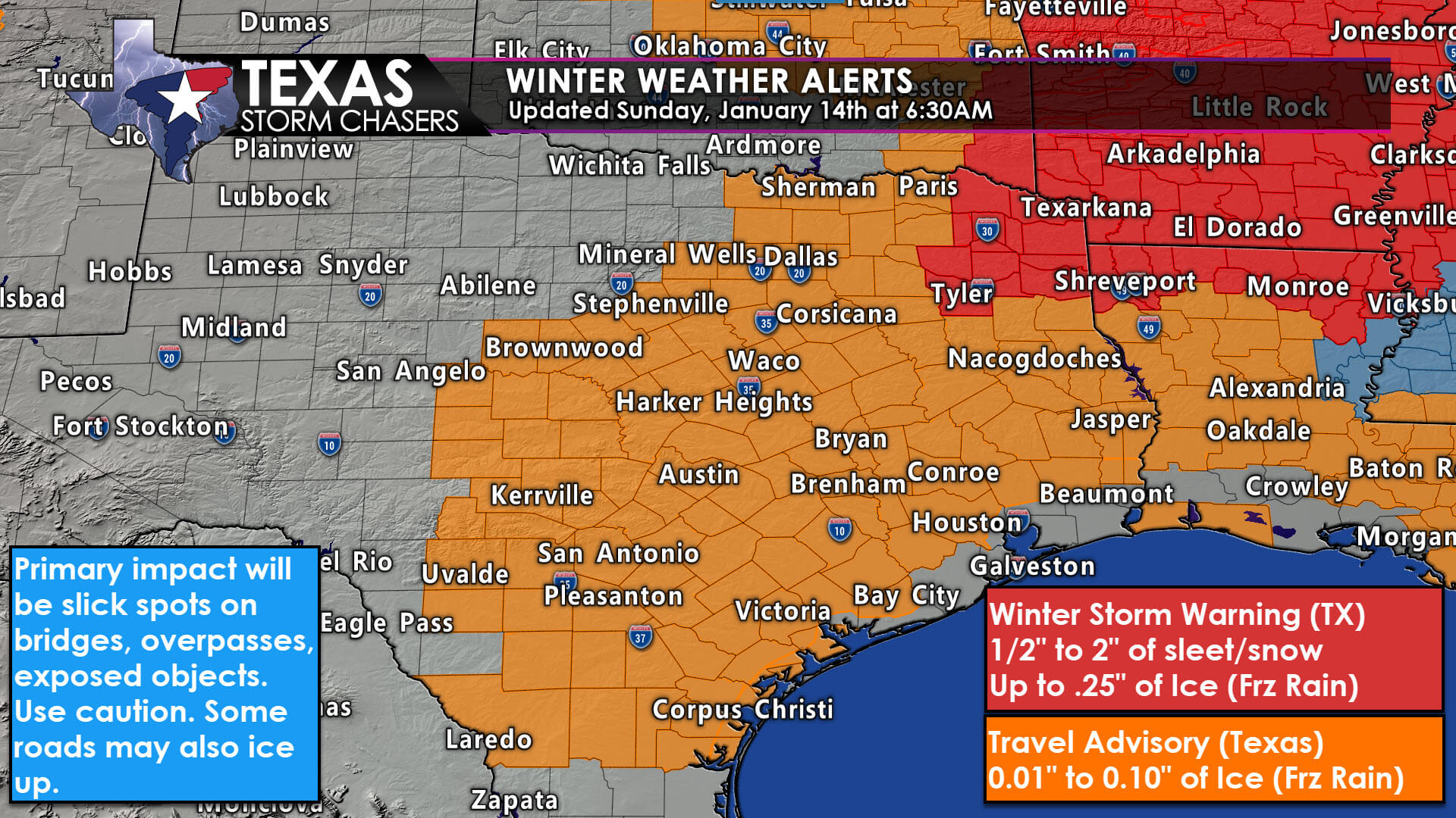
A quick round of snow is moving across the northeastern Texas Panhandle this morning. A dusting to one inch of accumulation is possible, but it won’t be a big deal. Patchy freezing drizzle is expected to begin this evening in several regions of Texas. It will be spotty at first, so we’ll need to carefully monitor observations and road conditions to see where things start going downhill – in a metaphorical sense. Freezing drizzle and light freezing rain will become more widespread Monday morning. By Monday afternoon, the best chance for light frozen precipitation will be in Central Texas, the Brazos Valley, Coastal Plains, and Southeast Texas – precariously close to the Houston metro.
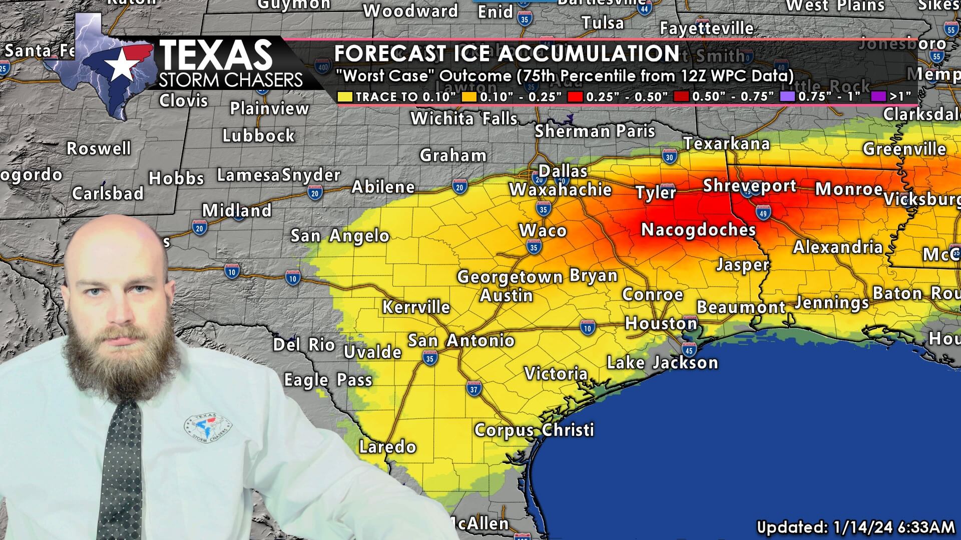
Overall, ice accumulations are expected to be on the light side. We’re thinking a trace to one-tenth of an inch, with some folks not getting a thing. Those totals are insufficient to cause tree or widespread infrastructure damage. However, those forecast ice amounts are plenty to turn bridges, overpasses, ramps, and exposed objects into slicky-slicky doom doom (ice). Some surface roads may also become slick, though pre-treatment from TxDOT will go a long way to (hopefully) thwart that.
Precipitation will end Monday evening, but some locations may still be icy until Tuesday, when sublimation and sunshine work alongside TxDOT to fix up any trouble spots.
Get the FREE Texas Storm Chasers Mobile App for your local weather forecast, interactive weather radars, live Texas weather coverage, and more! Available in your device’s app store.
Good morning y’all
Cold weather will be the most impactful, widespread issue across Texas through Wednesday. We will see freezing drizzle and light freezing rain tonight into Monday. Impacts to ramps, bridges, overpasses, and even some surface roads are expected. What we aren’t expecting is a crippling ice storm that takes down abhorrent numbers of trees or causes widespread infrastructure damage. Thank you for trusting us to provide you with Texas weather information. ~David
Thank you for sharing
🤗🏆🙏💙
Gladly take this for a few days versus 110 for a month