
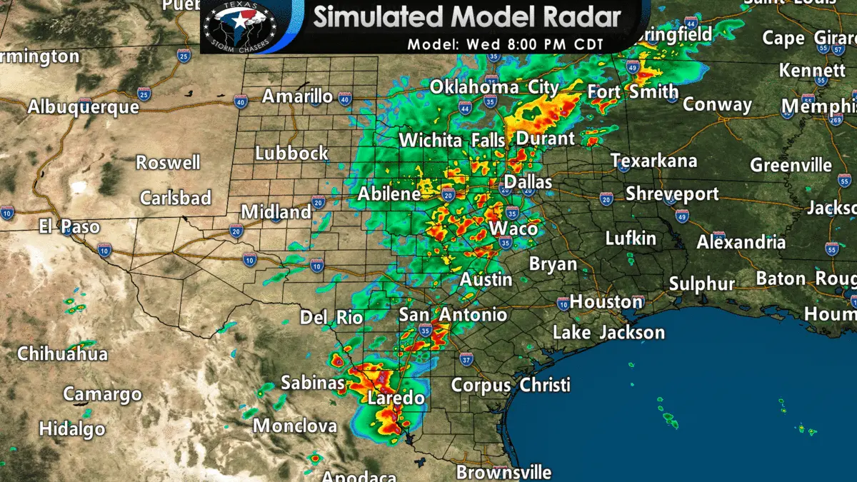
Simulated weather model radar tonight through Thursday morning – showing heavy rain moving across North, Central, and South Texas.
Heavy rain and thunderstorms are moving into the D/FW Metroplex. Activity farther to the southwest will be moving into Waco, Austin, and San Antonio in the coming hours. That will begin what is expected to be an active night in the flooding department. Let’s be clear – we’re not expecting widespread/high-impact flash flooding. We are expecting many low-water crossings to be flooded by morning.
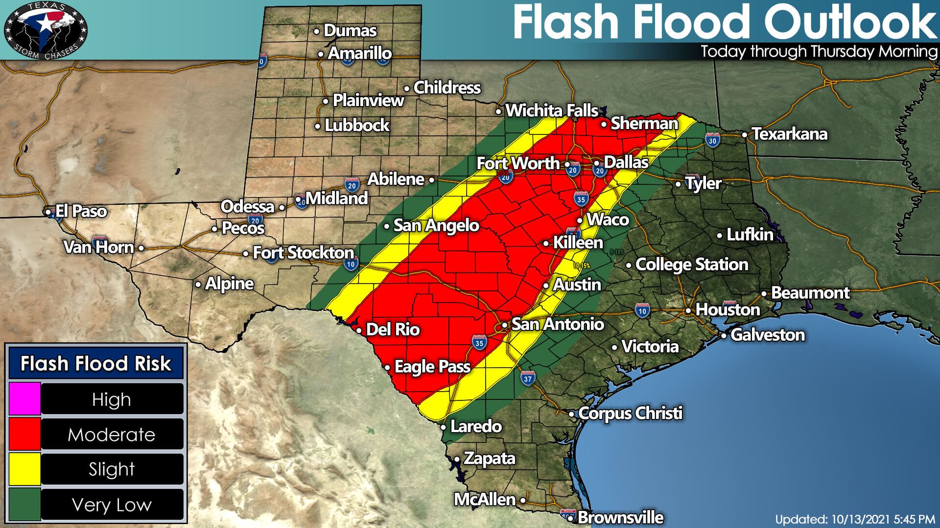
Some folks are going to get too much rain, and that will result in localized significant flooding. If the more considerable flooding occurs in areas with lower population density – well, it won’t be as big of a deal. If the more significant flooding happens on Interstate 35 in densely populated areas, well, impacts will be quite a bit more noticeable.
Either way, we emphasize the need to be careful when driving overnight and into Thursday morning. We will likely have plenty of road closures across North Texas, Central Texas, the Hill Country, and South-Central Texas by morning.
A low threat for a brief tornado and strong winds exists overnight in those same regions. The danger will be secondary to the more widespread expectation.
Widespread rain accumulations of two to four inches are likely tonight from the Hill Country and South-Central Texas northward through Central Texas and North Texas. Isolated heavier rain totals up to eight inches may occur tonight, and those folks would likely experience flash flooding by morning.


0 Comments