
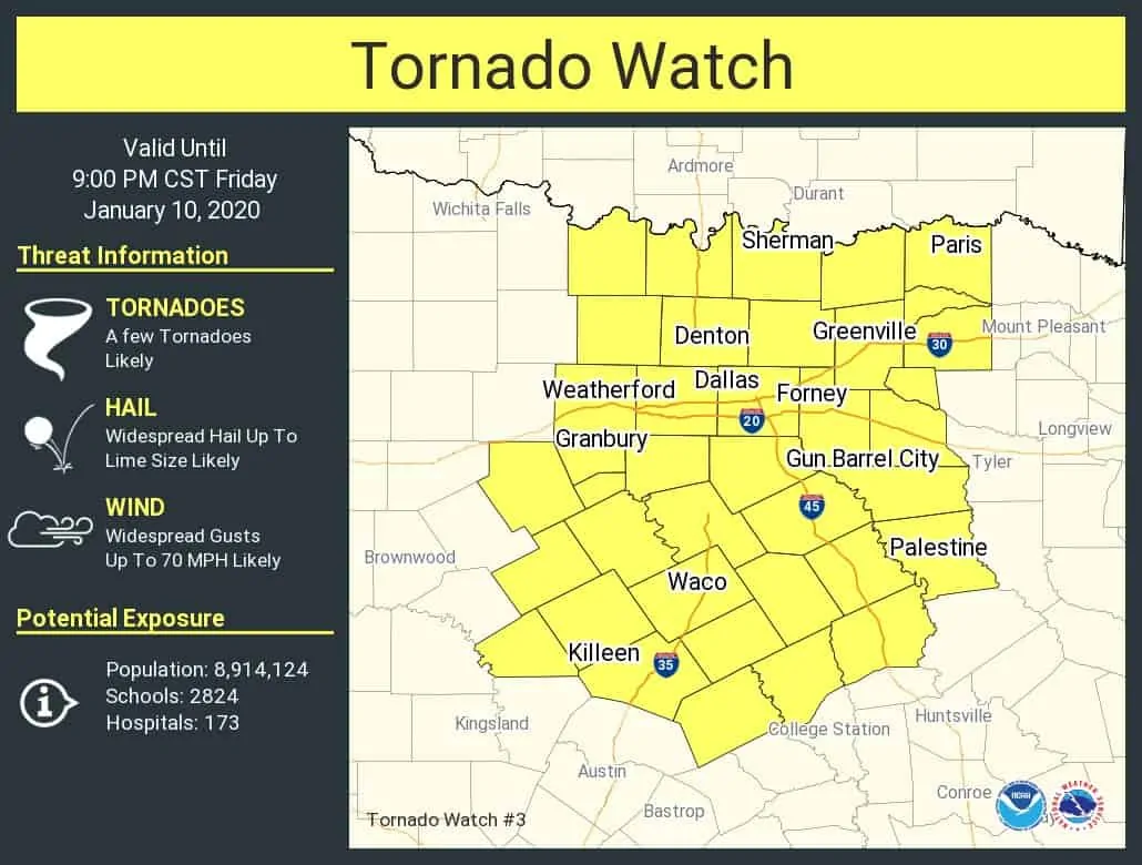
We have our first tornado watch of the day for Texas. That watch includes pretty much the entirety of North Texas. We will see several more watches issued later in the day. This first tornado watch includes Sherman, D/FW, Waco, Killeen, Palestine, Greenville, and Paris and runs until 9 PM. Again, we will have more watches issued later on farther to the south, and than for all of Northeast Texas and East Texas at some point tonight. A tornado watch means conditions are favorable for the development of severe weather including large hail, damaging winds, and the potential for a few tornadoes. Given strong low-level wind shear in place today we cannot rule out a strong, longer-lived tornado if any intense discrete supercells materialize.
URGENT – IMMEDIATE BROADCAST REQUESTED
Tornado Watch Number 3
NWS Storm Prediction Center Norman OK
115 PM CST Fri Jan 10 2020
The NWS Storm Prediction Center has issued a
* Tornado Watch for portions of
North Central Texas
* Effective this Friday afternoon and evening from 115 PM until
900 PM CST.
* Primary threats include…
A few tornadoes likely with a couple intense tornadoes possible
Widespread large hail and scattered very large hail events to 2
inches in diameter likely
Widespread damaging wind gusts to 70 mph likely
SUMMARY…Thunderstorms will rapidly develop this afternoon and
affect the watch area through the evening. The strongest cells will
be capable of damaging wind gusts, large hail, and a few tornadoes.
Strong tornadoes are possible.
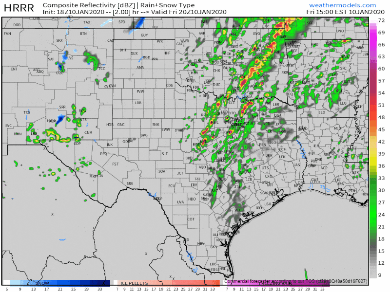
18Z HRRR: Simulated weather model radar this afternoon through tonight.
Here’s an estimate on timing for the line of storms this afternoon and tonight from the HRRR model. We’re now entering the ‘watch’ phase of the day where we quit looking at model data and just start looking out the window. Individual storms will move north/northeast quickly at 50 MPH. The squall lin itself later today will accelerate east tonight. We continue to anticipate a major damaging wind event across Northeast Texas and East Texas tonight. Numerous trees may be downed and result in power outages, structural damage, and blocked roads.
This may be out last blog post of the afternoon, but we will be providing live coverage once a tornado warning is issued. Live coverage can be watched on our social media channels and here on our website. Those using our free mobile app can just click the ‘live’ button in the bottom menu bar.


0 Comments