
A cold front continues to push south through Texas this evening. Temperatures north of the front are a good 30 to 40 degrees cooler than the high temperatures experienced in the last several days. Warm weather fans are not going to enjoy Tuesday’s weather. We’ll see a slow warm-up ahead of another warm weekend before another substantial cool down early next week. I seriously doubt many of you are here to read about the extended range temperature forecast. Let’s just get down to the real topic of interest.
A relatively broad area of rain will continue to expand overnight across the southern three-quarters of Texas. The Texas Panhandle, West Texas, Northwest Texas, and far South Texas are the only regions that are likely to stay dry tonight and on Tuesday. Rainfall amounts are not impressive with some folks picking up one-half to perhaps one inch of rainfall. Severe thunderstorms and flooding are not expected, although we do have to keep a closer eye on rain totals during the winter since vegetation is dormant and runoff increases.
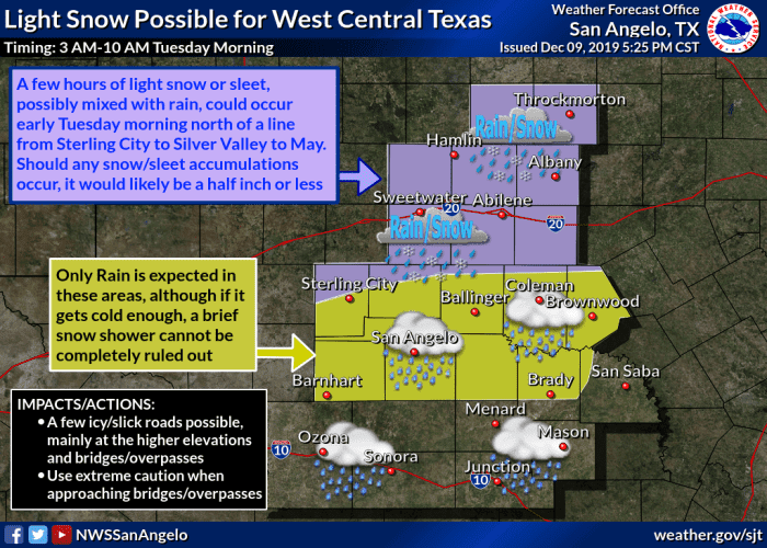
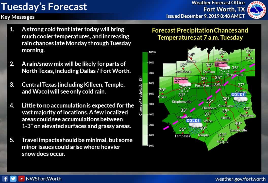
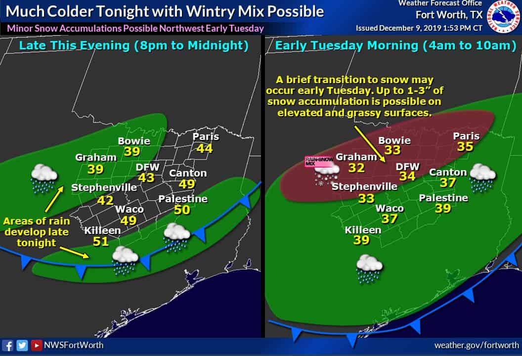
Very cold air aloft, continuing precipitation, and temperatures getting near freezing in portions of the Big Country and North Texas tomorrow morning will probably result in rain mixing with or even completely changing over to snow. This is not going to be a high-impact winter weather event and we’re not looking for widespread snow accumulations. This scenario is always quite conditional on everything coming together at the right time.
Literally a one-degree difference at the surface could make or break any snowfall potential. Don’t be surprised if we don’t end up with much more than some flurries mixing in with the rain. On the other side of the spectrum if we were to have everything come together perfectly we could see a period of heavier wet snow with thunder in parts of the Big Country and North Texas. Should that unfold we could see a small area of one to three-inch snow accumulations on grassy and elevated surfaces. Temperatures at the surface should remain just above freezing, so even if we do have any snow accumulate, it should melt within a few hours of falling.

The animation above shows one model’s expectation (simulation) of how tonight and tomorrow morning will play out. A vast majority of the precipitation will fall as rain. A small section in the Big Country and North Texas (generally west/north of Fort Worth) could briefly experience snow for a few hours tomorrow morning. If we were to have any accumulations they would likely be quite light and melt by the afternoon. There is a small chance we could have a few problems with snow accumulating on bridges if any small bands of heavier snow materialized. Again – all of that would melt by the evening rush hour. However, roads tomorrow will be wet and that in itself will probably cause mayhem.
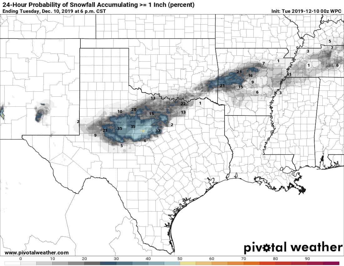
Probability of 1 inch of snowfall accumulation Tuesday morning
Just for fun here’s a graphic depicting the probability of one inch of snow accumulation on grassy and elevated surfaces Tuesday morning. As you can see this isn’t expected to be a big snow maker or something that sticks around long. It’ll be pretty to look at while it lasts, but it won’t last long with warm soil temperatures and surface temperatures remaining above freezing.
All the rain will move out by tomorrow evening with another chilly night expected into Wednesday morning. We’ll be fairly calm with a slow warming trend as we head toward the weekend.


0 Comments