
Isolated thunderstorms were able to develop this afternoon from the higher terrain of the Trans-Pecos northeast through the Concho Valley, North Texas along and north of Highway 380, north into Texoma. Some storms produced wind gusts over 60 MPH. A 64 MPH wind gust was measured in Sherman – where some general aviation aircraft were flipped at the local airport. Thunderstorm coverage will decrease through the mid-evening hours as we start losing some day-time heating. However, we’ll see new storms develop late tonight and into the morning hours Wednesday.
You can keep tabs on storms with our free HD interactive weather radar here on our website.
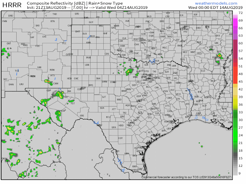
Simulated weather model radar overnight into Wednesday morning from the High-Resolution Rapid Refresh model. Keep in mind that this is only a model simulation. The eventual outcome may differ from what is shown.
Those new storms will fire up in the proximity of a weak cool front across Northwest Texas, Texoma, and North Texas overnight. Storms will generally move to the south slowly. Widespread severe weather is not expected. A few storms may become strong enough to produce small hail, gusty winds, and an excessive amount of lightning. A complex of thunderstorms in Colorado and Kansas will also likely move southeast into the Texas Panhandle tomorrow morning. Some of those storms may also be strong to marginally severe with hail and gusty winds. Again – this isn’t a big severe weather setup, but a few severe storms can’t be ruled out simply because of its August. The atmosphere is hot, juicy, and unstable.
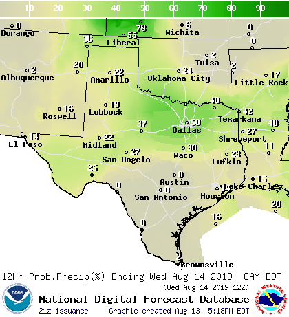
Chance of showers and storms Tonight, Wednesday, Wednesday Night, and Thursday.
Our weak cool front will slowly sag south into Central Texas on Wednesday. Scattered showers and thunderstorms will spread south along that front tomorrow and continue into Thursday. A few severe storms with localized damaging winds could occur throughout the day tomorrow.
Besides a few folks getting much-needed rainfall the primary benefit of these rain chances will be reduced temperatures. We’re not talking about a big cooldown by nay stretch of the imagination. Yet temperatures in the 90s are better than temperatures in the 100s. Those who end up under a storm will probably drop off into the 80s for a while. So let’s hope you’re one of the lucky ones who gets a quick downpour over the coming days! Unfourtinietly, this front will not make it south of Interstate 10 – and very hot/humid conditions will continue unabated for the foreseeable future.


0 Comments