
A weak frontal boundary is located from near Andrews to Sweetwater to Plano over toward Mount Pleasant. Even those looking at a weather map would be hard-pressed to find such a pathetic front. There is no temperature difference – and there is definitely not anything remotely close to the cold front we had last week. Nevertheless, this boundary will help spark off scattered to numerous thunderstorms by the late morning and afternoon hours as it drifts south. The highest chance of rain today will be across East Texas, Southeast Texas, and the Coastal Plains. It probably won’t rain at any given location all day, but heavy downpours are certainly probable. Isolated storms are also possible today across Central Texas and the Brazos Valley.
Some storms may produce localized wind gusts over 50 MPH, small hail, and all storms produce deadly cloud to ground lightning. Rain chances will decrease tonight, but isolated storms will remain possible across Southeast Texas into Wednesday morning. The same can be said for tomorrow. That activity will be more typical of summer though. You can keep tabs on nearby storms with our interactive weather radar here on our website and in our free mobile app.
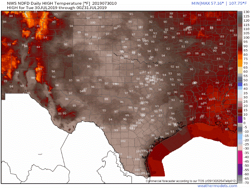
Daily high-temperature forecasts from today through Sunday (August 2nd). Notice that we do see a gradual drop in temperatures by the end of the forecast
Outside of today’s rain chances we’re not really looking at too much in the weather department through the end of the workweek. Temperatures will generally be about 3 to 7 degrees above late July averages. That means we’ll likely see plenty of triple digits. Overnight low temperatures may also struggle to fall much below 76-78 degrees in urban corridors across the eastern half of Texas. There is some good news in that the upper-level high pressure looks to shift west (farther from Texas) by the weekend. That should allow temperatures to be a few degrees cooler (low to upper 90s instead of middle 90s to the middle 100s). We could also see some increase in daily thunderstorm chances. We’re not talking widespread by any means and most folks wouldn’t see a thing. However, a weaker high pressure means we may be able to squeeze out a few more ‘popcorn’ storms during the afternoon hours. We’ll talk more about that as we get closer to the weekend.
Have a great Tuesday and God Bless!


0 Comments