
While I don’t want to tempt Mother Nature, I am comfortable saying that thus far the storms in North Texas have been underperforming. Whether or not that remains the case over the next several hours? I can’t say for sure.
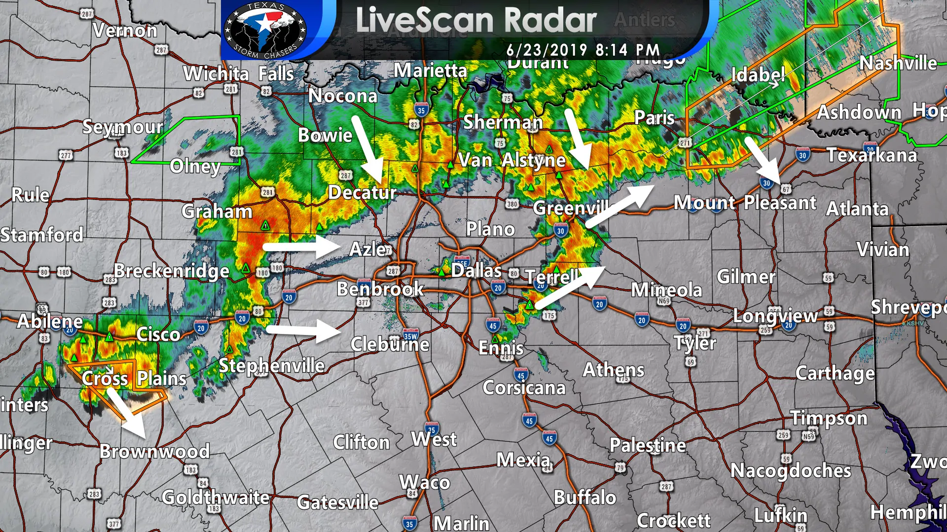
Storms that earlier produced wind gusts over 65 MPH in the Big Country and large hail up in Wichita Falls have seemingly weakened over the last hour. Those storms extend from near Cross Plains to near Mineral Wells to Sanger to Greenville to the south of Clarksville. Now let me be clear – some of those storms are severe and capable of producing quarter size hail and wind gusts over 60 MPH. However, the storms approaching the immediate D/FW metroplex from the north are lacking in the intensity department. An outflow boundary about 10 to 15 miles ‘ahead’ of those storms certainly looks impressive, but the storms themselves are “only” producing wind gusts of 35 to 45 MPH, heavy rain, and small hail. Hopefully, that continues and the metroplex gets nothing more than some heavy rain.
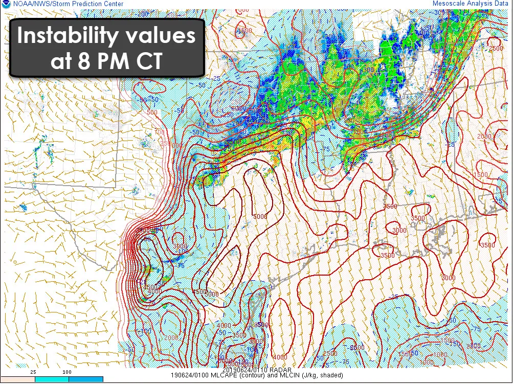
Some storms are firing up from near Arlington east into Kaufman and Hunt counties. Those storms are not severe at this time, although they’re producing small hail, gusty winds, and plenty of lightning. I am watching a small line of storms back in Jack and Palo Pinto counties. That’s the line that brought high wind to Abilene back around 6 PM. Those storms are moving pretty quickly to the east now – and we will have to watch them in case they go severe as they move into the metroplex. We’ll see. Wind shear values may be a little weaker than what weather models had predicted (one guess as to why its been ‘quiet’ for the last hour). However, there is still an extreme amount of instability in place ahead of these storms – and plenty of moisture too.
Regardless – thunderstorms are expected to continue to slowly push east/southeast over the next several hours across North Texas and Northeast Texas. Eventually, storms may make it into portions of southern North Texas and East Texas later this evening. Some of those storms may be severe, especially those south of Interstate 20. I’m not ready to call the threat of severe weather over just yet, but the current trends are certainly favorable (although some will whine because storms are underperforming in the intensity department). Localized flash flooding wil remain possible in portions of North Texas and Northeast Texas tonight.


0 Comments