
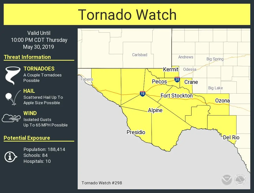
A tornado watch has been issued for portions of Far West Texas and the Trans-Pecos until 10 PM CT. Presidio, Alpine, Fort Stockton, Pecos, Kermit, Crane, Ozona, and Del Rio are a few towns included in this watch. The strongest storms may be capable of producing very large hail up to the size of baseballs, localized damaging wind gusts up to 65 MPH, and a couple of tornadoes.
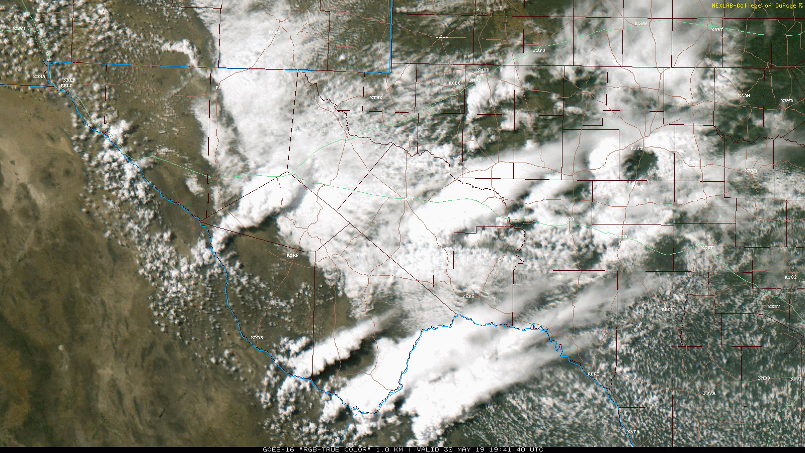
Thunderstorms are developing in the higher terrain of the Trans-Pecos and Far West Texas this afternoon. Those locations have had the most sunshine compared to the lower elevations of the Trans-Pecos farther north. These initial thunderstorms will probably be supercelluar with all modes of severe weather possible. The highest tornado threat should be in areas that have had the most destabilization this afternoon. Storms will tend to move east or east/northeast at 25 to 35 MPH. Cloud to ground lightning and localized flash flooding are also threats.
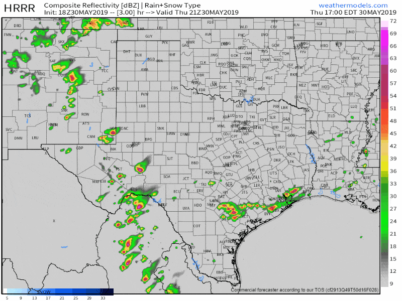
Simulated weather model radar through the evening and overnight hours. Remember, this is only a simulation from one weather model.
We could see a cluster of thunderstorms move into the Edwards Plateau this evening. Those storms could produce large hail, localized damaging winds, and perhaps some isolated flooding. Storms ongoing now across Southeast Texas are the typical ‘popup’ storms – disorganized afternoon storms we deal with during the summer months.


0 Comments